 |
|
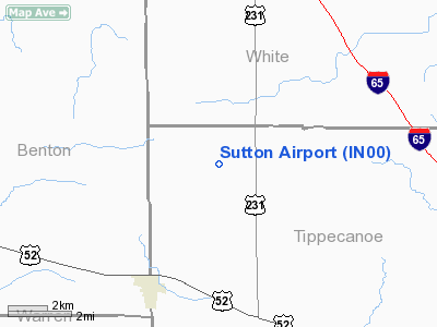
Location & QuickFacts
|
FAA
Information Effective: |
2008-06-05 |
|
Airport
Identifier: |
IN00 |
| Airport
Status: |
Operational |
|
Longitude/Latitude: |
087-03-08.0510W/40-32-43.1260N
-87.052236/40.545313 (Estimated) |
|
Elevation: |
740
ft / 225.55 m (Estimated) |
|
Land: |
0 acres |
| From
nearest city: |
4
nautical miles NW of Montmorenci, IN |
|
Location: |
Tippecanoe County, IN |
|
Magnetic Variation: |
01W
(1985) |
Owner & Manager
|
Ownership: |
Privately
owned |
| Owner: |
C.
V. Sutton |
|
Address: |
8216 N 750 W West
Lafayette, IN 47906 |
|
Phone number: |
317-583-4723 |
|
Address: |
|
Airport
Operations and Facilities
|
Airport Use: |
Private |
|
Wind indicator: |
Yes |
|
Segmented Circle: |
No |
|
Control
Tower: |
No |
|
Landing fee charge: |
No |
|
Sectional
chart: |
Chicago |
|
Region: |
AGL
- Great Lakes |
|
Boundary
ARTCC: |
ZAU - Chicago |
|
Tie-in FSS: |
HUF
- Terre Haute |
|
FSS on
Airport: |
No |
|
FSS Toll Free: |
1-800-WX-BRIEF |
Airport
Services
|
Airframe
Repair: |
MAJOR |
|
Power
Plant Repair: |
MAJOR |
|
Runway Information
Runway E/W
|
Dimension: |
2400 x 100 ft
/ 731.5 x 30.5 m |
| Surface: |
TURF,
|
|
|
Runway E |
Runway W |
|
Traffic Pattern: |
Left |
Left |
| Displaced
threshold: |
0.00
ft |
200.00
ft |
|
Radio Navigation Aids
|
ID |
Type |
Name |
Ch |
Freq |
Var |
Dist |
| MCX |
NDB |
White
County |
|
377.00 |
03W |
16.5
nm |
|
RZL |
NDB |
Rensselaer |
|
362.00 |
02W |
24.9 nm |
| FKR |
NDB |
Frankfort |
|
278.00 |
02W |
27.8
nm |
|
GGP |
NDB |
Logansport |
|
263.00 |
01W |
32.5 nm |
| CFJ |
NDB |
Crawfordsville |
|
388.00 |
02W |
34.5
nm |
|
RWN |
NDB |
Winamac/dcmsnd |
|
335.00 |
00W |
38.8 nm |
| IKK |
VOR/DME |
Kankakee |
053X |
111.60 |
00E |
48.2
nm |
|
BVT |
VORTAC |
Boiler |
098X |
115.10 |
01E |
1.0 nm |
| DNV |
VORTAC |
Danville |
047X |
111.00 |
02E |
27.6
nm |
|
GUS |
VORTAC |
Grissom |
21Y |
108.45 |
02W |
41.5 nm |
| OKK |
VORTAC |
Kokomo |
082X |
113.50 |
00E |
45.4
nm |
Based Aircraft
|
Aircraft
based on field: |
3 |
|
Single Engine Airplanes: |
3 |
Sutton Airport
Address:
Tippecanoe County, IN
Tel:
317-583-4723
Images
and information placed above are from
http://www.airport-data.com/airport/IN00/
We
thank them for the data!
| General
Info |
| Country |
United
States |
| State |
INDIANA
|
| FAA ID |
IN00 |
| Latitude |
40-32-43.126N
|
| Longitude |
087-03-08.051W
|
| Elevation |
740 feet
|
| Near City |
MONTMORENCI
|
We don't guarantee the information is fresh and accurate. The data may
be wrong or outdated.
For more up-to-date information please refer to other sources.
|
|


