 |
|
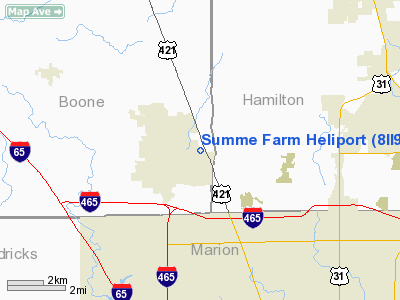
Location & QuickFacts
|
FAA
Information Effective: |
2008-06-05 |
|
Airport
Identifier: |
8II9 |
| Airport
Status: |
Operational |
|
Longitude/Latitude: |
086-14-52.9700W/39-57-27.1400N
-86.248047/39.957539 (Estimated) |
|
Elevation: |
880
ft / 268.22 m (Estimated) |
|
Land: |
0 acres |
| From
nearest city: |
1
nautical miles E of Zionsville, IN |
|
Location: |
Boone County, IN |
|
Magnetic Variation: |
02W
(1990) |
Owner & Manager
|
Ownership: |
Privately
owned |
| Owner: |
Richard
D. Summe |
|
Address: |
895 Sugar Bush Ridge
Zionsville, IN 46077 |
| Phone
number: |
317-873-6914 |
|
Manager: |
Richard D. Summe |
| Address: |
895
Sugar Bush Ridge
Zionsville, IN 46077 |
|
Phone
number: |
317-873-6914 |
Airport
Operations and Facilities
|
Airport
Use: |
Private |
|
Segmented
Circle: |
No |
| Control
Tower: |
No |
|
Sectional
chart: |
St Louis |
| Region: |
AGL
- Great Lakes |
|
Boundary
ARTCC: |
ZID - Indianapolis |
| Tie-in
FSS: |
HUF
- Terre Haute |
|
FSS Toll
Free: |
1-800-WX-BRIEF |
|
Runway Information
Helipad H1
|
Dimension: |
50 x 16 ft /
15.2 x 4.9 m |
|
Surface: |
CONC, |
|
|
Runway H1 |
Runway |
| Traffic
Pattern: |
Left |
Left |
|
Radio Navigation Aids
|
ID |
Type |
Name |
Ch |
Freq |
Var |
Dist |
| HZP |
NDB |
Zionsville |
|
248.00 |
03W |
1.1
nm |
|
UMP |
NDB |
Metropolitan |
|
338.00 |
03W |
9.2 nm |
| HFY |
NDB |
Greenwood |
|
398.00 |
02W |
20.8
nm |
|
FKR |
NDB |
Frankfort |
|
278.00 |
02W |
23.7 nm |
| TVX |
NDB |
Greencastle |
|
521.00 |
03W |
29.6
nm |
|
CFJ |
NDB |
Crawfordsville |
|
388.00 |
02W |
30.8 nm |
| AI |
NDB |
Video |
|
371.00 |
03W |
34.6
nm |
|
BA |
NDB |
Clifs |
|
410.00 |
03W |
43.1 nm |
| UWL |
NDB |
New
Castle |
|
385.00 |
02W |
43.1
nm |
|
GGP |
NDB |
Logansport |
|
263.00 |
01W |
45.5 nm |
| MZZ |
VOR/DME |
Marion |
023X |
108.60 |
03W |
41.5
nm |
|
MIE |
VOR/DME |
Muncie |
091X |
114.40 |
03W |
42.7 nm |
| VHP |
VORTAC |
Brickyard |
110X |
116.30 |
01E |
10.2
nm |
|
SHB |
VORTAC |
Shelbyville |
057X |
112.00 |
01E |
27.7 nm |
| OKK |
VORTAC |
Kokomo |
082X |
113.50 |
00E |
35.4
nm |
|
GUS |
VORTAC |
Grissom |
21Y |
108.45 |
02W |
41.6 nm |
| IND |
VOT |
Indianapolis
Intl |
|
109.60 |
|
14.1
nm |
Remarks
- PRVDD
ALL APCH/DEP ROUTE HELICOPTER OPERATIONS ARE CONDUCTED FM 170 TO 180
DEG (DEPARTURE ONLY 350 TO 360 DEG); AREA APPROPRIATELY MKD; & A
WIND INDICATOR IS MAINTAINED.
Based Aircraft
|
Aircraft
based on field: |
1 |
|
Helicopters: |
1 |
Summe Farm Heliport
Address:
Boone County, IN
Tel:
317-873-6914
Images
and information placed above are from
http://www.airport-data.com/airport/8II9/
We
thank them for the data!
| General
Info |
| Country |
United
States |
| State |
INDIANA
|
| FAA ID |
8II9 |
| Latitude |
39-57-27.140N
|
| Longitude |
086-14-52.970W
|
| Elevation |
880 feet
|
| Near City |
ZIONSVILLE
|
We don't guarantee the information is fresh and accurate. The data may
be wrong or outdated.
For more up-to-date information please refer to other sources.
|
|


