 |
|
| Sullivan County Airport |
| IATA: SIV â ICAO: KSIV â FAA LID: SIV |
| Summary |
| Airport type |
Public |
| Owner |
Sullivan County BOAC |
| Serves |
Sullivan, Indiana |
| Elevation AMSL |
540 ft / 165 m |
| Coordinates |
39°06â²53â³N 087°26â²54â³W / 39.11472°N 87.44833°W / 39.11472; -87.44833 |
| Runways |
| Direction |
Length |
Surface |
| ft |
m |
| 18/36 |
4,360 |
1,329 |
Asphalt |
| Statistics (2006) |
| Aircraft operations |
8,657 |
| Based aircraft |
29 |
| Source: Federal Aviation Administration |
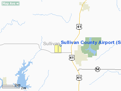
Sullivan County Airport (IATA: SIV, ICAO: KSIV, FAA LID: SIV) is a county-owned public-use airport located three nautical miles (6 km) northwest of the central business district of Sullivan, a city in Sullivan County, Indiana, United States.
Facilities and aircraft
Sullivan County Airport covers an area of 108 acres (44 ha) at an elevation of 540 feet (165 m) above mean sea level. It has one asphalt paved runway designated 18/36 which measures 4,360 by 75 feet (1,329 x 23 m).
For the 12-month period ending December 31, 2006, the airport had 8,657 aircraft operations, an average of 23 per day: 97% general aviation and 3% air taxi. At that time there were 29 aircraft based at this airport: 97% single-engine and 3% multi-engine.
The above content comes from Wikipedia and is published under free licenses – click here to read more.
Location & QuickFacts
|
FAA
Information Effective: |
2008-06-05 |
|
Airport
Identifier: |
SIV |
| Airport
Status: |
Operational |
|
Longitude/Latitude: |
087-26-53.9850W/39-06-52.9650N
-87.448329/39.114712 (Estimated) |
|
Elevation: |
540
ft / 164.59 m (Surveyed) |
|
Land: |
108 acres |
| From
nearest city: |
3
nautical miles NW of Sullivan, IN |
|
Location: |
Sullivan County, IN |
|
Magnetic Variation: |
02W
(1995) |
Owner & Manager
|
Ownership: |
Publicly
owned |
| Owner: |
Sullivan
County Boac |
|
Address: |
2001 N Co Rd 200w
Sullivan, IN 47882 |
| Phone
number: |
812-268-6959 |
|
Manager: |
Guy Hammond |
| Address: |
2001
N Co Rd 200w
Sullivan, IN 47882 |
|
Phone
number: |
812-268-6959 |
Airport
Operations and Facilities
|
Airport
Use: |
Open
to public |
|
Wind indicator: |
Yes |
|
Segmented Circle: |
No |
|
Control
Tower: |
No |
| Lighting
Schedule: |
24
HRS
ACTVT MIRL RY 18/36 & REILS RYS 18 & 36 - CTAF.
ROT BCN & VASI RYS 18 & 36 ON CONTINUOUSLY. |
|
Beacon Color: |
Clear-Green (lighted land airport) |
| Landing
fee charge: |
No |
|
Sectional
chart: |
St Louis |
| Region: |
AGL
- Great Lakes |
|
Traffic
Pattern Alt: |
800 ft |
| Boundary
ARTCC: |
ZID
- Indianapolis |
|
Tie-in FSS: |
HUF - Terre Haute |
| FSS
on Airport: |
No |
|
FSS Toll
Free: |
1-800-WX-BRIEF |
| NOTAMs
Facility: |
HUF
(NOTAM-d service avaliable) |
|
Federal
Agreements: |
NGY |
Airport
Communications
|
CTAF: |
122.800 |
|
Unicom: |
122.800
|
Airport Services
|
Runway Information
Runway 18/36
|
Dimension: |
4360 x 75 ft
/ 1328.9 x 22.9 m |
| Surface: |
ASPH,
Good Condition |
|
Surface Treatment: |
Rubberized Friction Seal Coat |
| Weight
Limit: |
Single wheel: 27000 lbs.
Dual wheel: 35000 lbs. |
|
Edge Lights: |
Medium |
|
|
Runway 18 |
Runway 36 |
| Longitude: |
087-26-53.6560W |
087-26-54.3130W |
|
Latitude: |
39-07-14.5100N |
39-06-31.4190N |
| Elevation: |
537.00
ft |
535.00
ft |
|
Alignment: |
127 |
1 |
| Traffic
Pattern: |
Left |
Left |
|
Markings: |
Non-precision instrument, Good Condition |
Non-precision instrument, Good Condition |
| Crossing
Height: |
21.00
ft |
21.00
ft |
|
VASI: |
2-box on left side |
2-box on left side |
| Visual
Glide Angle: |
3.00° |
3.00° |
|
Runway End
Identifier: |
Yes |
Yes |
| Centerline
Lights: |
No |
No |
|
Touchdown
Lights: |
No |
No |
|
Obstruction: |
10
ft crops, 302.0 ft from runway, 10:1 slope to clear |
10
ft crops, 340.0 ft from runway, 14:1 slope to clear |
|
Radio Navigation Aids
|
ID |
Type |
Name |
Ch |
Freq |
Var |
Dist |
| PLX |
NDB |
Palestine |
|
391.00 |
00W |
10.9
nm |
|
HU |
NDB |
Yinno |
|
245.00 |
02W |
16.6 nm |
| OEA |
NDB |
Vincennes |
|
251.00 |
00E |
25.9
nm |
|
CZB |
NDB |
Casey |
|
359.00 |
00E |
28.2 nm |
| DCY |
NDB |
Washington |
|
212.00 |
03W |
29.2
nm |
|
AJG |
NDB |
Mount Carmel |
|
524.00 |
02W |
32.9 nm |
| PRG |
NDB |
Paris |
|
341.00 |
01E |
36.6
nm |
|
MT |
NDB |
Zebre |
|
347.00 |
00E |
39.1 nm |
| BM |
NDB |
Claye |
|
382.00 |
02W |
39.8
nm |
|
OLY |
NDB |
Olney |
|
272.00 |
00W |
41.4 nm |
| TVX |
NDB |
Greencastle |
|
521.00 |
03W |
46.8
nm |
|
RSV |
VOR/DME |
Robinson |
021X |
108.40 |
02E |
11.0 nm |
| LWV |
VOR/DME |
Lawrenceville |
025X |
108.80 |
01W |
22.0
nm |
|
MTO |
VOR/DME |
Mattoon |
031X |
109.40 |
03E |
44.7 nm |
| SAM |
VOR/DME |
Samsville |
113X |
116.60 |
03E |
48.2
nm |
|
TTH |
VORTAC |
Terre Haute |
100X |
115.30 |
02E |
24.3 nm |
| OOM |
VORTAC |
Hoosier |
039X |
110.20 |
02W |
39.0
nm |
|
BIB |
VORTAC |
Bible Grove |
027X |
109.00 |
03E |
49.7 nm |
Remarks
- 153'AGL
FM ANT TWR 6600'SE.
- MOORED
BALLOON, 2 MILES EAST OF ARPT AT 1600 FT & BLO.
Based Aircraft
|
Aircraft
based on field: |
31 |
|
Single Engine Airplanes: |
30 |
| Multi
Engine Airplanes: |
1 |
Operational Statistics
Time
Period: 2006-01-01 - 2006-12-31
|
Aircraft
Operations: |
167/Week |
| Air
Taxi: |
3.1% |
|
General Aviation
Local: |
45.3% |
| General
Aviation Itinerant: |
51.6% |
Sullivan County Airport
Address:
Sullivan County, IN
Tel:
812-268-6959
Images
and information placed above are from
http://www.airport-data.com/airport/SIV/
We
thank them for the data!
| General
Info |
| Country |
United
States |
| State |
INDIANA
|
| FAA ID |
SIV |
| Latitude |
39-06-52.965N
|
| Longitude |
087-26-53.985W
|
| Elevation |
540 feet
|
| Near City |
SULLIVAN
|
We don't guarantee the information is fresh and accurate. The data may
be wrong or outdated.
For more up-to-date information please refer to other sources.
|
|


