 |
|
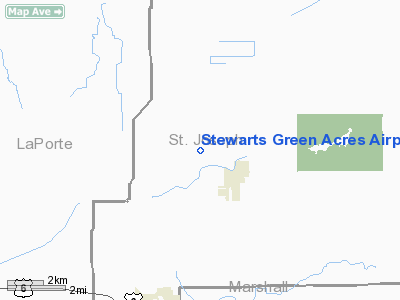
Stewarts Green Acres Airport |
Location & QuickFacts
|
FAA
Information Effective: |
2008-06-05 |
|
Airport
Identifier: |
IN38 |
| Airport
Status: |
Operational |
|
Longitude/Latitude: |
086-27-10.0460W/41-32-43.1630N
-86.452791/41.545323 (Estimated) |
|
Elevation: |
725
ft / 220.98 m (Estimated) |
|
Land: |
44 acres |
| From
nearest city: |
2
nautical miles NW of North Liberty, IN |
|
Location: |
St Joseph County, IN |
|
Magnetic Variation: |
03W
(1990) |
Owner & Manager
|
Ownership: |
Privately
owned |
| Owner: |
Richard
S. Stewart, Jr. |
|
Address: |
30212 Osborne Rd
North
Liberty, IN 46554 |
| Phone
number: |
219-656-3717 |
|
Manager: |
Richard S. Stewart, Jr. |
| Address: |
30212
Osborne Rd
North
Liberty, IN 46554 |
|
Phone
number: |
219-656-3717 |
Airport
Operations and Facilities
|
Airport
Use: |
Private
PERSONAL USE. |
|
Wind indicator: |
Yes |
|
Segmented Circle: |
No |
|
Control
Tower: |
No |
|
Sectional chart: |
Chicago |
|
Region: |
AGL - Great Lakes |
| Boundary
ARTCC: |
ZAU
- Chicago |
|
Tie-in FSS: |
HUF - Terre Haute |
| FSS
Toll Free: |
1-800-WX-BRIEF |
|
Runway Information
Runway 18/36
|
Dimension: |
2600 x 80 ft
/ 792.5 x 24.4 m |
| Surface: |
TURF,
|
|
|
Runway 18 |
Runway 36 |
|
Traffic Pattern: |
Left |
Left |
|
Obstruction: |
300
ft pline, 4000.0 ft from runway |
|
|
Radio Navigation Aids
|
ID |
Type |
Name |
Ch |
Freq |
Var |
Dist |
| IUL |
NDB |
La
Porte |
|
356.00 |
03W |
14.6
nm |
|
MGC |
NDB |
Michigan City |
|
203.00 |
01W |
19.0 nm |
| VP |
NDB |
Sedly |
|
212.00 |
02W |
19.9
nm |
|
CPB |
NDB |
Culver |
|
391.00 |
01W |
20.0 nm |
| RWN |
NDB |
Winamac/dcmsnd |
|
335.00 |
00W |
28.0
nm |
|
RCR |
NDB |
Rochester |
|
216.00 |
03W |
31.2 nm |
| HAI |
NDB |
Three
Rivers |
|
407.00 |
02W |
45.9
nm |
|
IRS |
NDB |
Sturgis |
|
382.00 |
04W |
48.5 nm |
| RZL |
NDB |
Rensselaer |
|
362.00 |
02W |
48.8
nm |
|
OLK |
VOR |
Wolf Lake |
|
110.40 |
03W |
46.7 nm |
| OXI |
VOR/DME |
Knox |
103X |
115.60 |
00E |
16.1
nm |
|
ELX |
VOR/DME |
Keeler |
113X |
116.60 |
00E |
38.9 nm |
| GIJ |
VORTAC |
Gipper |
101X |
115.40 |
00E |
14.7
nm |
|
GSH |
VORTAC |
Goshen |
084X |
113.70 |
00E |
19.2 nm |
Remarks
- PRVDD
ANY OBSTN IN RY APCH SLOPE IS REMOVED/LWRD, OR THE RY THR IS DSPLCD
& CLRLY MKD TO PRVD A MIN 20:1 APCH CLNC OVER THE OBSTN. THE AREA
125' EITHER SIDE OF RY CNTRLN &200' OFF THE RY END BE CLR OF ANY
OBSTN. CONTROL BY GATES, FENCES, ETC. TO KEEP VEHICLES OFF RY DURG OPNS.
Stewarts Green Acres Airport
Address:
St Joseph County, IN
Tel:
219-656-3717
Images
and information placed above are from
http://www.airport-data.com/airport/IN38/
We
thank them for the data!
| General
Info |
| Country |
United
States |
| State |
INDIANA
|
| FAA ID |
IN38 |
| Latitude |
41-32-43.163N
|
| Longitude |
086-27-10.046W
|
| Elevation |
725 feet
|
| Near City |
NORTH
LIBERTY |
We don't guarantee the information is fresh and accurate. The data may
be wrong or outdated.
For more up-to-date information please refer to other sources.
|
|


