 |
|
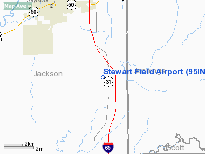
Location & QuickFacts
|
FAA
Information Effective: |
2008-06-05 |
|
Airport
Identifier: |
95IN |
| Airport
Status: |
Operational |
|
Longitude/Latitude: |
085-49-35.0000W/38-53-15.0000N
-85.826389/38.887500 (Estimated) |
|
Elevation: |
550
ft / 167.64 m (Estimated) |
|
Land: |
0 acres |
| From
nearest city: |
6
nautical miles SS of Seymour, IN |
|
Location: |
Jackson County, IN |
|
Magnetic Variation: |
03W
(1995) |
Owner & Manager
|
Ownership: |
Privately
owned |
| Owner: |
Larry
Stewart |
|
Address: |
11293 E Co. Rd 50n
Seymour, IN 47274 |
| Phone
number: |
812-523-8029 |
|
Manager: |
Larry Stewart |
| Address: |
11293
E. Co. Rd 50n
Seymour, IN 47274 |
|
Phone
number: |
812-523-8029 |
Airport
Operations and Facilities
|
Airport
Use: |
Private |
|
Wind indicator: |
Yes |
|
Segmented Circle: |
No |
|
Control
Tower: |
No |
|
Sectional chart: |
St
Louis |
|
Region: |
AGL - Great Lakes |
| Boundary
ARTCC: |
ZID
- Indianapolis |
|
Tie-in FSS: |
HUF - Terre Haute |
| FSS
on Airport: |
No |
|
FSS Toll
Free: |
1-800-WX-BRIEF |
|
Runway Information
Runway 08/26
|
Dimension: |
1050 x 150 ft
/ 320.0 x 45.7 m |
|
Surface: |
TURF, |
|
|
Runway 08 |
Runway 26 |
| Traffic
Pattern: |
Left |
Left |
|
Radio Navigation Aids
|
ID |
Type |
Name |
Ch |
Freq |
Var |
Dist |
| EQZ |
NDB |
Captain |
|
308.00 |
02W |
7.0
nm |
|
OVO |
NDB |
North Vernon |
|
374.00 |
02W |
14.4 nm |
| IMS |
NDB |
Madison |
|
404.00 |
03W |
18.7
nm |
|
BA |
NDB |
Clifs |
|
410.00 |
03W |
26.1 nm |
| BFR |
NDB |
Bedford |
|
344.00 |
02W |
28.7
nm |
|
BM |
NDB |
Claye |
|
382.00 |
02W |
37.5 nm |
| HLB |
NDB |
Batesville |
|
254.00 |
02W |
38.4
nm |
|
RRJ |
NDB |
Oranj |
|
368.00 |
02W |
39.4 nm |
| HFY |
NDB |
Greenwood |
|
398.00 |
02W |
46.4
nm |
|
BQM |
VOR/DME |
Bowman |
059X |
112.20 |
01W |
40.2 nm |
| ABB |
VORTAC |
Nabb |
071X |
112.40 |
01E |
20.0
nm |
|
OOM |
VORTAC |
Hoosier |
039X |
110.20 |
02W |
39.8 nm |
| SHB |
VORTAC |
Shelbyville |
057X |
112.00 |
01E |
44.8
nm |
|
IIU |
VORTAC |
Louisville |
095X |
114.80 |
01E |
48.6 nm |
| SDF |
VOT |
Louisville
Standifd |
|
111.00 |
|
42.9
nm |
Remarks
- PRVDD
ANY OBSTN BE REMOVED OR LOWERED OR THLD DSPLCD TO PRVD A CLEAR 20:1
APCH.
Based Aircraft
|
Aircraft
based on field: |
1 |
|
Single Engine Airplanes: |
1 |
Stewart Field Airport
Address:
Jackson County, IN
Tel:
812-523-8029
Images
and information placed above are from
http://www.airport-data.com/airport/95IN/
We
thank them for the data!
| General
Info |
| Country |
United
States |
| State |
INDIANA
|
| FAA ID |
95IN |
| Latitude |
38-53-15.000N
|
| Longitude |
085-49-35.000W
|
| Elevation |
550 feet
|
| Near City |
SEYMOUR
|
We don't guarantee the information is fresh and accurate. The data may
be wrong or outdated.
For more up-to-date information please refer to other sources.
|
|


