 |
|
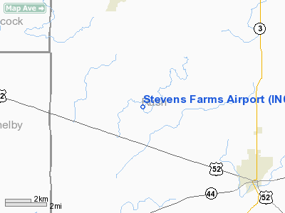
Location & QuickFacts
|
FAA
Information Effective: |
2008-06-05 |
|
Airport
Identifier: |
IN05 |
| Airport
Status: |
Operational |
|
Longitude/Latitude: |
085-32-54.0000W/39-39-38.0000N
-85.548333/39.660556 (Estimated) |
|
Elevation: |
930
ft / 283.46 m (Estimated) |
|
Land: |
0 acres |
| From
nearest city: |
6
nautical miles NW of Rushville, IN |
|
Location: |
Rush County, IN |
|
Magnetic Variation: |
03W
(1995) |
Owner
& Manager
|
Ownership: |
Privately
owned |
|
Owner: |
Jerry
A. Stevens |
|
Address: |
5554 W 300 N
Rushville, IN 46173 |
|
Phone number: |
765-663-2865 |
|
Manager: |
Jerry A. Stevens |
|
Address: |
5554
W 300 N
Rushville, IN 46173 |
|
Phone
number: |
765-663-2865 |
Airport Operations and Facilities
|
Airport
Use: |
Private |
|
Segmented
Circle: |
No |
| Control
Tower: |
No |
|
Sectional
chart: |
St Louis |
| Region: |
AGL
- Great Lakes |
|
Boundary
ARTCC: |
ZID - Indianapolis |
| Tie-in
FSS: |
HUF
- Terre Haute |
|
FSS Toll
Free: |
1-800-WX-BRIEF |
|
Runway Information
Runway 18/36
|
Dimension: |
1500 x 75 ft
/ 457.2 x 22.9 m |
|
Surface: |
TURF, |
|
|
Runway 18 |
Runway 36 |
| Traffic
Pattern: |
Left |
Left |
|
Radio Navigation Aids
|
ID |
Type |
Name |
Ch |
Freq |
Var |
Dist |
| UWL |
NDB |
New
Castle |
|
385.00 |
02W |
16.9
nm |
|
HLB |
NDB |
Batesville |
|
254.00 |
02W |
23.0 nm |
| BA |
NDB |
Clifs |
|
410.00 |
03W |
23.9
nm |
|
AI |
NDB |
Video |
|
371.00 |
03W |
24.6 nm |
| HFY |
NDB |
Greenwood |
|
398.00 |
02W |
25.2
nm |
|
UMP |
NDB |
Metropolitan |
|
338.00 |
03W |
28.5 nm |
| HZP |
NDB |
Zionsville |
|
248.00 |
03W |
36.5
nm |
|
OXD |
NDB |
Oxford |
|
282.00 |
04W |
36.7 nm |
| OVO |
NDB |
North
Vernon |
|
374.00 |
02W |
36.8
nm |
|
HAO |
NDB |
Hamilton |
|
260.00 |
04W |
48.5 nm |
| MIE |
VOR/DME |
Muncie |
091X |
114.40 |
03W |
35.4
nm |
|
SHB |
VORTAC |
Shelbyville |
057X |
112.00 |
01E |
12.9 nm |
| RID |
VORTAC |
Richmond |
043X |
110.60 |
03W |
33.3
nm |
|
VHP |
VORTAC |
Brickyard |
110X |
116.30 |
01E |
39.0 nm |
| IND |
VOT |
Indianapolis
Intl |
|
109.60 |
|
34.2
nm |
Remarks
- PRVDD
CLEAR 20:1 APCH & CLEAR OBSTACLE FREE ZONE.
Based Aircraft
|
Aircraft
based on field: |
1 |
|
Single Engine Airplanes: |
1 |
Stevens Farms Airport
Address:
Rush County, IN
Tel:
765-663-2865
Images
and information placed above are from
http://www.airport-data.com/airport/IN05/
We
thank them for the data!
| General
Info |
| Country |
United
States |
| State |
INDIANA
|
| FAA ID |
IN05 |
| Latitude |
39-39-38.000N
|
| Longitude |
085-32-54.000W
|
| Elevation |
930 feet
|
| Near City |
RUSHVILLE
|
We don't guarantee the information is fresh and accurate. The data may
be wrong or outdated.
For more up-to-date information please refer to other sources.
|
|


