 |
|
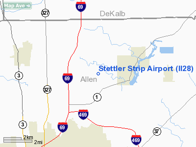
Location & QuickFacts
|
FAA
Information Effective: |
2008-06-05 |
|
Airport
Identifier: |
II28 |
| Airport
Status: |
Operational |
|
Longitude/Latitude: |
085-03-49.0000W/41-12-38.0000N
-85.063611/41.210556 (Estimated) |
|
Elevation: |
860
ft / 262.13 m (Estimated) |
|
Land: |
0 acres |
| From
nearest city: |
2
nautical miles W of Leo, IN |
|
Location: |
Allen County, IN |
|
Magnetic Variation: |
04W
(1995) |
Owner
& Manager
|
Ownership: |
Privately
owned |
|
Owner: |
Chad
A Stettler |
|
Address: |
6626 Hursh Road
219-627-6480 |
|
Phone number: |
219-637-8234 |
|
Manager: |
Chad A Stettler |
|
Address: |
6626
Hursh Road
219-627-6480 |
|
Phone
number: |
219-637-8234 |
Airport Operations and Facilities
|
Airport
Use: |
Private |
|
Wind indicator: |
Yes |
|
Segmented Circle: |
No |
|
Control
Tower: |
No |
|
Sectional chart: |
Chicago |
|
Region: |
AGL - Great Lakes |
| Boundary
ARTCC: |
ZAU
- Chicago |
|
Tie-in FSS: |
HUF - Terre Haute |
| FSS
on Airport: |
No |
|
FSS Toll
Free: |
1-800-WX-BRIEF |
|
Runway Information
Runway 09/27
|
Dimension: |
1400 x 50 ft
/ 426.7 x 15.2 m |
|
Surface: |
TURF, |
|
|
Runway 09 |
Runway 27 |
| Traffic
Pattern: |
Left |
Right |
|
Radio Navigation Aids
|
ID |
Type |
Name |
Ch |
Freq |
Var |
Dist |
| ANQ |
NDB |
Angola |
|
347.00 |
05W |
25.8
nm |
|
HHG |
NDB |
Huntington |
|
417.00 |
03W |
28.0 nm |
| VFU |
NDB |
Stanley |
|
411.00 |
05W |
29.2
nm |
|
DFI |
NDB |
Defiance |
|
246.00 |
05W |
29.7 nm |
| BYN |
NDB |
Bryan |
|
260.00 |
04W |
31.4
nm |
|
IRS |
NDB |
Sturgis |
|
382.00 |
04W |
39.9 nm |
| IWH |
NDB |
Wabash |
|
329.00 |
03W |
42.8
nm |
|
PLD |
NDB |
Portland |
|
257.00 |
03W |
45.6 nm |
| USE |
NDB |
Fulton |
|
375.00 |
05W |
48.3
nm |
|
CQA |
NDB |
Lakefield |
|
205.00 |
04W |
49.3 nm |
| OLK |
VOR |
Wolf
Lake |
|
110.40 |
03W |
19.7
nm |
|
FWA |
VORTAC |
Fort Wayne |
125X |
117.80 |
00E |
15.0 nm |
| GSH |
VORTAC |
Goshen |
084X |
113.70 |
00E |
47.4
nm |
|
FWA |
VOT |
Fort Wayne Baer |
|
111.00 |
|
15.1 nm |
Remarks
- PRVDD
ANY OBSTN BE REMOVED OR LOWERED OR THLD DSPLCD TO PRVD A CLEAR 20:1
APCH; AREA 125 FT EITHER SIDE OF RY & 200 FT OFF ENDS BE CLEAR;
AREA 60 FT EITHER SIDE OF RY & 240 FT OFF ENDS IS CLEAR OR GRADED
WITH NO HAZARDS.
Stettler Strip Airport
Address:
Allen County, IN
Tel:
219-637-8234
Images
and information placed above are from
http://www.airport-data.com/airport/II28/
We
thank them for the data!
| General
Info |
| Country |
United
States |
| State |
INDIANA
|
| FAA ID |
II28 |
| Latitude |
41-12-38.000N
|
| Longitude |
085-03-49.000W
|
| Elevation |
860 feet
|
| Near City |
LEO |
We don't guarantee the information is fresh and accurate. The data may
be wrong or outdated.
For more up-to-date information please refer to other sources.
|
|


