 |
|
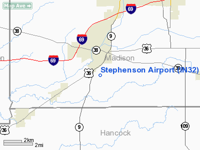
Location & QuickFacts
|
FAA
Information Effective: |
2008-06-05 |
|
Airport
Identifier: |
IN32 |
| Airport
Status: |
Operational |
|
Longitude/Latitude: |
085-44-39.9170W/39-58-38.1500N
-85.744421/39.977264 (Estimated) |
|
Elevation: |
880
ft / 268.22 m (Estimated) |
|
Land: |
0 acres |
| From
nearest city: |
2
nautical miles S of Pendleton, IN |
|
Location: |
Madison County, IN |
|
Magnetic Variation: |
02W
(1985) |
Owner
& Manager
|
Ownership: |
Privately
owned |
|
Owner: |
John
B. Stephenson |
|
Address: |
3606 W. 900s
Pendleton, IN 46064 |
|
Phone number: |
317-778-2820 |
|
Address: |
|
Airport Operations and Facilities
|
Airport
Use: |
Private |
|
Wind indicator: |
Yes |
|
Segmented Circle: |
No |
|
Control
Tower: |
No |
| Landing
fee charge: |
No |
|
Sectional
chart: |
St Louis |
| Region: |
AGL
- Great Lakes |
|
Boundary
ARTCC: |
ZID - Indianapolis |
| Tie-in
FSS: |
HUF
- Terre Haute |
|
FSS on Airport: |
No |
| FSS
Toll Free: |
1-800-WX-BRIEF |
|
Runway Information
Runway N/S
|
Dimension: |
1680 x 50 ft
/ 512.1 x 15.2 m |
| Surface: |
TURF,
|
|
|
Runway N |
Runway S |
|
Traffic Pattern: |
Left |
Left |
|
Radio Navigation Aids
|
ID |
Type |
Name |
Ch |
Freq |
Var |
Dist |
| AI |
NDB |
Video |
|
371.00 |
03W |
12.1
nm |
|
UMP |
NDB |
Metropolitan |
|
338.00 |
03W |
14.3 nm |
| UWL |
NDB |
New
Castle |
|
385.00 |
02W |
20.5
nm |
|
HZP |
NDB |
Zionsville |
|
248.00 |
03W |
23.4 nm |
| HFY |
NDB |
Greenwood |
|
398.00 |
02W |
26.2
nm |
|
BA |
NDB |
Clifs |
|
410.00 |
03W |
39.5 nm |
| FKR |
NDB |
Frankfort |
|
278.00 |
02W |
41.5
nm |
|
HLB |
NDB |
Batesville |
|
254.00 |
02W |
43.9 nm |
| PLD |
NDB |
Portland |
|
257.00 |
03W |
45.2
nm |
|
IWH |
NDB |
Wabash |
|
329.00 |
03W |
47.3 nm |
| MIE |
VOR/DME |
Muncie |
091X |
114.40 |
03W |
22.4
nm |
|
MZZ |
VOR/DME |
Marion |
023X |
108.60 |
03W |
31.2 nm |
| SHB |
VORTAC |
Shelbyville |
057X |
112.00 |
01E |
21.0
nm |
|
VHP |
VORTAC |
Brickyard |
110X |
116.30 |
01E |
30.4 nm |
| OKK |
VORTAC |
Kokomo |
082X |
113.50 |
00E |
36.1
nm |
|
RID |
VORTAC |
Richmond |
043X |
110.60 |
03W |
43.9 nm |
| GUS |
VORTAC |
Grissom |
21Y |
108.45 |
02W |
44.3
nm |
|
IND |
VOT |
Indianapolis Intl |
|
109.60 |
|
29.1 nm |
Remarks
- ALL
AERO OPNS WILL BE CONDUCTED N OF ROAD 950 S.
Based Aircraft
|
Aircraft
based on field: |
1 |
|
Single Engine Airplanes: |
1 |
Stephenson Airport
Address:
Madison County, IN
Tel:
317-778-2820
Images
and information placed above are from
http://www.airport-data.com/airport/IN32/
We
thank them for the data!
| General
Info |
| Country |
United
States |
| State |
INDIANA
|
| FAA ID |
IN32 |
| Latitude |
39-58-38.150N
|
| Longitude |
085-44-39.917W
|
| Elevation |
880 feet
|
| Near City |
PENDLETON
|
We don't guarantee the information is fresh and accurate. The data may
be wrong or outdated.
For more up-to-date information please refer to other sources.
|
|


