|
|
|
 |
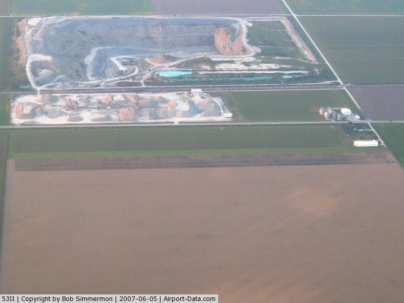
(Click on the photo to enlarge) |
Location & QuickFacts
|
FAA
Information Effective: |
2008-06-05 |
|
Airport
Identifier: |
53II |
| Airport
Status: |
Operational |
|
Longitude/Latitude: |
084-50-26.8650W/41-04-23.1760N
-84.840796/41.073104 (Estimated) |
|
Elevation: |
760
ft / 231.65 m (Estimated) |
|
Land: |
0 acres |
| From
nearest city: |
4
nautical miles NW of Woodburn, IN |
|
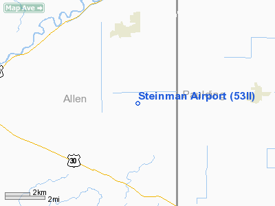
Location: |
Allen County, IN |
|
Magnetic Variation: |
03W
(1985) |
Owner & Manager
|
Ownership: |
Privately
owned |
| Owner: |
Barry
L. Steinman |
|
Address: |
23526 E St Rd 14
Woodburn, IN 46797 |
| Phone
number: |
219-632-4757 |
|
Manager: |
Barry L. Steinman |
| Address: |
23526
E St Rd 14
Woodburn, IN 46797 |
|
Phone
number: |
219-632-4757 |
Airport
Operations and Facilities
|
Airport
Use: |
Private |
|
Wind indicator: |
Yes |
|
Segmented Circle: |
No |
|
Control
Tower: |
No |
|
Sectional chart: |
Detroit |
|
Region: |
AGL - Great Lakes |
| Boundary
ARTCC: |
ZAU
- Chicago |
|
Tie-in FSS: |
HUF - Terre Haute |
| FSS
Toll Free: |
1-800-WX-BRIEF |
|
Runway Information
Runway 09/27
|
Dimension: |
2600 x 80 ft
/ 792.5 x 24.4 m |
| Surface: |
TURF,
|
|
|
Runway 09 |
Runway 27 |
|
Traffic Pattern: |
Right |
Left |
|
Radio Navigation Aids
|
ID |
Type |
Name |
Ch |
Freq |
Var |
Dist |
| VFU |
NDB |
Stanley |
|
411.00 |
05W |
16.3
nm |
|
DFI |
NDB |
Defiance |
|
246.00 |
05W |
24.4 nm |
| BYN |
NDB |
Bryan |
|
260.00 |
04W |
29.7
nm |
|
HHG |
NDB |
Huntington |
|
417.00 |
03W |
31.2 nm |
| ANQ |
NDB |
Angola |
|
347.00 |
05W |
35.8
nm |
|
CQA |
NDB |
Lakefield |
|
205.00 |
04W |
37.7 nm |
| PLD |
NDB |
Portland |
|
257.00 |
03W |
37.8
nm |
|
PDR |
NDB |
Ottawa |
|
233.00 |
05W |
39.3 nm |
| LYL |
NDB |
Lima |
|
362.00 |
04W |
43.3
nm |
|
USE |
NDB |
Fulton |
|
375.00 |
05W |
45.4 nm |
| IWH |
NDB |
Wabash |
|
329.00 |
03W |
47.3
nm |
|
OLK |
VOR |
Wolf Lake |
|
110.40 |
03W |
31.5 nm |
| AOH |
VOR |
Allen
County |
|
108.40 |
04W |
45.3
nm |
|
FWA |
VORTAC |
Fort Wayne |
125X |
117.80 |
00E |
16.7 nm |
| FDY |
VORTAC |
Findlay |
019X |
108.20 |
02W |
49.7
nm |
|
FWA |
VOT |
Fort Wayne Baer |
|
111.00 |
|
16.9 nm |
Remarks
- PRVD
ALL OPERATIONS ATTHIS ARPT BE CONDUCTED TO THE SOUTH; OWNER/OPERATOR
OF BASTING ARPT AGRESS TO CONDUCT ALL OPERATIONS TO THE NORTH.
Based Aircraft
|
Aircraft
based on field: |
2 |
|
Single Engine Airplanes: |
2 |
Steinman Airport
Address:
Allen County, IN
Tel:
219-632-4757
Images
and information placed above are from
http://www.airport-data.com/airport/53II/
We
thank them for the data!
| General
Info |
| Country |
United
States |
| State |
INDIANA
|
| FAA ID |
53II |
| Latitude |
41-04-23.176N
|
| Longitude |
084-50-26.865W
|
| Elevation |
760 feet
|
| Near City |
WOODBURN |
We don't guarantee the information is fresh and accurate. The data may
be wrong or outdated.
For more up-to-date information please refer to other sources.
|
|