 |
|
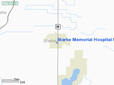
Starke Memorial Hospital Heliport |
Location & QuickFacts
|
FAA
Information Effective: |
2008-06-05 |
|
Airport
Identifier: |
II44 |
| Airport
Status: |
Operational |
|
Longitude/Latitude: |
086-37-21.0490W/41-17-14.1490N
-86.622514/41.287264 (Estimated) |
|
Elevation: |
717
ft / 218.54 m (Estimated) |
|
Land: |
0 acres |
| From
nearest city: |
0
nautical miles N of Knox, IN |
|
Location: |
Starke County, IN |
|
Magnetic Variation: |
02W
(1990) |
Owner & Manager
|
Ownership: |
Publicly
owned |
| Owner: |
Starke
Memorial Hospital |
|
Address: |
102 E. Culver Road
Knox,
IN 46534 |
| Phone
number: |
219-772-6231 |
|
Manager: |
Leonard W. Daugherty |
| Address: |
102
E. Culver Road
Knox,
IN 46534 |
|
Phone
number: |
219-772-6231 |
Airport
Operations and Facilities
|
Airport
Use: |
Private
MEDICAL USE. |
|
Wind indicator: |
Yes |
|
Segmented Circle: |
No |
|
Control
Tower: |
No |
| Lighting
Schedule: |
PHONE
REQ
FOR PERIMETER LGTS PHONE 219-772-6231. |
|
Sectional
chart: |
Chicago |
| Region: |
AGL
- Great Lakes |
|
Boundary
ARTCC: |
ZAU - Chicago |
| Tie-in
FSS: |
HUF
- Terre Haute |
|
FSS Toll
Free: |
1-800-WX-BRIEF |
|
Runway Information
Helipad H1
|
Dimension: |
40 x 40 ft /
12.2 x 12.2 m |
|
Surface: |
CONC, |
|
|
Runway H1 |
Runway |
| Traffic
Pattern: |
Left |
Left |
|
Radio Navigation Aids
|
ID |
Type |
Name |
Ch |
Freq |
Var |
Dist |
| CPB |
NDB |
Culver |
|
391.00 |
01W |
11.6
nm |
|
RWN |
NDB |
Winamac/dcmsnd |
|
335.00 |
00W |
11.6 nm |
| IUL |
NDB |
La
Porte |
|
356.00 |
03W |
14.4
nm |
|
VP |
NDB |
Sedly |
|
212.00 |
02W |
15.1 nm |
| RCR |
NDB |
Rochester |
|
216.00 |
03W |
23.7
nm |
|
MGC |
NDB |
Michigan City |
|
203.00 |
01W |
26.7 nm |
| RZL |
NDB |
Rensselaer |
|
362.00 |
02W |
32.6
nm |
|
MCX |
NDB |
White County |
|
377.00 |
03W |
35.3 nm |
| GGP |
NDB |
Logansport |
|
263.00 |
01W |
36.5
nm |
|
IWH |
NDB |
Wabash |
|
329.00 |
03W |
48.9 nm |
| OXI |
VOR/DME |
Knox |
103X |
115.60 |
00E |
2.4
nm |
|
GSH |
VORTAC |
Goshen |
084X |
113.70 |
00E |
30.4 nm |
| GIJ |
VORTAC |
Gipper |
101X |
115.40 |
00E |
32.0
nm |
|
GUS |
VORTAC |
Grissom |
21Y |
108.45 |
02W |
44.1 nm |
| CGT |
VORTAC |
Chicago
Heights |
089X |
114.20 |
02E |
44.8
nm |
|
BVT |
VORTAC |
Boiler |
098X |
115.10 |
01E |
48.4 nm |
Remarks
- ALL
APCH/DEP OPS ARE CONDUCTED 165-195 DEGS FM 325-355 DEGS; TAKEOFF/LNDG
AREA IS APPROPRIATELY MKD; &A NON-OBSTRUCTING WIND INDICATOR IS
MAINTAINED.
Starke Memorial Hospital Heliport
Address:
Starke County, IN
Tel:
219-772-6231
Images
and information placed above are from
http://www.airport-data.com/airport/II44/
We
thank them for the data!
| General
Info |
| Country |
United
States |
| State |
INDIANA
|
| FAA ID |
II44 |
| Latitude |
41-17-14.149N
|
| Longitude |
086-37-21.049W
|
| Elevation |
717 feet
|
| Near City |
KNOX |
We don't guarantee the information is fresh and accurate. The data may
be wrong or outdated.
For more up-to-date information please refer to other sources.
|
|


