 |
|
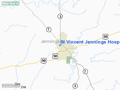
St Vincent Jennings Hospital Heliport |
Location & QuickFacts
|
FAA
Information Effective: |
2008-06-05 |
|
Airport
Identifier: |
07II |
| Airport
Status: |
Operational |
|
Longitude/Latitude: |
085-38-26.8890W/39-00-38.1930N
-85.640803/39.010609 (Estimated) |
|
Elevation: |
740
ft / 225.55 m (Estimated) |
|
Land: |
0 acres |
| From
nearest city: |
0
nautical miles N of North Vernon, IN |
|
Location: |
Jennings County, IN |
|
Magnetic Variation: |
02W
(1985) |
Owner & Manager
|
Ownership: |
Privately
owned |
| Owner: |
St
Vincent Jennings Hospital |
|
Address: |
301 Henry Street
North
Vernon, IN 47265 |
| Phone
number: |
812-346-6200 |
|
Manager: |
Steve Elmore |
| Address: |
301
Henry St
North
Vernon, IN 47265 |
|
Phone
number: |
812-346-6200 |
Airport
Operations and Facilities
|
Airport
Use: |
Private
MEDICAL USE. |
|
Wind indicator: |
Yes |
|
Segmented Circle: |
No |
|
Control
Tower: |
No |
|
Sectional chart: |
St
Louis |
|
Region: |
AGL - Great Lakes |
| Boundary
ARTCC: |
ZID
- Indianapolis |
|
Tie-in FSS: |
HUF - Terre Haute |
| FSS
on Airport: |
No |
|
FSS Toll
Free: |
1-800-WX-BRIEF |
|
Runway Information
Helipad H1
|
Dimension: |
60 x 60 ft /
18.3 x 18.3 m |
|
Surface: |
CONC, |
|
|
Runway H1 |
Runway |
| Traffic
Pattern: |
Left |
Left |
|
Radio Navigation Aids
|
ID |
Type |
Name |
Ch |
Freq |
Var |
Dist |
| OVO |
NDB |
North
Vernon |
|
374.00 |
02W |
3.0
nm |
|
IMS |
NDB |
Madison |
|
404.00 |
03W |
17.2 nm |
| EQZ |
NDB |
Captain |
|
308.00 |
02W |
17.8
nm |
|
BA |
NDB |
Clifs |
|
410.00 |
03W |
20.5 nm |
| HLB |
NDB |
Batesville |
|
254.00 |
02W |
27.1
nm |
|
BFR |
NDB |
Bedford |
|
344.00 |
02W |
38.6 nm |
| UR |
NDB |
Burln |
|
321.00 |
04W |
40.6
nm |
|
HFY |
NDB |
Greenwood |
|
398.00 |
02W |
42.8 nm |
| BM |
NDB |
Claye |
|
382.00 |
02W |
44.8
nm |
|
OXD |
NDB |
Oxford |
|
282.00 |
04W |
49.9 nm |
| BQM |
VOR/DME |
Bowman |
059X |
112.20 |
01W |
46.9
nm |
|
ABB |
VORTAC |
Nabb |
071X |
112.40 |
01E |
25.4 nm |
| SHB |
VORTAC |
Shelbyville |
057X |
112.00 |
01E |
38.3
nm |
|
CVG |
VORTAC |
Cincinnati |
120X |
117.30 |
04W |
43.8 nm |
| OOM |
VORTAC |
Hoosier |
039X |
110.20 |
02W |
46.1
nm |
Remarks
- PRVDD
OPNS ARE CONDD IN AN AREA 040-280 DEG, AREA MKD, WIND INDCR MAINTD,
SIGN RELCTD.
St Vincent Jennings Hospital Heliport
Address:
Jennings County, IN
Tel:
812-346-6200
Images
and information placed above are from
http://www.airport-data.com/airport/07II/
We
thank them for the data!
| General
Info |
| Country |
United
States |
| State |
INDIANA
|
| FAA ID |
07II |
| Latitude |
39-00-38.193N
|
| Longitude |
085-38-26.889W
|
| Elevation |
740 feet
|
| Near City |
NORTH
VERNON |
We don't guarantee the information is fresh and accurate. The data may
be wrong or outdated.
For more up-to-date information please refer to other sources.
|
|


