 |
|
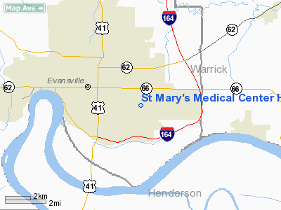
St Mary's Medical Center Heliport |
|
|
Location & QuickFacts
|
FAA
Information Effective: |
2008-06-05 |
|
Airport
Identifier: |
1II6 |
| Airport
Status: |
Operational |
|
Longitude/Latitude: |
087-30-15.0460W/37-57-54.1510N
-87.504179/37.965042 (Estimated) |
|
Elevation: |
386
ft / 117.65 m (Estimated) |
|
Land: |
0 acres |
| From
nearest city: |
0
nautical miles NW of Evansville, IN |
|
Location: |
Vanderburgh County, IN |
|
Magnetic Variation: |
00W
(1985) |
Owner
& Manager
|
Ownership: |
Privately
owned |
|
Owner: |
St.
Mary's Medical Center |
|
Address: |
3700 Washington Ave.
Evansville,
IN 47750 |
|
Phone number: |
812-479-4161 |
|
Manager: |
Saeid Elmi |
|
Address: |
3700
Washington Ave.
Evansville,
IN 47750 |
|
Phone
number: |
812-479-4161 |
Airport
Operations and Facilities
|
Airport Use: |
Private
MEDICAL USE. |
|
Wind indicator: |
Yes |
|
Segmented Circle: |
No |
|
Control
Tower: |
No |
|
Lighting Schedule: |
DUSK-DAWN |
|
Beacon
Color: |
Clear-Green-Yellow (heliport) |
|
Sectional chart: |
Chicago |
|
Region: |
AGL - Great Lakes |
|
Boundary ARTCC: |
ZID
- Indianapolis |
|
Tie-in
FSS: |
HUF - Terre Haute |
|
FSS on Airport: |
No |
|
FSS Toll
Free: |
1-800-WX-BRIEF |
Airport Communications
|
Runway Information
Helipad H1
|
Dimension: |
50 x 50 ft /
15.2 x 15.2 m |
| Surface: |
CONC,
|
|
Edge Lights: |
Low |
|
|
Runway H1 |
Runway |
| Traffic
Pattern: |
Left |
Left |
|
Radio Navigation Aids
|
ID |
Type |
Name |
Ch |
Freq |
Var |
Dist |
| PDW |
NDB |
Evansville |
|
284.00 |
00E |
4.7
nm |
|
GVA |
NDB |
Geneva |
|
224.00 |
01W |
16.0 nm |
| CUL |
NDB |
Carmi |
|
332.00 |
01W |
30.1
nm |
|
FNZ |
NDB |
Ferdinand |
|
239.00 |
00E |
35.8 nm |
| TWT |
NDB |
Tradewater |
|
276.00 |
00E |
36.6
nm |
|
TEL |
NDB |
Tell City |
|
206.00 |
02W |
38.7 nm |
| AJG |
NDB |
Mount
Carmel |
|
524.00 |
02W |
40.3
nm |
|
OEA |
NDB |
Vincennes |
|
251.00 |
00E |
43.7 nm |
| GMH |
NDB |
Muhlenberg |
|
362.00 |
01E |
47.3
nm |
|
DCY |
NDB |
Washington |
|
212.00 |
03W |
47.3 nm |
| FWC |
NDB |
Wayne
County |
|
257.00 |
01E |
49.5
nm |
|
OWB |
VOR/DME |
Owensboro |
023X |
108.60 |
01E |
20.9 nm |
| HNB |
VOR/DME |
Huntingburg |
029X |
109.20 |
00E |
31.1
nm |
|
SAM |
VOR/DME |
Samsville |
113X |
116.60 |
03E |
41.6 nm |
| LWV |
VOR/DME |
Lawrenceville |
025X |
108.80 |
01W |
48.6
nm |
|
PXV |
VORTAC |
Pocket City |
080X |
113.30 |
03E |
12.4 nm |
| CCT |
VORTAC |
Central
City |
035X |
109.80 |
01W |
36.8
nm |
Remarks
- PROVIDED
ALL APCH/DEP OPS 170-190 AND 350-010; TAKEOFF/LDG ARE APPROPRIATELY
MARKED; NON-OBSTRUCTING WIND INDICATOR MAINTAINED.
St Mary's Medical Center Heliport
Address:
Vanderburgh County, IN
Tel:
812-479-4161
Images
and information placed above are from
http://www.airport-data.com/airport/1II6/
We
thank them for the data!
| General
Info |
| Country |
United
States |
| State |
INDIANA
|
| FAA ID |
1II6 |
| Latitude |
37-57-54.151N
|
| Longitude |
087-30-15.046W
|
| Elevation |
386 feet
|
| Near City |
EVANSVILLE
|
We don't guarantee the information is fresh and accurate. The data may
be wrong or outdated.
For more up-to-date information please refer to other sources.
|
|


