 |
|
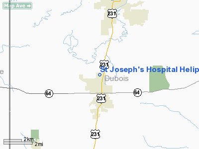
St Joseph's Hospital Heliport |
Location & QuickFacts
|
FAA
Information Effective: |
2008-06-05 |
|
Airport
Identifier: |
II47 |
| Airport
Status: |
Operational |
|
Longitude/Latitude: |
086-57-27.9910W/38-19-02.1910N
-86.957775/38.317275 (Estimated) |
|
Elevation: |
510
ft / 155.45 m (Estimated) |
|
Land: |
0 acres |
| From
nearest city: |
1
nautical miles SE of Huntingburg, IN |
|
Location: |
Dubois County, IN |
|
Magnetic Variation: |
01W
(1985) |
Owner & Manager
|
Ownership: |
Privately
owned |
| Owner: |
St
Joseph's Hospital |
|
Address: |
1900 Medical Arts Drive
Huntingburg, IN 47542 |
| Phone
number: |
812-683-2121 |
|
Manager: |
Dale R. Mulder |
| Address: |
1900
Medical Arts Drive
Huntingburg, IN 47542 |
|
Phone
number: |
812-683-2121 |
Airport
Operations and Facilities
|
Airport
Use: |
Private
MEDICAL USE. |
|
Wind indicator: |
Yes |
|
Segmented Circle: |
No |
|
Control
Tower: |
No |
| Landing
fee charge: |
No |
|
Sectional
chart: |
St Louis |
| Region: |
AGL
- Great Lakes |
|
Boundary
ARTCC: |
ZID - Indianapolis |
| Tie-in
FSS: |
HUF
- Terre Haute |
|
FSS on Airport: |
No |
| FSS
Toll Free: |
1-800-WX-BRIEF |
|
Runway Information
Helipad H1
|
Dimension: |
50 x 50 ft /
15.2 x 15.2 m |
| Surface: |
CONC,
|
|
|
Runway H1 |
Runway |
|
Traffic Pattern: |
Left |
Left |
|
Radio Navigation Aids
|
ID |
Type |
Name |
Ch |
Freq |
Var |
Dist |
| FNZ |
NDB |
Ferdinand |
|
239.00 |
00E |
7.0
nm |
|
TEL |
NDB |
Tell City |
|
206.00 |
02W |
22.2 nm |
| RRJ |
NDB |
Oranj |
|
368.00 |
02W |
23.9
nm |
|
DCY |
NDB |
Washington |
|
212.00 |
03W |
24.2 nm |
| PDW |
NDB |
Evansville |
|
284.00 |
00E |
31.8
nm |
|
OEA |
NDB |
Vincennes |
|
251.00 |
00E |
36.0 nm |
| BFR |
NDB |
Bedford |
|
344.00 |
02W |
39.8
nm |
|
AJG |
NDB |
Mount Carmel |
|
524.00 |
02W |
40.3 nm |
| BM |
NDB |
Claye |
|
382.00 |
02W |
47.5
nm |
|
GVA |
NDB |
Geneva |
|
224.00 |
01W |
49.3 nm |
| MYS |
VOR |
Mystic |
|
108.20 |
01W |
42.3
nm |
|
HNB |
VOR/DME |
Huntingburg |
029X |
109.20 |
00E |
4.0 nm |
| OWB |
VOR/DME |
Owensboro |
023X |
108.60 |
01E |
35.9
nm |
|
LWV |
VOR/DME |
Lawrenceville |
025X |
108.80 |
01W |
40.8 nm |
| PXV |
VORTAC |
Pocket
City |
080X |
113.30 |
03E |
44.7
nm |
Remarks
- VFR
USE ONLY; SE INGRESS/EGRESS SHALL NOT BE USED; LIGHTS TO BE INSTALLED
ON EACH SIDE; LIGHTED WIND INDICATOR IS INSTALLED ON MAIN HOSPITAL BUILDING.
St Joseph's Hospital Heliport
Address:
Dubois County, IN
Tel:
812-683-2121
Images
and information placed above are from
http://www.airport-data.com/airport/II47/
We
thank them for the data!
| General
Info |
| Country |
United
States |
| State |
INDIANA
|
| FAA ID |
II47 |
| Latitude |
38-19-02.191N
|
| Longitude |
086-57-27.991W
|
| Elevation |
510 feet
|
| Near City |
HUNTINGBURG
|
We don't guarantee the information is fresh and accurate. The data may
be wrong or outdated.
For more up-to-date information please refer to other sources.
|
|


