 |
|
St Joseph Medical Center Heliport |
|
|
Location & QuickFacts
|
FAA
Information Effective: |
2008-06-05 |
|
Airport
Identifier: |
13II |
| Airport
Status: |
Operational |
|
Longitude/Latitude: |
085-08-58.8950W/41-04-43.1730N
-85.149693/41.078659 (Estimated) |
|
Elevation: |
845
ft / 257.56 m (Estimated) |
|
Land: |
0 acres |
| From
nearest city: |
0
nautical miles N of Fort Wayne, IN |
|
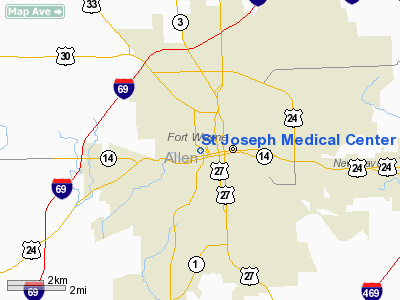
Location: |
Allen County, IN |
|
Magnetic Variation: |
03W
(1980) |
Owner
& Manager
|
Ownership: |
Privately
owned |
|
Owner: |
St
Joseph Medical Center |
|
Address: |
700 Broadway
Fort Wayne, IN 46802 |
|
Phone number: |
219-425-3140 |
|
Manager: |
Everett Lawson |
|
Address: |
700
Broadway
Fort Wayne, IN 46802 |
|
Phone
number: |
219-425-3140 |
Airport Operations and Facilities
|
Airport
Use: |
Private
MEDICAL USE. |
|
Wind indicator: |
Yes |
|
Segmented Circle: |
No |
|
Control
Tower: |
No |
| Lighting
Schedule: |
RDO-CTL
ACTVT ROTG BCN & PERIMETER LIGHTS - 155.340. |
|
Beacon Color: |
Clear-Green-Yellow (heliport) |
|
Sectional chart: |
Chicago |
|
Region: |
AGL - Great Lakes |
| Boundary
ARTCC: |
ZAU
- Chicago |
|
Tie-in FSS: |
HUF - Terre Haute |
| FSS
Toll Free: |
1-800-WX-BRIEF |
|
Runway Information
Helipad H1
|
Dimension: |
50 x 50 ft /
15.2 x 15.2 m |
| Surface: |
CONC,
LNDG AREA LCTD ON ROOFTOP. |
|
|
Runway H1 |
Runway |
|
Traffic Pattern: |
Left |
Left |
|
Radio Navigation Aids
|
ID |
Type |
Name |
Ch |
Freq |
Var |
Dist |
| HHG |
NDB |
Huntington |
|
417.00 |
03W |
19.6
nm |
|
VFU |
NDB |
Stanley |
|
411.00 |
05W |
27.6 nm |
| ANQ |
NDB |
Angola |
|
347.00 |
05W |
33.8
nm |
|
IWH |
NDB |
Wabash |
|
329.00 |
03W |
35.0 nm |
| DFI |
NDB |
Defiance |
|
246.00 |
05W |
36.1
nm |
|
PLD |
NDB |
Portland |
|
257.00 |
03W |
38.3 nm |
| BYN |
NDB |
Bryan |
|
260.00 |
04W |
39.2
nm |
|
CQA |
NDB |
Lakefield |
|
205.00 |
04W |
44.7 nm |
| IRS |
NDB |
Sturgis |
|
382.00 |
04W |
46.0
nm |
|
RCR |
NDB |
Rochester |
|
216.00 |
03W |
47.2 nm |
| OLK |
VOR |
Wolf
Lake |
|
110.40 |
03W |
18.7
nm |
|
MZZ |
VOR/DME |
Marion |
023X |
108.60 |
03W |
42.6 nm |
| FWA |
VORTAC |
Fort
Wayne |
125X |
117.80 |
00E |
6.2
nm |
|
GSH |
VORTAC |
Goshen |
084X |
113.70 |
00E |
47.9 nm |
| FWA |
VOT |
Fort
Wayne Baer |
|
111.00 |
|
6.3
nm |
Remarks
- PRVDD
OPNS CONDUCTED FM 045 DEG TO 130 DEG & 270 DEG TO 360 DEG; AREA
MKD; WIND INDICATOR MNTD.
St Joseph Medical Center Heliport
Address:
Allen County, IN
Tel:
219-425-3140
Images
and information placed above are from
http://www.airport-data.com/airport/13II/
We
thank them for the data!
| General
Info |
| Country |
United
States |
| State |
INDIANA
|
| FAA ID |
13II |
| Latitude |
41-04-43.173N
|
| Longitude |
085-08-58.895W
|
| Elevation |
845 feet
|
| Near City |
FORT WAYNE
|
We don't guarantee the information is fresh and accurate. The data may
be wrong or outdated.
For more up-to-date information please refer to other sources.
|
|


