 |
|
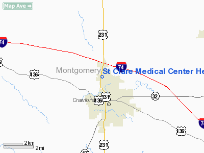
St Clare Medical Center Heliport |
|
|
Location & QuickFacts
|
FAA
Information Effective: |
2008-06-05 |
|
Airport
Identifier: |
7II2 |
| Airport
Status: |
Operational |
|
Longitude/Latitude: |
086-54-21.0260W/40-03-58.1500N
-86.905841/40.066153 (Estimated) |
|
Elevation: |
760
ft / 231.65 m (Estimated) |
|
Land: |
0 acres |
| From
nearest city: |
0
nautical miles N of Crawfordsville, IN |
|
Location: |
Montgomery County, IN |
|
Magnetic Variation: |
01W
(1985) |
Owner & Manager
|
Ownership: |
Privately
owned |
| Owner: |
Sisters
Of St Francis Health Svcs |
|
Address: |
1515 Dragoon Trail, Po Box 1290
Misawaka, IN 46546-1290 |
| Phone
number: |
800-975-3935 |
|
Manager: |
Jeanette Allen |
| Address: |
St
Clare Medical Center, 1710 Lafayette Road
Crawfordsville, IN 47933 |
|
Phone
number: |
765-364-3103 |
Airport
Operations and Facilities
|
Airport
Use: |
Private
MEDICAL USE. |
|
Wind indicator: |
Yes |
|
Segmented Circle: |
No |
|
Control
Tower: |
No |
| Lighting
Schedule: |
PHONE
REQ
FOR HELI LGTS CALL 317-362-2800. |
|
Beacon Color: |
Clear-Green-Yellow (heliport) |
|
Sectional chart: |
St
Louis |
|
Region: |
AGL - Great Lakes |
| Boundary
ARTCC: |
ZAU
- Chicago |
|
Tie-in FSS: |
HUF - Terre Haute |
| FSS
on Airport: |
No |
|
FSS Toll
Free: |
1-800-WX-BRIEF |
|
Runway Information
Helipad H1
|
Dimension: |
65 x 65 ft /
19.8 x 19.8 m |
|
Surface: |
CONC, Good Condition |
| Edge
Lights: |
Medium
HELI LGTD WITH PERIMETER LGTS. |
|
|
Runway H1 |
Runway |
|
Traffic Pattern: |
Left |
Left |
|
Radio Navigation Aids
|
ID |
Type |
Name |
Ch |
Freq |
Var |
Dist |
| CFJ |
NDB |
Crawfordsville |
|
388.00 |
02W |
5.1
nm |
|
FKR |
NDB |
Frankfort |
|
278.00 |
02W |
20.0 nm |
| TVX |
NDB |
Greencastle |
|
521.00 |
03W |
21.7
nm |
|
HZP |
NDB |
Zionsville |
|
248.00 |
03W |
31.2 nm |
| MCX |
NDB |
White
County |
|
377.00 |
03W |
39.3
nm |
|
UMP |
NDB |
Metropolitan |
|
338.00 |
03W |
40.1 nm |
| PRG |
NDB |
Paris |
|
341.00 |
01E |
41.8
nm |
|
GGP |
NDB |
Logansport |
|
263.00 |
01W |
45.7 nm |
| HFY |
NDB |
Greenwood |
|
398.00 |
02W |
45.8
nm |
|
HU |
NDB |
Yinno |
|
245.00 |
02W |
46.7 nm |
| HMJ |
NDB |
Homer |
|
281.00 |
01E |
48.2
nm |
|
VHP |
VORTAC |
Brickyard |
110X |
116.30 |
01E |
29.0 nm |
| BVT |
VORTAC |
Boiler |
098X |
115.10 |
01E |
30.4
nm |
|
DNV |
VORTAC |
Danville |
047X |
111.00 |
02E |
32.9 nm |
| TTH |
VORTAC |
Terre
Haute |
100X |
115.30 |
02E |
38.1
nm |
|
OKK |
VORTAC |
Kokomo |
082X |
113.50 |
00E |
47.8 nm |
| GUS |
VORTAC |
Grissom |
21Y |
108.45 |
02W |
49.0
nm |
|
IND |
VOT |
Indianapolis Intl |
|
109.60 |
|
35.3 nm |
Remarks
- PRVDD
OPNS ARE CONDD IN ANAREA TO/FM 360 DEG & TO/FM 180 DEG, AREA APROPLY
MKD, WIND INDCR MAINTD. NO
LGTS OPERS UNLESS AREA & WIND INDCR ARE LGTD.
St Clare Medical Center Heliport
Address:
Montgomery County, IN
Tel:
800-975-3935,
765-364-3103
Images
and information placed above are from
http://www.airport-data.com/airport/7II2/
We
thank them for the data!
| General
Info |
| Country |
United
States |
| State |
INDIANA
|
| FAA ID |
7II2 |
| Latitude |
40-03-58.150N
|
| Longitude |
086-54-21.026W
|
| Elevation |
760 feet
|
| Near City |
CRAWFORDSVILLE
|
We don't guarantee the information is fresh and accurate. The data may
be wrong or outdated.
For more up-to-date information please refer to other sources.
|
|


