 |
|
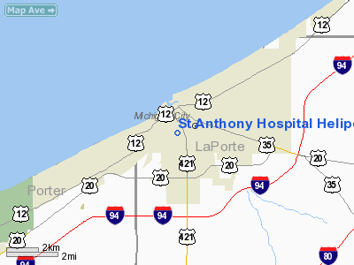
St Anthony Hospital Heliport |
Location & QuickFacts
|
FAA
Information Effective: |
2008-06-05 |
|
Airport
Identifier: |
IN24 |
| Airport
Status: |
Operational |
|
Longitude/Latitude: |
086-54-04.1070W/41-42-21.1410N
-86.901141/41.705872 (Estimated) |
|
Elevation: |
635
ft / 193.55 m (Estimated) |
|
Land: |
1 acres |
| From
nearest city: |
0
nautical miles W of Michigan City, IN |
|
Location: |
La Porte County, IN |
|
Magnetic Variation: |
02W
(1985) |
Owner & Manager
|
Ownership: |
Privately
owned |
| Owner: |
St
Anthony Hospital
SISTERS OF ST FRANCIS HEALTH SERVICES INC. |
|
Address: |
301 W Homer Street
Michigan
City, IN 46360 |
| Phone
number: |
219-874-0411 |
|
Manager: |
Edel Dunne-o'toole |
| Address: |
301
W Homer Street
Michigan
City, IN 46360 |
Airport Operations and Facilities
|
Airport
Use: |
Private
MEDICAL USE |
| Wind
indicator: |
Yes |
|
Segmented
Circle: |
No |
| Control
Tower: |
No |
|
Sectional
chart: |
Chicago |
| Region: |
AGL
- Great Lakes |
|
Boundary
ARTCC: |
ZAU - Chicago |
| Tie-in
FSS: |
HUF
- Terre Haute |
|
FSS Toll
Free: |
1-800-WX-BRIEF |
|
Runway Information
Helipad H1
|
Dimension: |
60 x 60 ft /
18.3 x 18.3 m |
|
Surface: |
CONC, |
|
|
Runway H1 |
Runway |
| Traffic
Pattern: |
Left |
Left |
|
Radio Navigation Aids
|
ID |
Type |
Name |
Ch |
Freq |
Var |
Dist |
| MGC |
NDB |
Michigan
City |
|
203.00 |
01W |
3.8
nm |
|
IUL |
NDB |
La Porte |
|
356.00 |
03W |
13.7 nm |
| VP |
NDB |
Sedly |
|
212.00 |
02W |
15.3
nm |
|
MX |
NDB |
Kedzi |
|
248.00 |
01W |
35.4 nm |
| CPB |
NDB |
Culver |
|
391.00 |
01W |
37.5
nm |
|
RWN |
NDB |
Winamac/dcmsnd |
|
335.00 |
00W |
39.1 nm |
| HK |
NDB |
Ermin |
|
332.00 |
01W |
42.0
nm |
|
RZL |
NDB |
Rensselaer |
|
362.00 |
02W |
47.4 nm |
| OXI |
VOR/DME |
Knox |
103X |
115.60 |
00E |
25.7
nm |
|
ELX |
VOR/DME |
Keeler |
113X |
116.60 |
00E |
43.7 nm |
| ORD |
VOR/DME |
Chicago
O'hare |
086X |
113.90 |
02E |
48.0
nm |
|
GIJ |
VORTAC |
Gipper |
101X |
115.40 |
00E |
26.4 nm |
| CGT |
VORTAC |
Chicago
Heights |
089X |
114.20 |
02E |
32.3
nm |
|
GSH |
VORTAC |
Goshen |
084X |
113.70 |
00E |
40.7 nm |
| EON |
VORTAC |
Peotone |
079X |
113.20 |
02E |
47.9
nm |
|
MDW |
VOT |
Chicago Midway |
|
111.00 |
|
38.5 nm |
| ORD |
VOT |
Chicago
O'hare Intl |
|
112.00 |
|
48.0
nm |
Remarks
- PROVIDED
OPNS ARE CONDUCTED FROM 270 TO 330; AREA IS MARKED; WIND INDICATOR IS
MAINTAINED; 2 POLES N OF PAD ARE REMOVED.
St Anthony Hospital Heliport
Address:
La Porte County, IN
Tel:
219-874-0411
Images
and information placed above are from
http://www.airport-data.com/airport/IN24/
We
thank them for the data!
| General
Info |
| Country |
United
States |
| State |
INDIANA
|
| FAA ID |
IN24 |
| Latitude |
41-42-21.141N
|
| Longitude |
086-54-04.107W
|
| Elevation |
635 feet
|
| Near City |
MICHIGAN
CITY |
We don't guarantee the information is fresh and accurate. The data may
be wrong or outdated.
For more up-to-date information please refer to other sources.
|
|


