 |
|
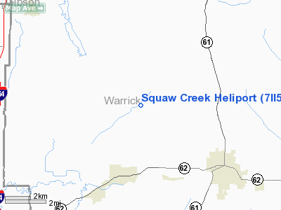
Location & QuickFacts
|
FAA
Information Effective: |
2008-06-05 |
|
Airport
Identifier: |
7II5 |
| Airport
Status: |
Operational |
|
Longitude/Latitude: |
087-20-58.0330W/38-05-35.1640N
-87.349454/38.093101 (Estimated) |
|
Elevation: |
410
ft / 124.97 m (Estimated) |
|
Land: |
0 acres |
| From
nearest city: |
3
nautical miles NE of Chandler, IN |
|
Location: |
Warrick County, IN |
|
Magnetic Variation: |
02W
(2000) |
Owner
& Manager
|
Ownership: |
Privately
owned |
|
Owner: |
Squaw
Creek Coal Company |
|
Address: |
Po Box 111
Boonville,
IN 47715 |
|
Phone number: |
812-925-3362 |
|
Manager: |
Mitchell S Tilley |
|
Address: |
Po
Box 111
Boonville,
IN 47715 |
|
Phone
number: |
812-925-3362 |
Airport Operations and Facilities
|
Airport
Use: |
Private |
|
Wind indicator: |
Yes |
|
Segmented Circle: |
No |
|
Control
Tower: |
No |
|
Sectional chart: |
St
Louis |
|
Region: |
AGL - Great Lakes |
| Boundary
ARTCC: |
ZID
- Indianapolis |
|
Tie-in FSS: |
HUF - Terre Haute |
| FSS
on Airport: |
No |
|
FSS Toll
Free: |
1-800-WX-BRIEF |
|
Runway Information
Helipad H1
|
Dimension: |
30 x 30 ft /
9.1 x 9.1 m |
|
Surface: |
ASPH, |
|
|
Runway H1 |
Runway |
| Traffic
Pattern: |
Left |
Left |
|
Radio Navigation Aids
|
ID |
Type |
Name |
Ch |
Freq |
Var |
Dist |
| PDW |
NDB |
Evansville |
|
284.00 |
00E |
9.2
nm |
|
FNZ |
NDB |
Ferdinand |
|
239.00 |
00E |
25.9 nm |
| GVA |
NDB |
Geneva |
|
224.00 |
01W |
26.5
nm |
|
TEL |
NDB |
Tell City |
|
206.00 |
02W |
31.6 nm |
| AJG |
NDB |
Mount
Carmel |
|
524.00 |
02W |
35.9
nm |
|
CUL |
NDB |
Carmi |
|
332.00 |
01W |
36.4 nm |
| OEA |
NDB |
Vincennes |
|
251.00 |
00E |
37.2
nm |
|
DCY |
NDB |
Washington |
|
212.00 |
03W |
37.7 nm |
| RRJ |
NDB |
Oranj |
|
368.00 |
02W |
46.7
nm |
|
TWT |
NDB |
Tradewater |
|
276.00 |
00E |
47.2 nm |
| HNB |
VOR/DME |
Huntingburg |
029X |
109.20 |
00E |
20.8
nm |
|
OWB |
VOR/DME |
Owensboro |
023X |
108.60 |
01E |
22.7 nm |
| SAM |
VOR/DME |
Samsville |
113X |
116.60 |
03E |
42.0
nm |
|
LWV |
VOR/DME |
Lawrenceville |
025X |
108.80 |
01W |
42.4 nm |
| PXV |
VORTAC |
Pocket
City |
080X |
113.30 |
03E |
21.9
nm |
|
CCT |
VORTAC |
Central City |
035X |
109.80 |
01W |
42.9 nm |
Remarks
- ALL
OPNS ARE CONDD IN AREA FM 370-100 DEG; AREA IS MKD; WIND INDCR IS MAINTD.
Squaw Creek Heliport
Address:
Warrick County, IN
Tel:
812-925-3362
Images
and information placed above are from
http://www.airport-data.com/airport/7II5/
We
thank them for the data!
| General
Info |
| Country |
United
States |
| State |
INDIANA
|
| FAA ID |
7II5 |
| Latitude |
38-05-35.164N
|
| Longitude |
087-20-58.033W
|
| Elevation |
410 feet
|
| Near City |
CHANDLER
|
We don't guarantee the information is fresh and accurate. The data may
be wrong or outdated.
For more up-to-date information please refer to other sources.
|
|


