 |
|
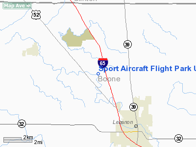
Sport Aircraft Flight Park Ultralight |
Location & QuickFacts
|
FAA
Information Effective: |
2008-06-05 |
|
Airport
Identifier: |
4II7 |
| Airport
Status: |
Operational |
|
Longitude/Latitude: |
086-31-19.0090W/40-06-21.1440N
-86.521947/40.105873 (Estimated) |
|
Elevation: |
900
ft / 274.32 m (Estimated) |
|
Land: |
10 acres |
| From
nearest city: |
5
nautical miles ES of Thorntown, IN |
|
Location: |
Boone County, IN |
|
Magnetic Variation: |
02W
(1985) |
Owner
& Manager
|
Ownership: |
Privately
owned |
|
Owner: |
Sport
Aircraft, Incorporated |
|
Address: |
2700 W 450 North
Lebanon, IN 46052 |
|
Phone number: |
765-436-2335 |
|
Manager: |
David Riggs |
|
Address: |
2700
W 450 North
Lebanon, IN 46052 |
|
Phone
number: |
765-436-2335 |
Airport Operations and Facilities
|
Airport
Use: |
Private |
|
Wind indicator: |
Yes |
|
Segmented Circle: |
No |
|
Control
Tower: |
No |
| Landing
fee charge: |
No |
|
Sectional
chart: |
Chicago |
| Region: |
AGL
- Great Lakes |
|
Boundary
ARTCC: |
ZAU - Chicago |
| Tie-in
FSS: |
HUF
- Terre Haute |
|
FSS on Airport: |
No |
| FSS
Toll Free: |
1-800-WX-BRIEF |
|
Runway Information
Runway 06/24
|
Dimension: |
820 x 40 ft /
249.9 x 12.2 m |
| Surface: |
TURF,
|
|
|
Runway 06 |
Runway 24 |
|
Traffic Pattern: |
Left |
Left |
| Displaced
threshold: |
50.00
ft |
0.00
ft |
|
Radio Navigation Aids
|
ID |
Type |
Name |
Ch |
Freq |
Var |
Dist |
| FKR |
NDB |
Frankfort |
|
278.00 |
02W |
10.1
nm |
|
HZP |
NDB |
Zionsville |
|
248.00 |
03W |
16.0 nm |
| CFJ |
NDB |
Crawfordsville |
|
388.00 |
02W |
19.6
nm |
|
UMP |
NDB |
Metropolitan |
|
338.00 |
03W |
24.0 nm |
| TVX |
NDB |
Greencastle |
|
521.00 |
03W |
26.9
nm |
|
HFY |
NDB |
Greenwood |
|
398.00 |
02W |
34.7 nm |
| GGP |
NDB |
Logansport |
|
263.00 |
01W |
36.9
nm |
|
MCX |
NDB |
White County |
|
377.00 |
03W |
38.0 nm |
| AI |
NDB |
Video |
|
371.00 |
03W |
46.6
nm |
|
MZZ |
VOR/DME |
Marion |
023X |
108.60 |
03W |
45.1 nm |
| VHP |
VORTAC |
Brickyard |
110X |
116.30 |
01E |
18.9
nm |
|
OKK |
VORTAC |
Kokomo |
082X |
113.50 |
00E |
33.1 nm |
| GUS |
VORTAC |
Grissom |
21Y |
108.45 |
02W |
36.6
nm |
|
BVT |
VORTAC |
Boiler |
098X |
115.10 |
01E |
36.9 nm |
| SHB |
VORTAC |
Shelbyville |
057X |
112.00 |
01E |
43.0
nm |
|
DNV |
VORTAC |
Danville |
047X |
111.00 |
02E |
48.9 nm |
| IND |
VOT |
Indianapolis
Intl |
|
109.60 |
|
25.4
nm |
Remarks
- PRVDD
ADQT CLRNCS EXIST OVER ALL OBSTNS TO THE RWY APCH SFCS.
Sport Aircraft Flight Park Ultralight
Address:
Boone County, IN
Tel:
765-436-2335
Images
and information placed above are from
http://www.airport-data.com/airport/4II7/
We
thank them for the data!
| General
Info |
| Country |
United
States |
| State |
INDIANA
|
| FAA ID |
4II7 |
| Latitude |
40-06-21.144N
|
| Longitude |
086-31-19.009W
|
| Elevation |
900 feet
|
| Near City |
THORNTOWN
|
We don't guarantee the information is fresh and accurate. The data may
be wrong or outdated.
For more up-to-date information please refer to other sources.
|
|


