 |
|
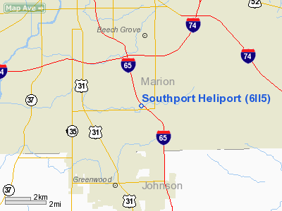
Location & QuickFacts
|
FAA
Information Effective: |
2008-06-05 |
|
Airport
Identifier: |
6II5 |
| Airport
Status: |
Operational |
|
Longitude/Latitude: |
086-05-41.9460W/39-40-05.1630N
-86.094985/39.668101 (Estimated) |
|
Elevation: |
801
ft / 244.14 m (Estimated) |
|
Land: |
0 acres |
| From
nearest city: |
3
nautical miles N of Indianapolis, IN |
|
Location: |
Marion County, IN |
|
Magnetic Variation: |
02W
(1985) |
Owner & Manager
|
Ownership: |
Privately
owned |
| Owner: |
Solar
Sources Inc |
|
Address: |
6755 South Gray Road
Indianapolis,
IN 46247 |
| Phone
number: |
317-788-0084 |
|
Manager: |
Felson Bowman |
| Address: |
6755
South Gray Road
Indianapolis,
IN 46247 |
|
Phone
number: |
317-788-0084 |
Airport
Operations and Facilities
|
Airport
Use: |
Private |
|
Segmented
Circle: |
No |
| Control
Tower: |
No |
|
Sectional
chart: |
St Louis |
| Region: |
AGL
- Great Lakes |
|
Boundary
ARTCC: |
ZID - Indianapolis |
| Tie-in
FSS: |
HUF
- Terre Haute |
|
FSS Toll
Free: |
1-800-WX-BRIEF |
|
Runway Information
Helipad H1
|
Dimension: |
70 x 70 ft /
21.3 x 21.3 m |
|
Surface: |
ASPH, |
|
|
Runway H1 |
Runway |
| Traffic
Pattern: |
Left |
Left |
|
Radio Navigation Aids
|
ID |
Type |
Name |
Ch |
Freq |
Var |
Dist |
| HFY |
NDB |
Greenwood |
|
398.00 |
02W |
2.2
nm |
|
UMP |
NDB |
Metropolitan |
|
338.00 |
03W |
16.3 nm |
| HZP |
NDB |
Zionsville |
|
248.00 |
03W |
17.8
nm |
|
BA |
NDB |
Clifs |
|
410.00 |
03W |
24.4 nm |
| TVX |
NDB |
Greencastle |
|
521.00 |
03W |
33.0
nm |
|
AI |
NDB |
Video |
|
371.00 |
03W |
36.2 nm |
| UWL |
NDB |
New
Castle |
|
385.00 |
02W |
38.1
nm |
|
FKR |
NDB |
Frankfort |
|
278.00 |
02W |
42.1 nm |
| CFJ |
NDB |
Crawfordsville |
|
388.00 |
02W |
42.3
nm |
|
HLB |
NDB |
Batesville |
|
254.00 |
02W |
43.3 nm |
| BM |
NDB |
Claye |
|
382.00 |
02W |
43.6
nm |
|
OVO |
NDB |
North Vernon |
|
374.00 |
02W |
43.7 nm |
| EQZ |
NDB |
Captain |
|
308.00 |
02W |
48.5
nm |
|
MIE |
VOR/DME |
Muncie |
091X |
114.40 |
03W |
47.1 nm |
| SHB |
VORTAC |
Shelbyville |
057X |
112.00 |
01E |
12.7
nm |
|
VHP |
VORTAC |
Brickyard |
110X |
116.30 |
01E |
15.4 nm |
| OOM |
VORTAC |
Hoosier |
039X |
110.20 |
02W |
39.6
nm |
|
IND |
VOT |
Indianapolis Intl |
|
109.60 |
|
9.3 nm |
Remarks
- PRVDD
ALL APCH/DEP OPS 090-130 DEGS; TAKEOFF/LDG AREA APPROPRIATELY MARKED;
NON-OBSTRUCTING WIND INDICATOR MAINTAINED.
Southport Heliport
Address:
Marion County, IN
Tel:
317-788-0084
Images
and information placed above are from
http://www.airport-data.com/airport/6II5/
We
thank them for the data!
| General
Info |
| Country |
United
States |
| State |
INDIANA
|
| FAA ID |
6II5 |
| Latitude |
39-40-05.163N
|
| Longitude |
086-05-41.946W
|
| Elevation |
801 feet
|
| Near City |
INDIANAPOLIS
|
We don't guarantee the information is fresh and accurate. The data may
be wrong or outdated.
For more up-to-date information please refer to other sources.
|
|


