 |
|
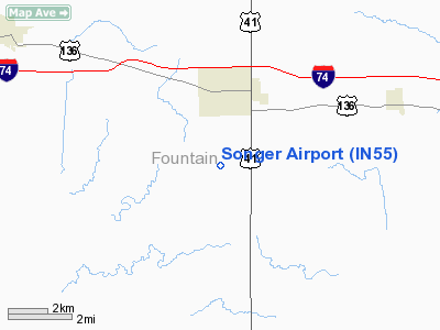
Location & QuickFacts
|
FAA
Information Effective: |
2008-06-05 |
|
Airport
Identifier: |
IN55 |
| Airport
Status: |
Operational |
|
Longitude/Latitude: |
087-15-40.0360W/40-04-45.1420N
-87.261121/40.079206 (Estimated) |
|
Elevation: |
652
ft / 198.73 m (Estimated) |
|
Land: |
0 acres |
| From
nearest city: |
2
nautical miles S of Veedersburg, IN |
|
Location: |
Fountain County, IN |
|
Magnetic Variation: |
01W
(1985) |
Owner
& Manager
|
Ownership: |
Privately
owned |
|
Address: |
|
|
Manager: |
Stephen Songer |
|
Address: |
Rr
2
Veedersburg, IN 47987 |
|
Phone
number: |
317-294-4056 |
Airport
Operations and Facilities
|
Airport Use: |
Private |
|
Wind indicator: |
No |
|
Segmented Circle: |
No |
|
Control
Tower: |
No |
|
Landing fee charge: |
No |
|
Sectional
chart: |
Chicago |
|
Region: |
AGL
- Great Lakes |
|
Boundary
ARTCC: |
ZAU - Chicago |
|
Tie-in FSS: |
HUF
- Terre Haute |
|
FSS on
Airport: |
No |
|
FSS Toll Free: |
1-800-WX-BRIEF |
Airport
Services
|
Fuel
available: |
100 |
|
Airframe
Repair: |
MAJOR |
|
Power
Plant Repair: |
MAJOR |
|
Runway Information
Runway 18/36
|
Dimension: |
2500 x 100 ft
/ 762.0 x 30.5 m |
|
Surface: |
TURF, |
|
|
Runway 18 |
Runway 36 |
| Traffic
Pattern: |
Left |
Left |
|
Helipad H1
|
Dimension: |
20 x 10 ft /
6.1 x 3.0 m |
| Surface: |
CONC,
|
|
|
Runway H1 |
Runway |
|
Traffic Pattern: |
Left |
Left |
|
Radio Navigation Aids
|
ID |
Type |
Name |
Ch |
Freq |
Var |
Dist |
| CFJ |
NDB |
Crawfordsville |
|
388.00 |
02W |
17.0
nm |
|
PRG |
NDB |
Paris |
|
341.00 |
01E |
29.8 nm |
| TVX |
NDB |
Greencastle |
|
521.00 |
03W |
30.4
nm |
|
HMJ |
NDB |
Homer |
|
281.00 |
01E |
32.0 nm |
| FKR |
NDB |
Frankfort |
|
278.00 |
02W |
34.1
nm |
|
HU |
NDB |
Yinno |
|
245.00 |
02W |
42.0 nm |
| MCX |
NDB |
White
County |
|
377.00 |
03W |
44.3
nm |
|
HZP |
NDB |
Zionsville |
|
248.00 |
03W |
47.3 nm |
| DNV |
VORTAC |
Danville |
047X |
111.00 |
02E |
18.7
nm |
|
BVT |
VORTAC |
Boiler |
098X |
115.10 |
01E |
30.0 nm |
| TTH |
VORTAC |
Terre
Haute |
100X |
115.30 |
02E |
35.5
nm |
|
VHP |
VORTAC |
Brickyard |
110X |
116.30 |
01E |
44.1 nm |
| CMI |
VORTAC |
Champaign |
037X |
110.00 |
03E |
46.8
nm |
|
IND |
VOT |
Indianapolis Intl |
|
109.60 |
|
49.9 nm |
Songer Airport
Address:
Fountain County, IN
Tel:
317-294-4056
Images
and information placed above are from
http://www.airport-data.com/airport/IN55/
We
thank them for the data!
| General
Info |
| Country |
United
States |
| State |
INDIANA
|
| FAA ID |
IN55 |
| Latitude |
40-04-45.142N
|
| Longitude |
087-15-40.036W
|
| Elevation |
652 feet
|
| Near City |
VEEDERSBURG
|
We don't guarantee the information is fresh and accurate. The data may
be wrong or outdated.
For more up-to-date information please refer to other sources.
|
|


