 |
|
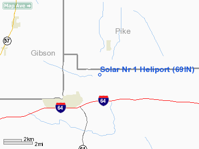
Location & QuickFacts
|
FAA
Information Effective: |
2008-06-05 |
|
Airport
Identifier: |
69IN |
| Airport
Status: |
Operational |
|
Longitude/Latitude: |
087-16-11.0270W/38-13-33.1750N
-87.269730/38.225882 (Estimated) |
|
Elevation: |
510
ft / 155.45 m (Estimated) |
|
Land: |
0 acres |
| From
nearest city: |
4
nautical miles NE of Lynnville, IN |
|
Location: |
Warrick County, IN |
|
Magnetic Variation: |
01W
(1985) |
Owner
& Manager
|
Ownership: |
Privately
owned |
|
Owner: |
Solar
Sources, Inc. |
|
Address: |
Po Box 47068
Indianapolis,
IN 46247 |
|
Phone number: |
317-882-4530 |
|
Manager: |
Solar Sources, Inc. |
|
Address: |
Po
Box 47068
Indianapolis,
IN 46247 |
|
Phone
number: |
317-882-4530 |
Airport Operations and Facilities
|
Airport
Use: |
Private |
|
Wind indicator: |
Yes |
|
Segmented Circle: |
No |
|
Control
Tower: |
No |
| Landing
fee charge: |
No |
|
Sectional
chart: |
St Louis |
| Region: |
AGL
- Great Lakes |
|
Boundary
ARTCC: |
ZID - Indianapolis |
| Tie-in
FSS: |
HUF
- Terre Haute |
|
FSS on Airport: |
No |
| FSS
Toll Free: |
1-800-WX-BRIEF |
|
Runway Information
Helipad H1
|
Dimension: |
50 x 50 ft /
15.2 x 15.2 m |
| Surface: |
GRAVEL,
|
|
|
Runway H1 |
Runway |
|
Traffic Pattern: |
Left |
Left |
|
Radio Navigation Aids
|
ID |
Type |
Name |
Ch |
Freq |
Var |
Dist |
| PDW |
NDB |
Evansville |
|
284.00 |
00E |
16.6
nm |
|
FNZ |
NDB |
Ferdinand |
|
239.00 |
00E |
20.4 nm |
| DCY |
NDB |
Washington |
|
212.00 |
03W |
29.0
nm |
|
TEL |
NDB |
Tell City |
|
206.00 |
02W |
30.2 nm |
| OEA |
NDB |
Vincennes |
|
251.00 |
00E |
31.0
nm |
|
AJG |
NDB |
Mount Carmel |
|
524.00 |
02W |
31.6 nm |
| GVA |
NDB |
Geneva |
|
224.00 |
01W |
34.8
nm |
|
RRJ |
NDB |
Oranj |
|
368.00 |
02W |
39.4 nm |
| CUL |
NDB |
Carmi |
|
332.00 |
01W |
40.9
nm |
|
HNB |
VOR/DME |
Huntingburg |
029X |
109.20 |
00E |
14.9 nm |
| OWB |
VOR/DME |
Owensboro |
023X |
108.60 |
01E |
29.4
nm |
|
LWV |
VOR/DME |
Lawrenceville |
025X |
108.80 |
01W |
36.3 nm |
| SAM |
VOR/DME |
Samsville |
113X |
116.60 |
03E |
41.5
nm |
|
PXV |
VORTAC |
Pocket City |
080X |
113.30 |
03E |
29.4 nm |
Remarks
- E111:
PRVDD ALL APCH/DEP RTE HEL OPNS ARE CONDUCTED IN AN AREA FROM 20 DEGS
CLKWS TO 160 DEGS USING TOUCHDOWN PAD AS THE CNTR OF A COMPASS ROSE;
E111 CONT'D: TKOF/LNDG AREA IS APROPLY MKD; NON-OBSTRUCTING WIND INDCR
IS MAINTD ADJ TO THE TKOF/LNDG AREA.
Solar Nr 1 Heliport
Address:
Warrick County, IN
Tel:
317-882-4530
Images
and information placed above are from
http://www.airport-data.com/airport/69IN/
We
thank them for the data!
| General
Info |
| Country |
United
States |
| State |
INDIANA
|
| FAA ID |
69IN |
| Latitude |
38-13-33.175N
|
| Longitude |
087-16-11.027W
|
| Elevation |
510 feet
|
| Near City |
LYNNVILLE
|
We don't guarantee the information is fresh and accurate. The data may
be wrong or outdated.
For more up-to-date information please refer to other sources.
|
|


