 |
|
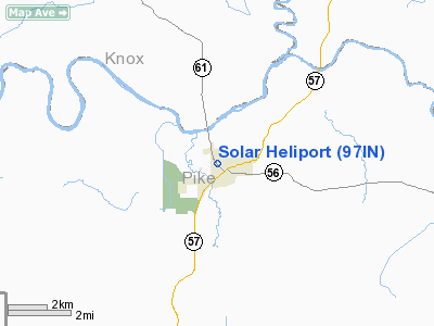
Location & QuickFacts
|
FAA
Information Effective: |
2008-06-05 |
|
Airport
Identifier: |
97IN |
| Airport
Status: |
Operational |
|
Longitude/Latitude: |
087-16-57.0480W/38-29-45.1760N
-87.282513/38.495882 (Estimated) |
|
Elevation: |
445
ft / 135.64 m (Estimated) |
|
Land: |
0 acres |
| From
nearest city: |
0
nautical miles NW of Petersburg, IN |
|
Location: |
Pike County, IN |
|
Magnetic Variation: |
01W
(1985) |
Owner
& Manager
|
Ownership: |
Privately
owned |
|
Owner: |
Solar
Sources, Inc. |
|
Address: |
Po Box 7
Petersburg,
IN 47567 |
|
Phone number: |
812-354-8776 |
|
Manager: |
Steve Kinneman |
|
Address: |
Po
Box 7
Petersburg,
IN 47567 |
|
Phone
number: |
812-35408776 |
Airport Operations and Facilities
|
Airport
Use: |
Private |
|
Wind indicator: |
Yes |
|
Segmented Circle: |
No |
|
Control
Tower: |
No |
| Landing
fee charge: |
No |
|
Sectional
chart: |
St Louis |
| Region: |
AGL
- Great Lakes |
|
Boundary
ARTCC: |
ZID - Indianapolis |
| Tie-in
FSS: |
HUF
- Terre Haute |
|
FSS on Airport: |
No |
| FSS
Toll Free: |
1-800-WX-BRIEF |
|
Runway Information
Helipad H1
|
Dimension: |
40 x 40 ft /
12.2 x 12.2 m |
| Surface: |
CONC,
|
|
|
Runway H1 |
Runway |
|
Traffic Pattern: |
Left |
Left |
|
Radio Navigation Aids
|
ID |
Type |
Name |
Ch |
Freq |
Var |
Dist |
| DCY |
NDB |
Washington |
|
212.00 |
03W |
13.9
nm |
|
OEA |
NDB |
Vincennes |
|
251.00 |
00E |
17.4 nm |
| AJG |
NDB |
Mount
Carmel |
|
524.00 |
02W |
22.0
nm |
|
FNZ |
NDB |
Ferdinand |
|
239.00 |
00E |
25.7 nm |
| PDW |
NDB |
Evansville |
|
284.00 |
00E |
29.8
nm |
|
PLX |
NDB |
Palestine |
|
391.00 |
00W |
35.4 nm |
| RRJ |
NDB |
Oranj |
|
368.00 |
02W |
35.5
nm |
|
SIV |
NDB |
Sullivan |
|
326.00 |
02W |
37.9 nm |
| TEL |
NDB |
Tell
City |
|
206.00 |
02W |
40.2
nm |
|
OLY |
NDB |
Olney |
|
272.00 |
00W |
43.9 nm |
| BFR |
NDB |
Bedford |
|
344.00 |
02W |
44.7
nm |
|
CUL |
NDB |
Carmi |
|
332.00 |
01W |
46.3 nm |
| BM |
NDB |
Claye |
|
382.00 |
02W |
46.5
nm |
|
GVA |
NDB |
Geneva |
|
224.00 |
01W |
47.6 nm |
| HNB |
VOR/DME |
Huntingburg |
029X |
109.20 |
00E |
21.3
nm |
|
LWV |
VOR/DME |
Lawrenceville |
025X |
108.80 |
01W |
22.3 nm |
| RSV |
VOR/DME |
Robinson |
021X |
108.40 |
02E |
35.8
nm |
|
SAM |
VOR/DME |
Samsville |
113X |
116.60 |
03E |
37.8 nm |
| OWB |
VOR/DME |
Owensboro |
023X |
108.60 |
01E |
45.6
nm |
|
PXV |
VORTAC |
Pocket City |
080X |
113.30 |
03E |
41.0 nm |
| OOM |
VORTAC |
Hoosier |
039X |
110.20 |
02W |
50.0
nm |
Remarks
- PROVIDED
APCH/DEP OPNS ARE CONDUCTED IN AN AREA FROM 30 DEG CLOCKWISE TO 330
DEG; TAKEOFF/LNDG AREA IS APPROPRIATELY MKD; NON-OBSTRUCTING WIND INDICATOR
IS MAINTAINED ADJ TO TAKEOFF/LNDG AREA.
Based Aircraft
|
Aircraft
based on field: |
1 |
|
Helicopters: |
1 |
Solar Heliport
Address:
Pike County, IN
Tel:
812-354-8776
Images
and information placed above are from
http://www.airport-data.com/airport/97IN/
We
thank them for the data!
| General
Info |
| Country |
United
States |
| State |
INDIANA
|
| FAA ID |
97IN |
| Latitude |
38-29-45.176N
|
| Longitude |
087-16-57.048W
|
| Elevation |
445 feet
|
| Near City |
PETERSBURG
|
We don't guarantee the information is fresh and accurate. The data may
be wrong or outdated.
For more up-to-date information please refer to other sources.
|
|


