 |
|
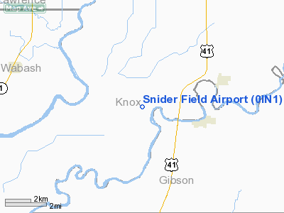
Location & QuickFacts
|
FAA
Information Effective: |
2008-06-05 |
|
Airport
Identifier: |
0IN1 |
| Airport
Status: |
Operational |
|
Longitude/Latitude: |
087-35-45.0860W/38-30-00.1700N
-87.595857/38.500047 (Estimated) |
|
Elevation: |
400
ft / 121.92 m (Estimated) |
|
Land: |
6 acres |
| From
nearest city: |
4
nautical miles SW of Decker, IN |
|
Location: |
Knox County, IN |
|
Magnetic Variation: |
00W
(1985) |
Owner
& Manager
|
Ownership: |
Privately
owned |
|
Owner: |
Kenneth
C. Snider |
|
Address: |
Rt 1 Box 20
Decker, IN 47524 |
|
Phone number: |
812-882-6420 |
|
Address: |
|
|
Phone number: |
812-769-4184 |
Airport Operations and Facilities
|
Airport
Use: |
Private |
| Wind
indicator: |
Yes |
|
Segmented
Circle: |
No |
| Control
Tower: |
No |
|
Sectional
chart: |
St Louis |
| Region: |
AGL
- Great Lakes |
|
Boundary
ARTCC: |
ZID - Indianapolis |
| Tie-in
FSS: |
HUF
- Terre Haute |
|
FSS on Airport: |
No |
| FSS
Toll Free: |
1-800-WX-BRIEF |
|
Runway Information
Runway 15/33
|
Dimension: |
2000 x 75 ft
/ 609.6 x 22.9 m |
| Surface: |
TURF,
|
|
|
Runway 15 |
Runway 33 |
|
Traffic Pattern: |
Left |
Left |
| Displaced
threshold: |
300.00
ft |
300.00
ft |
|
Obstruction: |
15 ft road, 15.0 ft from runway |
15 ft road, 15.0 ft from runway |
|
Radio Navigation Aids
|
ID |
Type |
Name |
Ch |
Freq |
Var |
Dist |
| AJG |
NDB |
Mount
Carmel |
|
524.00 |
02W |
9.1
nm |
|
OEA |
NDB |
Vincennes |
|
251.00 |
00E |
11.7 nm |
| DCY |
NDB |
Washington |
|
212.00 |
03W |
24.8
nm |
|
PDW |
NDB |
Evansville |
|
284.00 |
00E |
27.8 nm |
| OLY |
NDB |
Olney |
|
272.00 |
00W |
30.1
nm |
|
PLX |
NDB |
Palestine |
|
391.00 |
00W |
30.9 nm |
| CUL |
NDB |
Carmi |
|
332.00 |
01W |
34.8
nm |
|
SIV |
NDB |
Sullivan |
|
326.00 |
02W |
37.5 nm |
| FNZ |
NDB |
Ferdinand |
|
239.00 |
00E |
38.8
nm |
|
FWC |
NDB |
Wayne County |
|
257.00 |
01E |
39.0 nm |
| FOA |
NDB |
Elm
River |
|
353.00 |
00E |
41.5
nm |
|
GVA |
NDB |
Geneva |
|
224.00 |
01W |
42.7 nm |
| LWV |
VOR/DME |
Lawrenceville |
025X |
108.80 |
01W |
16.2
nm |
|
SAM |
VOR/DME |
Samsville |
113X |
116.60 |
03E |
23.1 nm |
| RSV |
VOR/DME |
Robinson |
021X |
108.40 |
02E |
31.2
nm |
|
HNB |
VOR/DME |
Huntingburg |
029X |
109.20 |
00E |
33.7 nm |
| OWB |
VOR/DME |
Owensboro |
023X |
108.60 |
01E |
49.8
nm |
|
PXV |
VORTAC |
Pocket City |
080X |
113.30 |
03E |
35.3 nm |
| BIB |
VORTAC |
Bible
Grove |
027X |
109.00 |
03E |
48.6
nm |
Remarks
- CALL
AMGR BEFO USING 812-769-4184 OR 812-882-6420
- PROVIDED
OBSTRUCTIONS ARE REMOVED/LOWERED OR THR DSPLCD TO PROVIDE 20:1 APP SFC
CLEARANCE.
Based Aircraft
|
Aircraft
based on field: |
3 |
|
Single Engine Airplanes: |
2 |
| Multi
Engine Airplanes: |
1 |
Snider Field Airport
Address:
Knox County, IN
Tel:
812-882-6420,
812-769-4184
Images
and information placed above are from
http://www.airport-data.com/airport/0IN1/
We
thank them for the data!
| General
Info |
| Country |
United
States |
| State |
INDIANA
|
| FAA ID |
0IN1 |
| Latitude |
38-30-00.170N
|
| Longitude |
087-35-45.086W
|
| Elevation |
400 feet
|
| Near City |
DECKER
|
We don't guarantee the information is fresh and accurate. The data may
be wrong or outdated.
For more up-to-date information please refer to other sources.
|
|


