|
|
|
 |
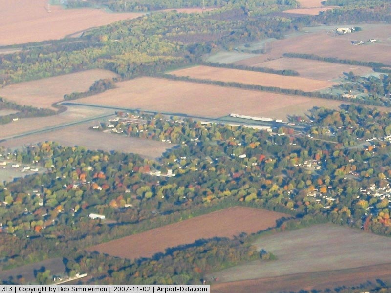
(Click on the photo to enlarge) |
|
 |
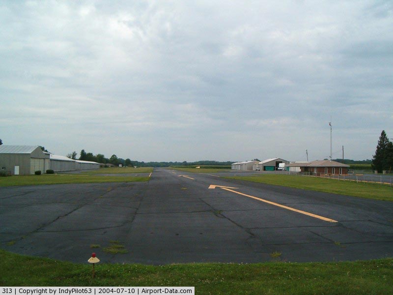
(Click on the photo to enlarge) |
|
 |
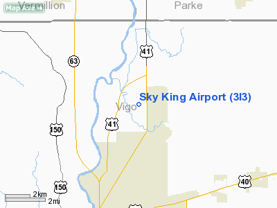
(Click on the photo to enlarge) |
Location
& QuickFacts
|
FAA
Information Effective: |
2008-06-05 |
|
Airport
Identifier: |
3I3 |
|
Airport
Status: |
Operational |
|
Longitude/Latitude: |
087-22-38.4690W/39-32-52.0320N
-87.377353/39.547787 (Estimated) |
|
Elevation: |
496 ft / 151.18 m (Surveyed) |
|
Land: |
33 acres |
|
From nearest
city: |
5 nautical miles N of Terre Haute, IN |
|
Location: |
Vigo County, IN |
|
Magnetic
Variation: |
02E (1965) |
Owner
& Manager
|
Ownership: |
Privately
owned |
|
Owner: |
Sky King Arpt Inc. |
|
Address: |
6898 N. Clinton St
Terre
Haute, IN 47805 |
|
Phone
number: |
812-466-2229 |
|
Manager: |
Steve Brown |
|
Address: |
6898 N. Clinton St
Terre
Haute, IN 47805 |
|
Phone
number: |
812-466-2229 |
Airport Operations
and Facilities
|
Airport
Use: |
Open
to public |
|
Wind indicator: |
Yes |
|
Segmented
Circle: |
No |
|
Control
Tower: |
No |
|
Lighting
Schedule: |
RDO REQ
ACTVT ROTG BCN; LIRL RYS 08/26 & 18/36 - CTAF. |
|
Beacon
Color: |
Clear-Green (lighted land airport) |
|
Landing
fee charge: |
No |
|
Sectional
chart: |
St Louis |
|
Region: |
AGL - Great Lakes |
|
Boundary
ARTCC: |
ZID - Indianapolis |
|
Tie-in
FSS: |
HUF - Terre Haute |
|
FSS on
Airport: |
No |
|
FSS Toll
Free: |
1-800-WX-BRIEF
OR LOCAL CALL 877-2571. |
|
NOTAMs
Facility: |
HUF (NOTAM-d service avaliable) |
Airport Communications
|
CTAF: |
122.800 |
|
Unicom: |
122.800
|
Airport Services
|
Fuel
available: |
100LL |
|
Airframe
Repair: |
MAJOR |
|
Power
Plant Repair: |
MAJOR |
|
Runway Information
Runway 08/26
|
Dimension: |
3557 x 50 ft
/ 1084.2 x 15.2 m |
|
Surface: |
ASPH, Fair Condition |
|
Edge Lights: |
Non-standard lighting system
RYS 08/26 & 18/36 NSTD LIRL, LGTS ARE 16 FT FM RY EDGE. |
|
|
Runway 08 |
Runway 26 |
|
Longitude: |
087-22-57.9170W |
087-22-12.7730W |
|
Latitude: |
39-32-53.5820N |
39-32-57.3960N |
|
Elevation: |
493.00 ft |
496.00 ft |
|
Alignment: |
84 |
127 |
|
Traffic
Pattern: |
Left |
Left |
|
Markings: |
Basic, Fair Condition |
Basic, Fair Condition |
|
Displaced
threshold: |
0.00 ft |
812.00 ft |
|
Runway End
Identifier: |
No |
No |
|
Centerline
Lights: |
No |
No |
|
Touchdown
Lights: |
No |
No |
|
Obstruction: |
62 ft trees, 2500.0 ft from runway, 325 ft
right of centerline, 37:1 slope to clear |
49 ft trees, 201.0 ft from runway
APCH SLOPE 20:1 TO DSPLCD THLD.
FENCE 29'FM RY END, 20'PLINE 45'FM RY END, ROAD 53'FM RY END, |
|
Runway 18/36
|
Dimension: |
1978 x 50 ft
/ 602.9 x 15.2 m |
|
Surface: |
ASPH, Fair Condition |
|
Edge Lights: |
Non-standard lighting system
RYS 08/26 & 18/36 NSTD LIRL, LGTS ARE 16 FT FM RY EDGE. |
|
|
Runway 18 |
Runway 36 |
|
Longitude: |
087-22-44.3150W |
087-22-44.0790W |
|
Latitude: |
39-32-55.7220N |
39-32-36.1710N |
|
Elevation: |
493.00 ft |
493.00 ft |
|
Alignment: |
127 |
127 |
|
Traffic
Pattern: |
Left |
Left |
|
Markings: |
Basic, Fair Condition |
Basic, Fair Condition |
|
Displaced
threshold: |
50.00 ft |
289.00 ft |
|
Runway End
Identifier: |
No |
No |
|
Centerline
Lights: |
No |
No |
|
Touchdown
Lights: |
No |
No |
|
Obstruction: |
10 ft crops, 201.0 ft from runway
APCH SLOPE 25:1 TO DSPLCD THLD. |
22 ft trees, 201.0 ft from runway, 60 ft right
of centerline
22:1 TO DSPLCD THR.
20'TREES & 4'FENCE 13'FM RWY END. |
|
Radio Navigation
Aids
|
ID |
Type |
Name |
Ch |
Freq |
Var |
Dist |
|
HU |
NDB |
Yinno |
|
245.00 |
02W |
9.7 nm |
|
PRG |
NDB |
Paris |
|
341.00 |
01E |
16.5 nm |
|
SIV |
NDB |
Sullivan |
|
326.00 |
02W |
26.3 nm |
|
TVX |
NDB |
Greencastle |
|
521.00 |
03W |
28.3 nm |
|
CZB |
NDB |
Casey |
|
359.00 |
00E |
32.5 nm |
|
CFJ |
NDB |
Crawfordsville |
|
388.00 |
02W |
33.7 nm |
|
PLX |
NDB |
Palestine |
|
391.00 |
00W |
34.4 nm |
|
MT |
NDB |
Zebre |
|
347.00 |
00E |
37.5 nm |
|
HMJ |
NDB |
Homer |
|
281.00 |
01E |
39.2 nm |
|
BM |
NDB |
Claye |
|
382.00 |
02W |
46.7 nm |
|
RSV |
VOR/DME |
Robinson |
021X |
108.40 |
02E |
34.2 nm |
|
MTO |
VOR/DME |
Mattoon |
031X |
109.40 |
03E |
42.3 nm |
|
LWV |
VOR/DME |
Lawrenceville |
025X |
108.80 |
01W |
47.9 nm |
|
TTH |
VORTAC |
Terre Haute |
100X |
115.30 |
02E |
6.9 nm |
|
OOM |
VORTAC |
Hoosier |
039X |
110.20 |
02W |
43.0 nm |
|
DNV |
VORTAC |
Danville |
047X |
111.00 |
02E |
45.6 nm |
|
VHP |
VORTAC |
Brickyard |
110X |
116.30 |
01E |
49.4 nm |
Remarks
- CAUTION:
50' GROUND ELEV DROP 60' FROM THR RWY 08.
- RY
36 +4 FT FENCE 108 FT E OF CNTRLN AND 44 FT FENCE AS CLOSE AS 63 FT
N OF RY 26 CNTRLN ADJ THLD; 18 FT CROPS 90 FT E 75 FT W; 4 FT FENCE
14 FT S.
- RY
36 ALSO +20 FT PLINE 250 FT FROM THLD ON CNTRLN MKD WITH ORANGE BALLS.
Based Aircraft
|
Aircraft
based on field: |
40 |
|
Single Engine
Airplanes: |
34 |
|
Multi Engine Airplanes: |
5 |
|
Helicopters: |
1 |
Operational Statistics
Time
Period: 2006-01-01 - 2006-12-31
|
Aircraft
Operations: |
64/Day |
|
Air Taxi: |
5.0% |
|
General Aviation
Local: |
79.0% |
|
General Aviation
Itinerant: |
16.0% |
Sky King Airport
Address:
Vigo County, IN
Tel:
812-466-2229
Images
and information placed above are from
http://www.airport-data.com/airport/3I3/
We
thank them for the data!
| General
Info |
| Country |
United
States |
| State |
INDIANA
|
| FAA ID |
3I3 |
| Latitude |
39-32-52.032N
|
| Longitude |
087-22-38.469W
|
| Elevation |
496 feet
|
| Near City |
TERRE
HAUTE |
We don't guarantee the information is fresh and accurate. The data may
be wrong or outdated.
For more up-to-date information please refer to other sources.
|
|