|
|
|
 |
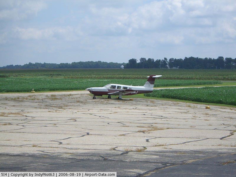
(Click on the photo to enlarge) |
|
 |
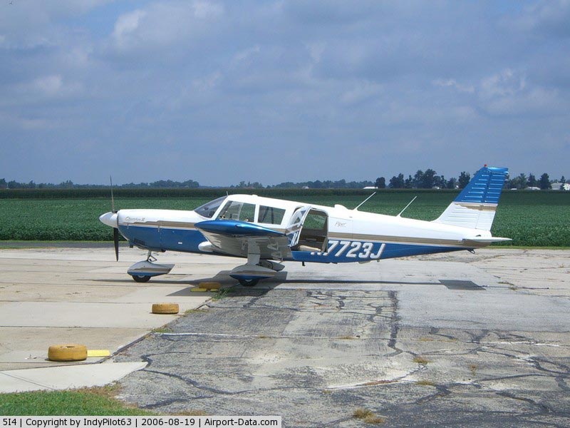
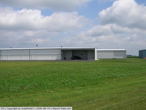
(Click on the photo to enlarge) |
|
 |
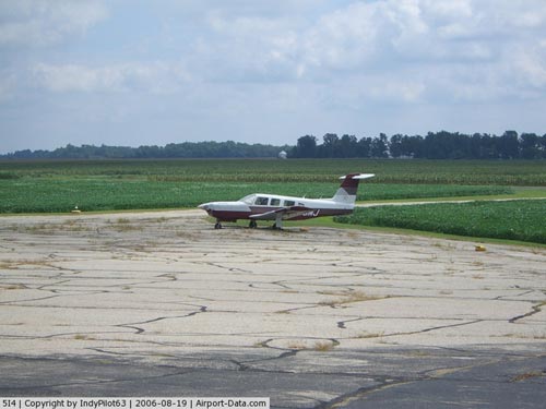
(Click on the photo to enlarge) |
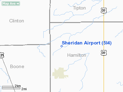
Location
& QuickFacts
|
FAA
Information Effective: |
2008-06-05 |
|
Airport
Identifier: |
5I4 |
|
Airport
Status: |
Operational |
|
Longitude/Latitude: |
086-13-02.2760W/40-10-40.5330N
-86.217299/40.177926 (Estimated) |
|
Elevation: |
936 ft / 285.29 m (Surveyed) |
|
Land: |
126 acres |
|
From nearest
city: |
3 nautical miles N of Sheridan, IN |
|
Location: |
Hamilton County, IN |
|
Magnetic
Variation: |
00E (1970) |
Owner & Manager
|
Ownership: |
Privately
owned |
|
Owner: |
Biddle Memorial Foundation |
|
Address: |
27045 Jerkwater Road
Sheridan, IN 46069 |
|
Phone
number: |
317-758-4451 |
|
Manager: |
Jeff Apple |
|
Address: |
27045 Jerkwater Rd.
Sheridan, IN 46069 |
|
Phone
number: |
317-758-4161 |
Airport
Operations and Facilities
|
Airport
Use: |
Open
to public |
|
Wind indicator: |
Yes |
|
Segmented
Circle: |
No |
|
Control
Tower: |
No |
|
Lighting
Schedule: |
PHONE REQ
ACTVT LIRL RY 05/23 - 123.0 |
|
Beacon
Color: |
Clear (unlighted land airport)
ARPT BCN AVBL BY REQUEST ON UNICOM OR CALL MGR 317-758-4161/0152. |
|
Landing
fee charge: |
No |
|
Sectional
chart: |
Chicago |
|
Region: |
AGL - Great Lakes |
|
Boundary
ARTCC: |
ZAU - Chicago |
|
Responsible
ARTCC: |
ZID - Indianapolis |
|
Tie-in
FSS: |
HUF - Terre Haute |
|
FSS on
Airport: |
No |
|
FSS Toll
Free: |
1-800-WX-BRIEF |
|
NOTAMs
Facility: |
HUF (NOTAM-d service avaliable) |
|
Federal
Agreements: |
N |
Airport Communications
|
CTAF: |
123.075 |
|
Unicom: |
123.075
|
Airport
Services
|
Fuel
available: |
100LL |
|
Airframe
Repair: |
MAJOR |
|
Power
Plant Repair: |
MAJOR |
|
Bottled
Oxygen: |
NONE |
|
Bulk Oxygen: |
NONE |
|
Runway Information
Runway 05/23
|
Dimension: |
3760 x 50 ft
/ 1146.0 x 15.2 m
HAS A 325 FT STWY WEST END. |
|
Surface: |
ASPH, Good Condition |
|
Edge Lights: |
Non-standard lighting system
RWY 05/23 NSTD LIRL; RY 23 NSTD THLD LGTS, ONLY 2 LIGHTS |
|
|
Runway 05 |
Runway 23 |
|
Longitude: |
086-13-23.5820W |
086-12-45.3920W |
|
Latitude: |
40-10-24.3340N |
40-10-47.1990N |
|
Elevation: |
930.00 ft |
932.00 ft |
|
Alignment: |
52 |
127 |
|
Traffic
Pattern: |
Left |
Left |
|
Markings: |
Basic, Good Condition |
Basic, Good Condition |
|
Displaced
threshold: |
650.00 ft |
0.00 ft |
|
VASI: |
|
tri-color
on left side |
|
Runway End
Identifier: |
No |
No |
|
Centerline
Lights: |
No |
No |
|
Touchdown
Lights: |
No |
No |
|
Obstruction: |
10 ft *,
200.0 ft from runway
RWY 05 APCH RATIO 44:1 TO DSPLCD THLD.
RWY 05 RD 15' FRM END, CROPS 50' FM RWY END. |
10 ft crops,
300.0 ft from runway, 10 ft right of centerline |
|
Runway 09/27
|
Dimension: |
3590 x 88 ft
/ 1094.2 x 26.8 m
HAS A 325 FT STWY WEST END. |
|
Surface: |
TURF, Good Condition |
|
|
Runway 09 |
Runway 27 |
|
Longitude: |
086-13-23.2100W |
086-12-36.9800W |
|
Latitude: |
40-10-45.1300N |
40-10-46.1300N |
|
Elevation: |
936.00 ft |
934.00 ft |
|
Alignment: |
88 |
127 |
|
Traffic
Pattern: |
Left |
Left |
|
Markings: |
None, |
None, |
|
Displaced
threshold: |
0.00 ft |
250.00 ft |
|
Runway End
Identifier: |
No |
No |
|
Centerline
Lights: |
No |
No |
|
Touchdown
Lights: |
No |
No |
|
Obstruction: |
18 ft bldg, 280.0 ft from runway, 125 ft right
of centerline, 15:1 slope to clear |
10 ft crops, 5.0 ft from runway
APCH RATIO 21:1 TO DSPLCD THLD. |
|
Radio Navigation
Aids
|
ID |
Type |
Name |
Ch |
Freq |
Var |
Dist |
|
HZP |
NDB |
Zionsville |
|
248.00 |
03W |
14.4 nm |
|
UMP |
NDB |
Metropolitan |
|
338.00 |
03W |
16.4 nm |
|
FKR |
NDB |
Frankfort |
|
278.00 |
02W |
16.8 nm |
|
GGP |
NDB |
Logansport |
|
263.00 |
01W |
32.7 nm |
|
AI |
NDB |
Video |
|
371.00 |
03W |
33.1 nm |
|
HFY |
NDB |
Greenwood |
|
398.00 |
02W |
33.3 nm |
|
CFJ |
NDB |
Crawfordsville |
|
388.00 |
02W |
34.2 nm |
|
TVX |
NDB |
Greencastle |
|
521.00 |
03W |
38.9 nm |
|
IWH |
NDB |
Wabash |
|
329.00 |
03W |
40.1 nm |
|
MCX |
NDB |
White County |
|
377.00 |
03W |
40.6 nm |
|
UWL |
NDB |
New Castle |
|
385.00 |
02W |
45.1 nm |
|
MZZ |
VOR/DME |
Marion |
023X |
108.60 |
03W |
31.1 nm |
|
MIE |
VOR/DME |
Muncie |
091X |
114.40 |
03W |
38.0 nm |
|
OKK |
VORTAC |
Kokomo |
082X |
113.50 |
00E |
22.3 nm |
|
VHP |
VORTAC |
Brickyard |
110X |
116.30 |
01E |
22.9 nm |
|
GUS |
VORTAC |
Grissom |
21Y |
108.45 |
02W |
28.2 nm |
|
SHB |
VORTAC |
Shelbyville |
057X |
112.00 |
01E |
37.5 nm |
|
BVT |
VORTAC |
Boiler |
098X |
115.10 |
01E |
45.2 nm |
|
IND |
VOT |
Indianapolis Intl |
|
109.60 |
|
27.4 nm |
Remarks
- LGTS
FOR NIGHT APCH PROCEDURE NOT AUTHORIZED EXCEPT BY PPR; CALL AMGR ON
317-758-4161 OR 317-758-5471.
- ARPT
CLSD THANKSGIVING; CHRISTMAS; NEW YEARS & EASTER.
- 24
HR PPR FOR NIGHT OPNS.
- DURING
WINTER MONTHS CALL AMGR TO VERIFY RY CONDS - 317-758-4161.
- EXISTED
PRIOR TO 1959.
Based Aircraft
|
Aircraft
based on field: |
39 |
|
Single Engine
Airplanes: |
35 |
|
Multi Engine Airplanes: |
3 |
|
Helicopters: |
1 |
Operational Statistics
Time
Period: 2006-01-01 - 2006-12-31
|
Aircraft
Operations: |
258/Week |
|
Air Taxi: |
2.9% |
|
General Aviation
Local: |
43.6% |
|
General Aviation
Itinerant: |
49.7% |
|
Military: |
3.8% |
Sheridan Airport
Address:
Hamilton County, IN
Tel:
317-758-4451,
317-758-4161
Images
and information placed above are from
http://www.airport-data.com/airport/5I4/
We
thank them for the data!
| General
Info |
| Country |
United
States |
| State |
INDIANA
|
| FAA ID |
5I4 |
| Latitude |
40-10-40.533N
|
| Longitude |
086-13-02.276W
|
| Elevation |
936 feet
|
| Near City |
SHERIDAN
|
We don't guarantee the information is fresh and accurate. The data may
be wrong or outdated.
For more up-to-date information please refer to other sources.
|
|