|
|
Shelbyville Municipal Airport |
| Shelbyville Municipal Airport |
| IATA: none â ICAO: KGEZ â FAA LID: GEZ |
| Summary |
| Airport type |
Public |
| Owner |
Shelbyville Board of Aviation Commissioners |
| Serves |
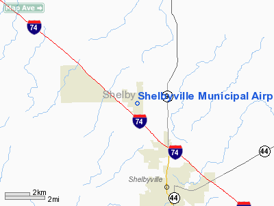
Shelbyville, Indiana |
| Elevation AMSL |
803 ft / 245 m |
| Coordinates |
39°34â²59â³N 085°48â²17â³W / 39.58306°N 85.80472°W / 39.58306; -85.80472 |
| Runways |
| Direction |
Length |
Surface |
| ft |
m |
| 1/19 |
5,000 |
1,524 |
Asphalt |
| 9/27 |
2,671 |
814 |
Turf |
| Statistics (2006) |
| Aircraft operations |
24,094 |
| Based aircraft |
60 |
| Source: Federal Aviation Administration |
Shelbyville Municipal Airport (ICAO: KGEZ, FAA LID: GEZ) is a public use airport located four nautical miles (7 km) northwest of the central business district of Shelbyville, in Shelby County, Indiana, United States. The airport is owned by the city of Shelbyville and is controlled by the mayor and an appointed Board of Commissioners. According to the FAA's National Plan of Integrated Airport Systems for 2009â2013, it was classified as a general aviation airport.
Although most U.S. airports use the same three-letter location identifier for the FAA and IATA, this airport is assigned GEZ by the FAA but has no designation from the IATA.
Facilities and aircraft
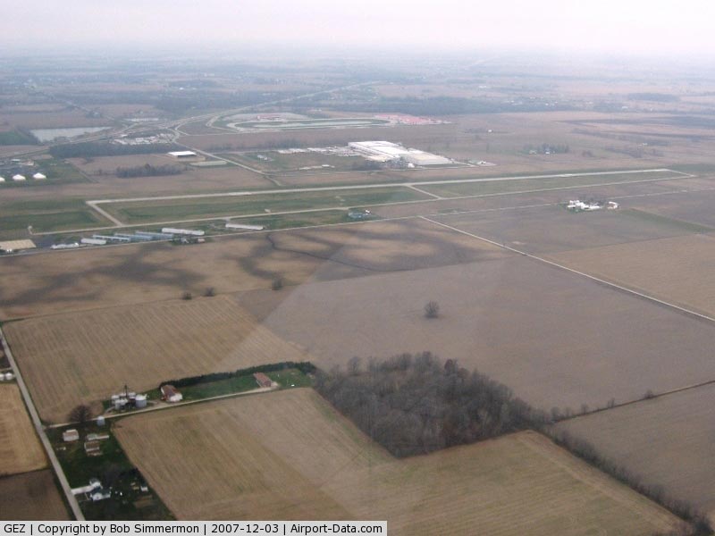
Shelbyville Municipal Airport covers an area of 550 acres (223 ha) at an elevation of 803 feet (245 m) above mean sea level. It has two runways: 1/19 is 5,000 by 100 feet (1,524 x 30 m) with an asphalt pavement; 9/27 is 2,671 by 190 feet (814 x 58 m) with a turf surface.
For the 12-month period ending December 31, 2006, the airport had 24,094 aircraft operations, an average of 66 per day: 91% general aviation, 5% military, and 4% air taxi. At that time there were 60 aircraft based at this airport: 88% single-engine, 10% multi-engine, and 2% jet.
The above content comes from Wikipedia and is published under free licenses – click here to read more.
|
 |
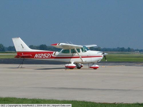
(Click on the photo to enlarge) |
|
 |
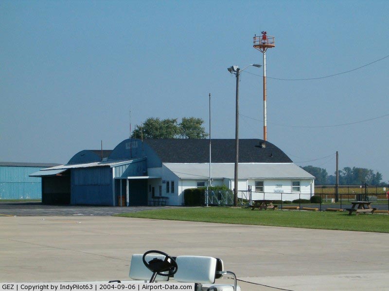
(Click on the photo to enlarge) |
|
 |
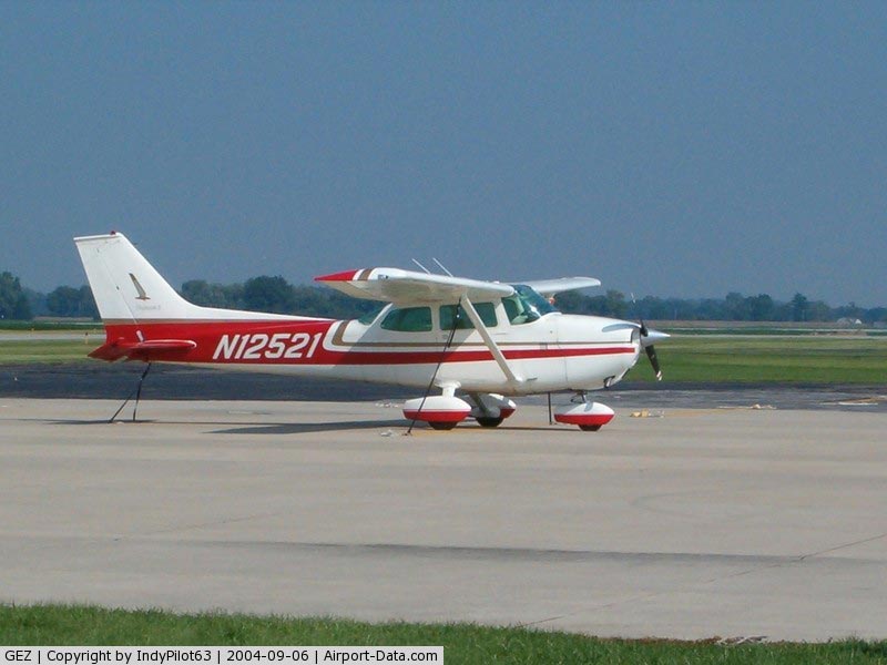
(Click on the photo to enlarge) |
Location
& QuickFacts
|
FAA
Information Effective: |
2008-06-05 |
|
Airport
Identifier: |
GEZ |
|
Airport
Status: |
Operational |
|
Longitude/Latitude: |
085-48-17.3000W/39-34-59.3000N
-85.804806/39.583139 (Estimated) |
|
Elevation: |
803 ft / 244.75 m (Surveyed) |
|
Land: |
550 acres |
|
From nearest
city: |
4 nautical miles NW of Shelbyville, IN |
|
Location: |
Shelby County, IN |
|
Magnetic
Variation: |
04W (2000) |
Owner
& Manager
|
Ownership: |
Publicly
owned |
|
Owner: |
Shelbyville Boac |
|
Address: |
44 W Washington St
Shelbyville,
IN 46176 |
|
Phone
number: |
317-398-6624 |
|
Manager: |
Darrell Shrader |
|
Address: |
3529 N.100 W.
Shelbyville, IN 46176 |
|
Phone
number: |
317-392-1284
ALSO 317-392-1284. |
Airport
Operations and Facilities
|
Airport
Use: |
Open
to public |
|
Wind indicator: |
Yes |
|
Segmented
Circle: |
No |
|
Control
Tower: |
No |
|
Lighting
Schedule: |
DUSK-DAWN
MIRL RY 01/19 PRESET ON LOW INTST; TO INCR INTST & ACTVT
PAPI RY 01 & VASI RY 19 - CTAF |
|
Beacon
Color: |
Clear-Green (lighted land airport) |
|
Landing
fee charge: |
No |
|
Sectional
chart: |
St Louis |
|
Region: |
AGL - Great Lakes |
|
Boundary
ARTCC: |
ZID - Indianapolis |
|
Tie-in
FSS: |
HUF - Terre Haute |
|
FSS on
Airport: |
No |
|
FSS Toll
Free: |
1-800-WX-BRIEF |
|
NOTAMs
Facility: |
GEZ (NOTAM-d service avaliable) |
|
Federal
Agreements: |
NGY |
Airport Communications
|
CTAF: |
122.800 |
|
Unicom: |
122.800
|
Airport
Services
|
Fuel
available: |
100LLA |
|
Airframe
Repair: |
MAJOR |
|
Power
Plant Repair: |
MAJOR |
|
Bottled
Oxygen: |
NONE |
|
Bulk Oxygen: |
NONE |
|
Runway Information
Runway 01/19
|
Dimension: |
5000 x 100 ft
/ 1524.0 x 30.5 m |
|
Surface: |
ASPH, Good Condition |
|
Surface Treatment: |
Saw-cut or plastic Grooved |
|
Weight Limit: |
Single wheel: 30000 lbs.
Dual wheel: 40000 lbs. |
|
Edge Lights: |
Medium |
|
|
Runway 01 |
Runway 19 |
|
Longitude: |
085-48-16.8149W |
085-48-11.7750W |
|
Latitude: |
39-34-46.5019N |
39-35-35.7662N |
|
Elevation: |
801.00 ft |
802.00 ft |
|
Alignment: |
5 |
127 |
|
Traffic
Pattern: |
Left |
Left |
|
Markings: |
Non-precision instrument, Good Condition |
Non-precision instrument, Good Condition |
|
Crossing
Height: |
25.00 ft |
38.00 ft |
|
VASI: |
2-light PAPI on left side |
4-box on left side |
|
Visual Glide
Angle: |
3.00° |
3.00° |
|
Runway End
Identifier: |
Yes |
Yes |
|
Obstruction: |
38 ft trees, 2058.0 ft from runway, 200 ft
left of centerline, 48:1 slope to clear |
45 ft trees, 2154.0 ft from runway, 43:1 slope
to clear |
|
Runway 09/27
|
Dimension: |
2671 x 190 ft
/ 814.1 x 57.9 m |
|
Surface: |
TURF, Fair Condition |
|
|
Runway 09 |
Runway 27 |
|
Longitude: |
085-48-40.0700W |
085-48-05.9900W |
|
Latitude: |
39-34-37.6700N |
39-34-36.6700N |
|
Elevation: |
790.00 ft |
800.00 ft |
|
Alignment: |
92 |
127 |
|
Traffic
Pattern: |
Left |
Left |
|
Markings: |
None, |
None,
RY 27 BEGINS AT WEST SIDE OF TWY 'A'; GRASS LINE MARKS RY
EDGES. |
|
Displaced
threshold: |
446.00 ft
RY 09/27 DSPLCD THLDS MKD WITH YELLOW CONES. |
289.00 ft |
|
Runway End
Identifier: |
No |
No |
|
Centerline
Lights: |
No |
No |
|
Touchdown
Lights: |
No |
No |
|
Obstruction: |
150 ft road, 15.0 ft from runway, 10:1 slope
to clear
APCH SLOPE 40:1 AT DSPLCD THR. |
23 ft bldg, 325.0 ft from runway, 120 ft right
of centerline, 14:1 slope to clear
APCH RATIO 27:1 TO DSPLCD THLD. |
|
Radio Navigation
Aids
|
ID |
Type |
Name |
Ch |
Freq |
Var |
Dist |
|
HFY |
NDB |
Greenwood |
|
398.00 |
02W |
13.6 nm |
|
BA |
NDB |
Clifs |
|
410.00 |
03W |
15.7 nm |
|
UMP |
NDB |
Metropolitan |
|
338.00 |
03W |
24.1 nm |
|
UWL |
NDB |
New Castle |
|
385.00 |
02W |
28.7 nm |
|
HLB |
NDB |
Batesville |
|
254.00 |
02W |
29.0 nm |
|
HZP |
NDB |
Zionsville |
|
248.00 |
03W |
29.7 nm |
|
AI |
NDB |
Video |
|
371.00 |
03W |
32.2 nm |
|
OVO |
NDB |
North Vernon |
|
374.00 |
02W |
33.4 nm |
|
EQZ |
NDB |
Captain |
|
308.00 |
02W |
43.7 nm |
|
TVX |
NDB |
Greencastle |
|
521.00 |
03W |
47.0 nm |
|
OXD |
NDB |
Oxford |
|
282.00 |
04W |
47.7 nm |
|
BM |
NDB |
Claye |
|
382.00 |
02W |
48.6 nm |
|
MIE |
VOR/DME |
Muncie |
091X |
114.40 |
03W |
43.6 nm |
|
SHB |
VORTAC |
Shelbyville |
057X |
112.00 |
01E |
3.1 nm |
|
VHP |
VORTAC |
Brickyard |
110X |
116.30 |
01E |
29.5 nm |
|
RID |
VORTAC |
Richmond |
043X |
110.60 |
03W |
45.9 nm |
|
OOM |
VORTAC |
Hoosier |
039X |
110.20 |
02W |
45.9 nm |
|
IND |
VOT |
Indianapolis Intl |
|
109.60 |
|
23.7 nm |
Remarks
- HELICOPTER
TFC ALL HRS.
- NG
HELIPAD & HELICOPTER FACILITY LCTD WEST OF ARPT.
Based Aircraft
|
Aircraft
based on field: |
61 |
|
Single Engine
Airplanes: |
57 |
|
Multi Engine Airplanes: |
3 |
|
Jet Engine Airplanes: |
1 |
Operational Statistics
Time
Period: 2006-01-01 - 2006-12-31
|
Aircraft
Operations: |
67/Day |
|
Air Taxi: |
4.0% |
|
General Aviation
Local: |
74.0% |
|
General Aviation
Itinerant: |
17.0% |
|
Military: |
5.0% |
Shelbyville Municipal Airport
Address:
Shelby County, IN
Tel:
317-398-6624,
317-392-1284
Images
and information placed above are from
http://www.airport-data.com/airport/GEZ/
We
thank them for the data!
| General
Info |
| Country |
United
States |
| State |
INDIANA
|
| FAA ID |
GEZ |
| Latitude |
39-34-59.397N
|
| Longitude |
085-48-17.316W
|
| Elevation |
804 feet
|
| Near City |
SHELBYVILLE
|
We don't guarantee the information is fresh and accurate. The data may
be wrong or outdated.
For more up-to-date information please refer to other sources.
|
|