 |
|
| Shawnee Field |
| IATA: none – ICAO: none – FAA LID: 1I3 |
| Summary |
| Airport type |
Public |
| Owner |
Shawnee Field Inc. |
| Serves |
Bloomfield, Indiana |
| Elevation AMSL |
501 ft / 153 m |
| Coordinates |
39°02′40.163″N 087°00′20.03″W / 39.04448972°N 87.0055639°W / 39.04448972; -87.0055639Coordinates: 39°02′40.163″N 087°00′20.03″W / 39.04448972°N 87.0055639°W / 39.04448972; -87.0055639 |
| Runways |
| Direction |
Length |
Surface |
| ft |
m |
| 18/36 |
2,160 |
658 |
Turf |
| Statistics (2007) |
| Aircraft operations |
8,283 |
| Based aircraft |
21 |
| Source: Federal Aviation Administration |
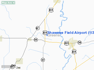
Shawnee Field is a public use airport in Greene County, Indiana, United States. It is owned by Shawnee Field Inc. and is located three nautical miles (5.56 km) west of the central business district of Bloomfield, Indiana.
Although most U.S. airports use the same three-letter location identifier for the FAA and IATA, this airport is assigned 1I3 by the FAA but has no designation from the IATA. Facilities and aircraft
Shawnee Field covers an area of 29 acres (8.1 ha) at an elevation of 501 feet (153 m) above mean sea level. It has one runway designated 18/36 with an turf surface measuring 2,160 by 150 feet (658 x 46 m).
For the 12-month period ending December 31, 2007, the airport had 8,283 aircraft operations, an average of 23 per day: 100% general aviation with a few ultralights. At that time there were 21 aircraft based at this airport: 86% single-engine and 14% ultralights.
Accidents
On August 25, 2009, two men were killed when their ultralight aircraft either failed to takeoff or failed to land. The craft crashed into a field.
The above content comes from Wikipedia and is published under free licenses – click here to read more.
Location
& QuickFacts
|
FAA
Information Effective: |
2008-06-05 |
|
Airport
Identifier: |
1I3 |
|
Airport
Status: |
Operational |
|
Longitude/Latitude: |
087-00-20.0300W/39-02-40.1630N
-87.005564/39.044490 (Estimated) |
|
Elevation: |
501 ft / 152.70 m (Surveyed) |
|
Land: |
29 acres |
|
From nearest
city: |
3 nautical miles W of Bloomfield, IN |
|
Location: |
Greene County, IN |
|
Magnetic
Variation: |
01W (1985) |
Owner
& Manager
|
Ownership: |
Privately
owned |
|
Owner: |
Shawnee Field Inc. |
|
Address: |
Rr2 Box 32b
Bloomfield, IN 47425 |
|
Phone
number: |
812-384-3903 |
|
Manager: |
J. E. Sutphin |
|
Address: |
Rt 2 Box 32b
Bloomfield, IN 47424 |
|
Phone
number: |
812-384-3903 |
Airport Operations
and Facilities
|
Airport
Use: |
Open
to public |
|
Wind indicator: |
Yes |
|
Segmented
Circle: |
No |
|
Control
Tower: |
No |
|
Lighting
Schedule: |
RDO-CTL
ACTVT EDGE LGTS RY 18/36 - CTAF. |
|
Landing
fee charge: |
No |
|
Sectional
chart: |
St Louis |
|
Region: |
AGL - Great Lakes |
|
Boundary
ARTCC: |
ZID - Indianapolis |
|
Tie-in
FSS: |
HUF - Terre Haute |
|
FSS on
Airport: |
No |
|
FSS Toll
Free: |
1-800-WX-BRIEF |
|
NOTAMs
Facility: |
HUF (NOTAM-d service avaliable) |
Airport Communications
Airport Services
|
Airframe
Repair: |
MINOR |
|
Power
Plant Repair: |
MINOR |
|
Runway Information
Runway 18/36
|
Dimension: |
2160 x 150
ft / 658.4 x 45.7 m
485 FT STWY NORTH END. |
|
Surface: |
TURF, Good Condition |
|
Edge Lights: |
Non-standard lighting system
RY 18/36 NSTD EDGE LGTS, PCV PIPE WITH GLASS JARS. |
|
|
Runway 18 |
Runway 36 |
|
Traffic
Pattern: |
Left |
Left |
|
Markings: |
None, |
None, |
|
Obstruction: |
, 50:1 slope to clear |
25 ft bldg, 280.0 ft from runway, 110 ft left
of centerline, 11:1 slope to clear |
|
Radio Navigation
Aids
|
ID |
Type |
Name |
Ch |
Freq |
Var |
Dist |
|
BM |
NDB |
Claye |
|
382.00 |
02W |
19.0 nm |
|
SIV |
NDB |
Sullivan |
|
326.00 |
02W |
21.0 nm |
|
DCY |
NDB |
Washington |
|
212.00 |
03W |
21.8 nm |
|
HU |
NDB |
Yinno |
|
245.00 |
02W |
27.6 nm |
|
BFR |
NDB |
Bedford |
|
344.00 |
02W |
29.3 nm |
|
PLX |
NDB |
Palestine |
|
391.00 |
00W |
29.7 nm |
|
OEA |
NDB |
Vincennes |
|
251.00 |
00E |
33.4 nm |
|
RRJ |
NDB |
Oranj |
|
368.00 |
02W |
38.3 nm |
|
TVX |
NDB |
Greencastle |
|
521.00 |
03W |
41.3 nm |
|
AJG |
NDB |
Mount Carmel |
|
524.00 |
02W |
42.6 nm |
|
FNZ |
NDB |
Ferdinand |
|
239.00 |
00E |
48.5 nm |
|
CZB |
NDB |
Casey |
|
359.00 |
00E |
49.0 nm |
|
EQZ |
NDB |
Captain |
|
308.00 |
02W |
49.4 nm |
|
RSV |
VOR/DME |
Robinson |
021X |
108.40 |
02E |
30.1 nm |
|
LWV |
VOR/DME |
Lawrenceville |
025X |
108.80 |
01W |
32.5 nm |
|
HNB |
VOR/DME |
Huntingburg |
029X |
109.20 |
00E |
47.8 nm |
|
OOM |
VORTAC |
Hoosier |
039X |
110.20 |
02W |
19.3 nm |
|
TTH |
VORTAC |
Terre Haute |
100X |
115.30 |
02E |
29.0 nm |
Remarks
- 370'ANTENNA
TWR 1 MI NW.
- RY
18/36 HAS A -4 FT SLOPE ON EAST SIDE; NORTH OF RY 18 THR.
- BIRDS
ON & INVOF RY.
- ULTRA
LGTS ON & INVOF ARPT.
Based Aircraft
|
Aircraft
based on field: |
24 |
|
Single Engine
Airplanes: |
18 |
|
Ultralights: |
6 |
Operational Statistics
Time
Period: 2004-01-02 - 2004-12-31
|
Aircraft
Operations: |
160/Week |
|
General Aviation
Local: |
91.4% |
|
General Aviation
Itinerant: |
8.6% |
Shawnee Field Airport
Address:
Greene County, IN
Tel:
812-384-3903
Images
and information placed above are from
http://www.airport-data.com/airport/1I3/
We
thank them for the data!
| General
Info |
| Country |
United
States |
| State |
INDIANA
|
| FAA ID |
1I3 |
| Latitude |
39-02-40.163N
|
| Longitude |
087-00-20.030W
|
| Elevation |
501 feet
|
| Near City |
BLOOMFIELD
|
We don't guarantee the information is fresh and accurate. The data may
be wrong or outdated.
For more up-to-date information please refer to other sources.
|
|


