 |
|
|
|
|
|
Location
& QuickFacts
|
FAA
Information Effective: |
2008-06-05 |
|
Airport
Identifier: |
3R8 |
|
Airport
Status: |
Operational |
|
Longitude/Latitude: |
085-47-24.8840W/38-39-26.2110N
-85.790246/38.657281 (Estimated) |
|
Elevation: |
600 ft / 182.88 m (Estimated) |
|
Land: |
121 acres |
|
From nearest
city: |
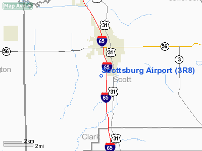
3 nautical miles SW of Scottsburg, IN |
|
Location: |
Scott County, IN |
|
Magnetic
Variation: |
02W (1985) |
Owner
& Manager
|
Ownership: |
Privately
owned |
|
Owner: |
Bruce Webb/larry Beckley |
|
Address: |
2527 Lake Road S.
Scottsburg,
IN 47170 |
|
Phone
number: |
812-752-6631 |
|
Manager: |
Larry Beckley |
|
Address: |
2527 Lake Road S.
Scottsburg,
IN 47170 |
|
Phone
number: |
812-752-6631 |
Airport Operations
and Facilities
|
Airport
Use: |
Open
to public |
|
Wind indicator: |
Yes |
|
Segmented
Circle: |
Yes |
|
Control
Tower: |
No |
|
Landing
fee charge: |
No |
|
Sectional
chart: |
St Louis |
|
Region: |
AGL - Great Lakes |
|
Boundary
ARTCC: |
ZID - Indianapolis |
|
Tie-in
FSS: |
HUF - Terre Haute |
|
FSS on
Airport: |
No |
|
FSS Toll
Free: |
1-800-WX-BRIEF |
|
NOTAMs
Facility: |
HUF (NOTAM-d service avaliable) |
Airport Communications
Airport Services
|
Fuel
available: |
100LL |
|
Airframe
Repair: |
MINOR |
|
Power
Plant Repair: |
MINOR |
|
Runway Information
Runway 02/20
|
Dimension: |
2844 x 100 ft
/ 866.9 x 30.5 m |
|
Surface: |
TURF, Good Condition |
|
|
Runway 02 |
Runway 20 |
|
Longitude: |
085-47-32.8800W |
085-47-19.3300W |
|
Latitude: |
38-39-15.2100N |
38-39-40.2300N |
|
Elevation: |
605.00 ft |
600.00 ft |
|
Traffic
Pattern: |
Left |
Left |
|
Displaced
threshold: |
200.00 ft |
380.00 ft |
|
Obstruction: |
35 ft trees, 150.0 ft from runway, 140 ft right
of centerline, 4:1 slope to clear
APCH RATIO 10:1 AT DSPLCD THLD. |
18 ft trees, 0.0 ft from runway, 80 ft left
of centerline
APCH RATIO 20:1 AT DSPLCD THLD. |
|
Radio Navigation
Aids
|
ID |
Type |
Name |
Ch |
Freq |
Var |
Dist |
|
EQZ |
NDB |
Captain |
|
308.00 |
02W |
15.3 nm |
|
IMS |
NDB |
Madison |
|
404.00 |
03W |
16.7 nm |
|
OVO |
NDB |
North Vernon |
|
374.00 |
02W |
25.2 nm |
|
BFR |
NDB |
Bedford |
|
344.00 |
02W |
32.2 nm |
|
RRJ |
NDB |
Oranj |
|
368.00 |
02W |
35.5 nm |
|
BA |
NDB |
Clifs |
|
410.00 |
03W |
40.0 nm |
|
GOI |
NDB |
Godman |
|
396.00 |
02W |
42.9 nm |
|
BM |
NDB |
Claye |
|
382.00 |
02W |
44.8 nm |
|
HLB |
NDB |
Batesville |
|
254.00 |
02W |
48.5 nm |
|
BQM |
VOR/DME |
Bowman |
059X |
112.20 |
01W |
26.3 nm |
|
FTK |
VOR/DME |
Fort Knox |
033X |
109.60 |
01W |
45.9 nm |
|
ABB |
VORTAC |
Nabb |
071X |
112.40 |
01E |
8.3 nm |
|
IIU |
VORTAC |
Louisville |
095X |
114.80 |
01E |
34.8 nm |
|
OOM |
VORTAC |
Hoosier |
039X |
110.20 |
02W |
48.3 nm |
|
SDF |
VOT |
Louisville Standifd |
|
111.00 |
|
28.9 nm |
Remarks
- ARPT
CLSD DEC 1 TO APR 1.
- TREES
ALL QUADRANTS.
Based Aircraft
|
Aircraft
based on field: |
16 |
|
Single Engine
Airplanes: |
2 |
|
Ultralights: |
14 |
Operational Statistics
Time
Period: 2006-03-27 - 2007-03-27
|
Aircraft
Operations: |
23/Week |
|
General Aviation
Local: |
72.4% |
|
General Aviation
Itinerant: |
27.6% |
Scottsburg Airport
Address:
Scott County, IN
Tel:
812-752-6631
Images
and information placed above are from
http://www.airport-data.com/airport/3R8/
We
thank them for the data!
| General
Info |
| Country |
United
States |
| State |
INDIANA
|
| FAA ID |
3R8 |
| Latitude |
38-39-26.211N
|
| Longitude |
085-47-24.884W
|
| Elevation |
600 feet
|
| Near City |
SCOTTSBURG
|
We don't guarantee the information is fresh and accurate. The data may
be wrong or outdated.
For more up-to-date information please refer to other sources.
|
|


