 |
|
Location
& QuickFacts
|
FAA
Information Effective: |
2008-06-05 |
|
Airport
Identifier: |
7II3 |
|
Airport
Status: |
Operational |
|
Longitude/Latitude: |
087-45-23.0810W/38-00-12.1520N
-87.756411/38.003376 (Estimated) |
|
Elevation: |
385 ft / 117.35 m (Estimated) |
|
Land: |
5 acres |
|
From nearest
city: |
8 nautical miles NE of Mount Vernon, IN |
|
Location: |
Posey County, IN |
|
Magnetic
Variation: |
00W (1985) |
Owner
& Manager
|
Ownership: |
Privately
owned |
|
Owner: |
Earl E. Schroeder |
|
Address: |
2103 Ford Road
Mount
Vernon, IN 47620 |
|
Phone
number: |
812-985-3339 |
|
Address: |
|
Airport Operations
and Facilities
|
Airport
Use: |
Private |
|
Wind indicator: |
Yes |
|
Segmented
Circle: |
No |
|
Control
Tower: |
No |
|
Lighting
Schedule: |
PHONE REQ
FOR LIRL 18/36 CALL 812-985-3339. |
|
Sectional
chart: |
St Louis |
|
Region: |
AGL - Great Lakes |
|
Boundary
ARTCC: |
ZID - Indianapolis |
|
Tie-in
FSS: |
HUF - Terre Haute |
|
FSS on
Airport: |
No |
|
FSS Toll
Free: |
1-800-WX-BRIEF |
Airport
Communications
|
Runway Information
Runway 17/35
|
Dimension: |
2200 x 45 ft
/ 670.6 x 13.7 m |
|
Surface: |
TURF, |
|
|
Runway 17 |
Runway 35 |
|
Traffic
Pattern: |
Left |
Left |
|
Displaced
threshold: |
200.00 ft |
0.00 ft |
|
Radio Navigation
Aids
|
ID |
Type |
Name |
Ch |
Freq |
Var |
Dist |
|
PDW |
NDB |
Evansville |
|
284.00 |
00E |
10.9 nm |
|
GVA |
NDB |
Geneva |
|
224.00 |
01W |
12.1 nm |
|
CUL |
NDB |
Carmi |
|
332.00 |
01W |
18.0 nm |
|
TWT |
NDB |
Tradewater |
|
276.00 |
00E |
33.5 nm |
|
AJG |
NDB |
Mount Carmel |
|
524.00 |
02W |
36.6 nm |
|
FWC |
NDB |
Wayne County |
|
257.00 |
01E |
38.3 nm |
|
HSB |
NDB |
Harrisburg-raleigh |
|
230.00 |
00E |
39.2 nm |
|
OEA |
NDB |
Vincennes |
|
251.00 |
00E |
42.4 nm |
|
FNZ |
NDB |
Ferdinand |
|
239.00 |
00E |
45.9 nm |
|
OLY |
NDB |
Olney |
|
272.00 |
00W |
47.2 nm |
|
OWB |
VOR/DME |
Owensboro |
023X |
108.60 |
01E |
32.1 nm |
|
SAM |
VOR/DME |
Samsville |
113X |
116.60 |
03E |
32.9 nm |
|
HNB |
VOR/DME |
Huntingburg |
029X |
109.20 |
00E |
40.6 nm |
|
LWV |
VOR/DME |
Lawrenceville |
025X |
108.80 |
01W |
46.6 nm |
|
PXV |
VORTAC |
Pocket City |
080X |
113.30 |
03E |
4.5 nm |
|
CCT |
VORTAC |
Central City |
035X |
109.80 |
01W |
44.1 nm |
Remarks
- PRVDD
NORTH END OF RWY IS DSPLCD TO PRVD 20:1 APCH SLOPE, TREES WEST &
SOUTH END ARE REMOVED FM THE 250' WIDE APCH AREA.
Based Aircraft
|
Aircraft
based on field: |
1 |
|
Single Engine
Airplanes: |
1 |
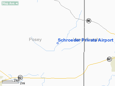
Schroeder Private Airport
Address:
Posey County, IN
Tel:
812-985-3339
Images
and information placed above are from
http://www.airport-data.com/airport/7II3/
We
thank them for the data!
| General
Info |
| Country |
United
States |
| State |
INDIANA
|
| FAA ID |
7II3 |
| Latitude |
38-00-12.152N
|
| Longitude |
087-45-23.081W
|
| Elevation |
385 feet
|
| Near City |
MOUNT
VERNON |
We don't guarantee the information is fresh and accurate. The data may
be wrong or outdated.
For more up-to-date information please refer to other sources.
|
|


