 |
|
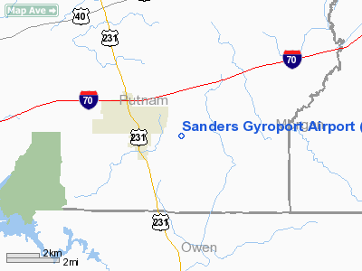
Location
& QuickFacts
|
FAA
Information Effective: |
2008-06-05 |
|
Airport
Identifier: |
IN88 |
|
Airport
Status: |
Operational |
|
Longitude/Latitude: |
086-45-50.0250W/39-30-48.1660N
-86.763896/39.513379 (Estimated) |
|
Elevation: |
760 ft / 231.65 m (Estimated) |
|
Land: |
8 acres |
|
From nearest
city: |
2 nautical miles E of Cloverdale, IN |
|
Location: |
Putnam County, IN |
|
Magnetic
Variation: |
02W (1990) |
Owner & Manager
|
Ownership: |
Privately
owned |
|
Owner: |
George W Sanders Jr |
|
Address: |
Rr 2 Box 15
Cloverdale, IN 46120 |
|
Phone
number: |
317-745-3489 |
|
Manager: |
George W Sanders Jr |
|
Address: |
Rr 2 Box 15
Cloverdale, IN 46120 |
|
Phone
number: |
317-745-3489 |
Airport
Operations and Facilities
|
Airport
Use: |
Private |
|
Wind indicator: |
Yes |
|
Segmented
Circle: |
No |
|
Control
Tower: |
No |
|
Sectional
chart: |
St Louis |
|
Region: |
AGL - Great Lakes |
|
Boundary
ARTCC: |
ZID - Indianapolis |
|
Tie-in
FSS: |
HUF - Terre Haute |
|
FSS Toll
Free: |
1-800-WX-BRIEF |
|
Runway Information
Runway 10/28
|
Dimension: |
1200 x 75 ft
/ 365.8 x 22.9 m |
|
Surface: |
TURF, |
|
|
Runway 10 |
Runway 28 |
|
Traffic
Pattern: |
Right |
Left |
|
Displaced
threshold: |
300.00 ft |
300.00 ft |
|
Obstruction: |
|
15 ft pline, 50.0 ft from runway |
|
Radio Navigation
Aids
|
ID |
Type |
Name |
Ch |
Freq |
Var |
Dist |
|
TVX |
NDB |
Greencastle |
|
521.00 |
03W |
12.2 nm |
|
BM |
NDB |
Claye |
|
382.00 |
02W |
28.5 nm |
|
CFJ |
NDB |
Crawfordsville |
|
388.00 |
02W |
29.0 nm |
|
HU |
NDB |
Yinno |
|
245.00 |
02W |
30.4 nm |
|
HFY |
NDB |
Greenwood |
|
398.00 |
02W |
32.0 nm |
|
HZP |
NDB |
Zionsville |
|
248.00 |
03W |
35.0 nm |
|
SIV |
NDB |
Sullivan |
|
326.00 |
02W |
39.8 nm |
|
UMP |
NDB |
Metropolitan |
|
338.00 |
03W |
41.7 nm |
|
BFR |
NDB |
Bedford |
|
344.00 |
02W |
43.3 nm |
|
PRG |
NDB |
Paris |
|
341.00 |
01E |
43.6 nm |
|
BA |
NDB |
Clifs |
|
410.00 |
03W |
45.4 nm |
|
FKR |
NDB |
Frankfort |
|
278.00 |
02W |
46.4 nm |
|
TTH |
VORTAC |
Terre Haute |
100X |
115.30 |
02E |
22.5 nm |
|
OOM |
VORTAC |
Hoosier |
039X |
110.20 |
02W |
23.3 nm |
|
VHP |
VORTAC |
Brickyard |
110X |
116.30 |
01E |
25.8 nm |
|
SHB |
VORTAC |
Shelbyville |
057X |
112.00 |
01E |
44.1 nm |
|
IND |
VOT |
Indianapolis Intl |
|
109.60 |
|
25.6 nm |
Remarks
- PRVDD
2:1 APCH SLOPE; 125' EITHER SIDE OF RY CNTRLN SHOULD BE CLEAR OF ALL
OBS.
Based Aircraft
|
Aircraft
based on field: |
2 |
|
Single Engine
Airplanes: |
2 |
Sanders Gyroport Airport
Address:
Putnam County, IN
Tel:
317-745-3489
Images
and information placed above are from
http://www.airport-data.com/airport/IN88/
We
thank them for the data!
| General
Info |
| Country |
United
States |
| State |
INDIANA
|
| FAA ID |
IN88 |
| Latitude |
39-30-48.166N
|
| Longitude |
086-45-50.025W
|
| Elevation |
760 feet
|
| Near City |
CLOVERDALE
|
We don't guarantee the information is fresh and accurate. The data may
be wrong or outdated.
For more up-to-date information please refer to other sources.
|
|


