 |
|
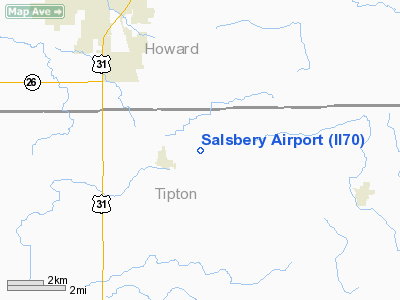
Location
& QuickFacts
|
FAA Information Effective: |
2008-06-05 |
|
Airport Identifier: |
II70 |
|
Airport Status: |
Operational |
|
Longitude/Latitude: |
086-03-47.9590W/40-23-04.1360N
-86.063322/40.384482 (Estimated) |
|
Elevation: |
870 ft / 265.18 m (Estimated) |
|
Land: |
0 acres |
|
From nearest city: |
1 nautical miles NE of Sharpsville, IN |
|
Location: |
Tipton County, IN |
|
Magnetic Variation: |
02W (1985) |
Owner & Manager
|
Ownership: |
Privately
owned |
|
Owner: |
Robert R. Salsbery |
|
Address: |
Rr 2
Sharpsville, IN 46068 |
|
Phone number: |
317-963-5829 |
|
Address: |
|
Airport
Operations and Facilities
|
Airport Use: |
Private |
|
Segmented Circle: |
No |
|
Control Tower: |
No |
|
Landing fee charge: |
No |
|
Sectional chart: |
Chicago |
|
Region: |
AGL - Great Lakes |
|
Boundary ARTCC: |
ZAU - Chicago |
|
Tie-in FSS: |
HUF - Terre Haute |
|
FSS Toll Free: |
1-800-WX-BRIEF |
|
Runway
Information
Runway 09/27
|
Dimension: |
1600 x 50 ft
/ 487.7 x 15.2 m |
|
Surface: |
TURF, |
|
|
Runway 09 |
Runway 27 |
|
Traffic Pattern: |
Left |
Left |
|
Obstruction: |
50 ft pline, 1050.0 ft from runway |
50 ft trees, 1050.0 ft from runway |
|
Radio Navigation
Aids
|
ID |
Type |
Name |
Ch |
Freq |
Var |
Dist |
|
FKR |
NDB |
Frankfort |
|
278.00 |
02W |
23.9 nm |
|
GGP |
NDB |
Logansport |
|
263.00 |
01W |
24.1 nm |
|
IWH |
NDB |
Wabash |
|
329.00 |
03W |
25.8 nm |
|
UMP |
NDB |
Metropolitan |
|
338.00 |
03W |
26.9 nm |
|
HZP |
NDB |
Zionsville |
|
248.00 |
03W |
28.1 nm |
|
AI |
NDB |
Video |
|
371.00 |
03W |
31.6 nm |
|
MCX |
NDB |
White County |
|
377.00 |
03W |
37.5 nm |
|
HHG |
NDB |
Huntington |
|
417.00 |
03W |
39.4 nm |
|
RCR |
NDB |
Rochester |
|
216.00 |
03W |
41.3 nm |
|
HFY |
NDB |
Greenwood |
|
398.00 |
02W |
45.2 nm |
|
UWL |
NDB |
New Castle |
|
385.00 |
02W |
45.7 nm |
|
CFJ |
NDB |
Crawfordsville |
|
388.00 |
02W |
46.0 nm |
|
RWN |
NDB |
Winamac/dcmsnd |
|
335.00 |
00W |
49.3 nm |
|
PLD |
NDB |
Portland |
|
257.00 |
03W |
49.6 nm |
|
MZZ |
VOR/DME |
Marion |
023X |
108.60 |
03W |
18.7 nm |
|
MIE |
VOR/DME |
Muncie |
091X |
114.40 |
03W |
31.9 nm |
|
OKK |
VORTAC |
Kokomo |
082X |
113.50 |
00E |
8.6 nm |
|
GUS |
VORTAC |
Grissom |
21Y |
108.45 |
02W |
16.2 nm |
|
VHP |
VORTAC |
Brickyard |
110X |
116.30 |
01E |
37.0 nm |
|
SHB |
VORTAC |
Shelbyville |
057X |
112.00 |
01E |
46.5 nm |
|
BVT |
VORTAC |
Boiler |
098X |
115.10 |
01E |
47.1 nm |
|
IND |
VOT |
Indianapolis Intl |
|
109.60 |
|
40.9 nm |
Remarks
- FILED
FOR RECORD PURPOSES ONLY.
Based Aircraft
|
Aircraft
based on field: |
2 |
|
Single Engine Airplanes: |
1 |
|
Ultralights: |
1 |
Salsbery Airport
Address: Tipton
County, IN
Tel:
317-963-5829
Images and information placed above are from
http://www.airport-data.com/airport/II70/
We thank them
for the data!
| General
Info |
| Country |
United
States |
| State |
INDIANA
|
| FAA ID |
II70 |
| Latitude |
40-23-04.136N
|
| Longitude |
086-03-47.959W
|
| Elevation |
870 feet
|
| Near City |
SHARPSVILLE
|
We don't guarantee the information is fresh and accurate. The data may
be wrong or outdated.
For more up-to-date information please refer to other sources.
|
|


