 |
|
|
|
|
|
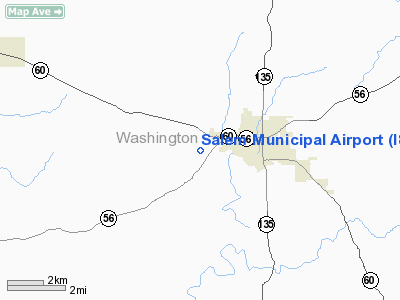
Location
& QuickFacts
|
FAA
Information Effective: |
2008-06-05 |
|
Airport
Identifier: |
I83 |
|
Airport
Status: |
Operational |
|
Longitude/Latitude: |
086-08-23.9240W/38-36-07.2060N
-86.139979/38.602002 (Estimated) |
|
Elevation: |
822 ft / 250.55 m (Estimated) |
|
Land: |
47 acres |
|
From nearest
city: |
2 nautical miles W of Salem, IN |
|
Location: |
Washington County, IN |
|
Magnetic
Variation: |
02W (1985) |
Owner
& Manager
|
Ownership: |
Publicly
owned |
|
Owner: |
Salem Board Of Avn Cmsnrs |
|
Address: |
P.o. Box 48
Salem,
IN 47167 |
|
Phone
number: |
812-883-0226 |
|
Manager: |
Jeff Burns |
|
Address: |
2593 W. Sr 56
Salem, IN 47167 |
|
Phone
number: |
812-883-5858 |
Airport
Operations and Facilities
|
Airport
Use: |
Open
to public |
|
Wind indicator: |
Yes |
|
Segmented
Circle: |
No |
|
Control
Tower: |
No |
|
Lighting
Schedule: |
DUSK-DAWN
MIRL RY 10/28 PRESET LOW INTST; TO INCR INTST ACTVT - CTAF. |
|
Beacon
Color: |
Clear-Green (lighted land airport) |
|
Landing
fee charge: |
No |
|
Sectional
chart: |
St Louis |
|
Region: |
AGL - Great Lakes |
|
Boundary
ARTCC: |
ZID - Indianapolis |
|
Tie-in
FSS: |
HUF - Terre Haute |
|
FSS on
Airport: |
No |
|
FSS Toll
Free: |
1-800-WX-BRIEF |
|
NOTAMs
Facility: |
HUF (NOTAM-d service avaliable) |
|
Federal
Agreements: |
N |
Airport Communications
|
CTAF: |
123.000 |
|
Unicom: |
123.000
UNICOM NOT RGRLY MNTRD. |
Airport Services
|
Fuel
available: |
100LL
FUEL AVBL 24 HRS WITH CREDIT CARD. |
|
Airframe
Repair: |
MINOR |
|
Power
Plant Repair: |
MINOR |
|
Bottled
Oxygen: |
NONE |
|
Bulk Oxygen: |
NONE |
|
Runway Information
Runway 10/28
|
Dimension: |
2738 x 50 ft
/ 834.5 x 15.2 m |
|
Surface: |
ASPH, Good Condition |
|
Weight Limit: |
Single wheel: 7000 lbs. |
|
Edge Lights: |
Medium |
|
|
Runway 10 |
Runway 28 |
|
Longitude: |
086-08-43.3300W |
086-08-09.2400W |
|
Latitude: |
38-36-09.0100N |
38-36-04.9000N |
|
Elevation: |
821.00 ft |
810.00 ft |
|
Traffic
Pattern: |
Left |
Left |
|
Markings: |
Basic, Good Condition |
Basic, Good Condition |
|
Crossing
Height: |
20.00 ft |
0.00 ft |
|
Displaced
threshold: |
0.00 ft |
238.00 ft |
|
VASI: |
2-light PAPI on left side |
|
|
Visual Glide
Angle: |
4.00° |
0.00° |
|
Runway End
Identifier: |
Yes
REIL OTS INDEFLY. |
Yes |
|
Centerline
Lights: |
No |
No |
|
Touchdown
Lights: |
No |
No |
|
Obstruction: |
61 ft trees, 1398.0 ft from runway, 53 ft right
of centerline, 19:1 slope to clear |
27 ft bldg, 257.0 ft from runway, 129 ft left
of centerline, 2:1 slope to clear
APCH RATIO 19:1 TO DSPLCD THLD. |
|
Radio Navigation
Aids
|
ID |
Type |
Name |
Ch |
Freq |
Var |
Dist |
|
EQZ |
NDB |
Captain |
|
308.00 |
02W |
17.8 nm |
|
RRJ |
NDB |
Oranj |
|
368.00 |
02W |
18.8 nm |
|
BFR |
NDB |
Bedford |
|
344.00 |
02W |
19.9 nm |
|
IMS |
NDB |
Madison |
|
404.00 |
03W |
33.3 nm |
|
BM |
NDB |
Claye |
|
382.00 |
02W |
34.8 nm |
|
OVO |
NDB |
North Vernon |
|
374.00 |
02W |
36.9 nm |
|
FNZ |
NDB |
Ferdinand |
|
239.00 |
00E |
39.1 nm |
|
GOI |
NDB |
Godman |
|
396.00 |
02W |
39.4 nm |
|
TEL |
NDB |
Tell City |
|
206.00 |
02W |
43.8 nm |
|
BA |
NDB |
Clifs |
|
410.00 |
03W |
45.8 nm |
|
DCY |
NDB |
Washington |
|
212.00 |
03W |
46.9 nm |
|
MYS |
VOR |
Mystic |
|
108.20 |
01W |
42.8 nm |
|
BQM |
VOR/DME |
Bowman |
059X |
112.20 |
01W |
31.6 nm |
|
FTK |
VOR/DME |
Fort Knox |
033X |
109.60 |
01W |
42.5 nm |
|
HNB |
VOR/DME |
Huntingburg |
029X |
109.20 |
00E |
43.9 nm |
|
ABB |
VORTAC |
Nabb |
071X |
112.40 |
01E |
23.7 nm |
|
OOM |
VORTAC |
Hoosier |
039X |
110.20 |
02W |
39.4 nm |
|
IIU |
VORTAC |
Louisville |
095X |
114.80 |
01E |
40.0 nm |
|
SDF |
VOT |
Louisville Standifd |
|
111.00 |
|
31.8 nm |
Based Aircraft
|
Aircraft
based on field: |
64 |
|
Single Engine
Airplanes: |
62 |
|
Helicopters: |
1 |
|
Ultralights: |
1 |
Operational Statistics
Time
Period: 2006-01-01 - 2006-12-31
|
Aircraft
Operations: |
145/Week |
|
Air Taxi: |
0.1% |
|
General Aviation
Local: |
73.0% |
|
General Aviation
Itinerant: |
26.9% |
|
Military: |
0.1% |
Salem Municipal Airport
Address:
Washington County, IN
Tel:
812-883-0226,
812-883-5858
Images
and information placed above are from
http://www.airport-data.com/airport/I83/
We
thank them for the data!
| General
Info |
| Country |
United
States |
| State |
INDIANA
|
| FAA ID |
I83 |
| Latitude |
38-36-07.206N
|
| Longitude |
086-08-23.924W
|
| Elevation |
822 feet
|
| Near City |
SALEM
|
We don't guarantee the information is fresh and accurate. The data may
be wrong or outdated.
For more up-to-date information please refer to other sources.
|
|


