 |
|
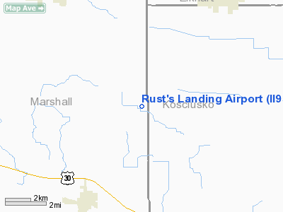
Location
& QuickFacts
|
FAA
Information Effective: |
2008-06-05 |
|
Airport
Identifier: |
II95 |
|
Airport
Status: |
Operational |
|
Longitude/Latitude: |
086-03-47.9970W/41-21-52.1650N
-86.063332/41.364490 (Estimated) |
|
Elevation: |
820 ft / 249.94 m (Estimated) |
|
Land: |
58 acres |
|
From nearest
city: |
6 nautical miles NE of Bourbon, IN |
|
Location: |
Marshall County, IN |
|
Magnetic
Variation: |
03W (1990) |
Owner
& Manager
|
Ownership: |
Privately
owned |
|
Owner: |
Wendell & Joyce Rust |
|
Address: |
7817 County Line Road
Bourbon,
IN 46504 |
|
Phone
number: |
219-646-3705 |
|
Address: |
|
Airport Operations
and Facilities
|
Airport
Use: |
Private |
|
Segmented
Circle: |
No |
|
Control
Tower: |
No |
|
Sectional
chart: |
Chicago |
|
Region: |
AGL - Great Lakes |
|
Boundary
ARTCC: |
ZAU - Chicago |
|
Tie-in
FSS: |
HUF - Terre Haute |
|
FSS Toll
Free: |
1-800-WX-BRIEF |
|
Runway Information
Runway 18/36
|
Dimension: |
1650 x 90 ft
/ 502.9 x 27.4 m |
|
Surface: |
TURF, |
|
|
Runway 18 |
Runway 36 |
|
Traffic
Pattern: |
Left |
Left |
|
Obstruction: |
|
20 ft pline, 400.0 ft from runway |
|
Radio Navigation
Aids
|
ID |
Type |
Name |
Ch |
Freq |
Var |
Dist |
|
CPB |
NDB |
Culver |
|
391.00 |
01W |
17.0 nm |
|
RCR |
NDB |
Rochester |
|
216.00 |
03W |
18.9 nm |
|
RWN |
NDB |
Winamac/dcmsnd |
|
335.00 |
00W |
29.4 nm |
|
IUL |
NDB |
La Porte |
|
356.00 |
03W |
32.9 nm |
|
VP |
NDB |
Sedly |
|
212.00 |
02W |
37.1 nm |
|
IWH |
NDB |
Wabash |
|
329.00 |
03W |
38.1 nm |
|
IRS |
NDB |
Sturgis |
|
382.00 |
04W |
39.1 nm |
|
MGC |
NDB |
Michigan City |
|
203.00 |
01W |
39.7 nm |
|
HHG |
NDB |
Huntington |
|
417.00 |
03W |
40.9 nm |
|
HAI |
NDB |
Three Rivers |
|
407.00 |
02W |
41.5 nm |
|
GGP |
NDB |
Logansport |
|
263.00 |
01W |
41.8 nm |
|
ANQ |
NDB |
Angola |
|
347.00 |
05W |
47.0 nm |
|
OLK |
VOR |
Wolf Lake |
|
110.40 |
03W |
26.5 nm |
|
OXI |
VOR/DME |
Knox |
103X |
115.60 |
00E |
26.6 nm |
|
ELX |
VOR/DME |
Keeler |
113X |
116.60 |
00E |
47.0 nm |
|
GSH |
VORTAC |
Goshen |
084X |
113.70 |
00E |
9.8 nm |
|
GIJ |
VORTAC |
Gipper |
101X |
115.40 |
00E |
26.9 nm |
|
GUS |
VORTAC |
Grissom |
21Y |
108.45 |
02W |
43.4 nm |
|
FWA |
VORTAC |
Fort Wayne |
125X |
117.80 |
00E |
45.9 nm |
|
FWA |
VOT |
Fort Wayne Baer |
|
111.00 |
|
45.8 nm |
Rust's Landing Airport
Address:
Marshall County, IN
Tel:
219-646-3705
Images
and information placed above are from
http://www.airport-data.com/airport/II95/
We
thank them for the data!
| General
Info |
| Country |
United
States |
| State |
INDIANA
|
| FAA ID |
II95 |
| Latitude |
41-21-52.165N
|
| Longitude |
086-03-47.997W
|
| Elevation |
820 feet
|
| Near City |
BOURBON
|
We don't guarantee the information is fresh and accurate. The data may
be wrong or outdated.
For more up-to-date information please refer to other sources.
|
|


