 |
|
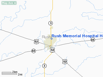
Rush Memorial Hospital Heliport |
Location
& QuickFacts
|
FAA
Information Effective: |
2008-06-05 |
|
Airport
Identifier: |
9II5 |
|
Airport
Status: |
Operational |
|
Longitude/Latitude: |
085-26-35.8930W/39-37-21.1680N
-85.443304/39.622547 (Estimated) |
|
Elevation: |
980 ft / 298.70 m (Estimated) |
|
Land: |
0 acres |
|
From nearest
city: |
1 nautical miles N of Rushville, IN |
|
Location: |
Rush County, IN |
|
Magnetic
Variation: |
03W (1985) |
Owner
& Manager
|
Ownership: |
Privately
owned |
|
Owner: |
Rush Memorial Hospital |
|
Address: |
1300 North Main Street
Rushville,
IN 46173 |
|
Phone
number: |
317-932-4111 |
|
Manager: |
Rick Chrisman |
|
Address: |
|
Airport
Operations and Facilities
|
Airport
Use: |
Private
MEDICAL USE. |
|
Wind indicator: |
Yes |
|
Segmented
Circle: |
No |
|
Control
Tower: |
No |
|
Sectional
chart: |
St Louis |
|
Region: |
AGL - Great Lakes |
|
Boundary
ARTCC: |
ZID - Indianapolis |
|
Tie-in
FSS: |
HUF - Terre Haute |
|
FSS on
Airport: |
No |
|
FSS Toll
Free: |
1-800-WX-BRIEF |
|
Runway Information
Helipad H1
|
Dimension: |
62 x 62 ft /
18.9 x 18.9 m |
|
Surface: |
ASPH, |
|
|
Runway H1 |
Runway |
|
Traffic
Pattern: |
Left |
Left |
|
Radio Navigation
Aids
|
ID |
Type |
Name |
Ch |
Freq |
Var |
Dist |
|
UWL |
NDB |
New Castle |
|
385.00 |
02W |
16.5 nm |
|
HLB |
NDB |
Batesville |
|
254.00 |
02W |
18.5 nm |
|
BA |
NDB |
Clifs |
|
410.00 |
03W |
25.1 nm |
|
AI |
NDB |
Video |
|
371.00 |
03W |
27.0 nm |
|
HFY |
NDB |
Greenwood |
|
398.00 |
02W |
30.0 nm |
|
OXD |
NDB |
Oxford |
|
282.00 |
04W |
31.5 nm |
|
UMP |
NDB |
Metropolitan |
|
338.00 |
03W |
33.8 nm |
|
OVO |
NDB |
North Vernon |
|
374.00 |
02W |
35.2 nm |
|
HZP |
NDB |
Zionsville |
|
248.00 |
03W |
41.8 nm |
|
HAO |
NDB |
Hamilton |
|
260.00 |
04W |
43.1 nm |
|
UR |
NDB |
Burln |
|
321.00 |
04W |
46.6 nm |
|
HKF |
NDB |
Hook Field |
|
239.00 |
04W |
46.7 nm |
|
MIE |
VOR/DME |
Muncie |
091X |
114.40 |
03W |
37.0 nm |
|
SHB |
VORTAC |
Shelbyville |
057X |
112.00 |
01E |
17.6 nm |
|
RID |
VORTAC |
Richmond |
043X |
110.60 |
03W |
29.1 nm |
|
VHP |
VORTAC |
Brickyard |
110X |
116.30 |
01E |
44.3 nm |
|
IND |
VOT |
Indianapolis Intl |
|
109.60 |
|
39.3 nm |
Remarks
- PRVDD
OPNS ARE CONDD IN AN AREA 360-020 DEG & 040-100 DEG, AREA IS MKD,
PLINE IS MKD, WIND INDCR MAINTD, NO NGT OPERN UNLESS AREA IS LGTD.
Rush Memorial Hospital Heliport
Address:
Rush County, IN
Tel:
317-932-4111
Images
and information placed above are from
http://www.airport-data.com/airport/9II5/
We
thank them for the data!
| General
Info |
| Country |
United
States |
| State |
INDIANA
|
| FAA ID |
9II5 |
| Latitude |
39-37-21.168N
|
| Longitude |
085-26-35.893W
|
| Elevation |
980 feet
|
| Near City |
RUSHVILLE
|
We don't guarantee the information is fresh and accurate. The data may
be wrong or outdated.
For more up-to-date information please refer to other sources.
|
|


