 |
|
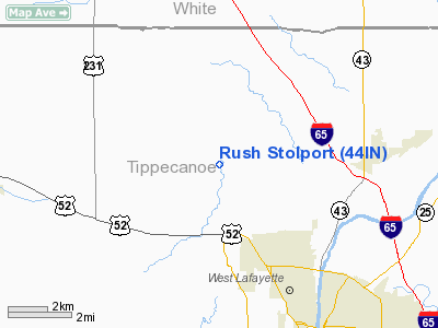
Location
& QuickFacts
|
FAA
Information Effective: |
2008-06-05 |
|
Airport
Identifier: |
44IN |
|
Airport
Status: |
Operational |
|
Longitude/Latitude: |
086-57-18.0440W/40-29-59.1220N
-86.955012/40.499756 (Estimated) |
|
Elevation: |
675 ft / 205.74 m (Estimated) |
|
Land: |
0 acres |
|
From nearest
city: |
2 nautical miles NW of West Lafayette, IN |
|
Location: |
Tippecanoe County, IN |
|
Magnetic
Variation: |
01W (1985) |
Owner
& Manager
|
Ownership: |
Privately
owned |
|
Owner: |
Charles K. Rush |
|
Address: |
4609 Morehouse Rd
West
Lafayette, IN 47906 |
|
Phone
number: |
317-463-5678 |
|
Manager: |
Charles K. Rush |
|
Address: |
4609 Morehouse Rd
West
Lafayette, IN 47906 |
|
Phone
number: |
317-463-5678 |
Airport Operations
and Facilities
|
Airport
Use: |
Private |
|
Wind indicator: |
No |
|
Segmented
Circle: |
No |
|
Control
Tower: |
No |
|
Landing
fee charge: |
No |
|
Sectional
chart: |
Chicago |
|
Region: |
AGL - Great Lakes |
|
Boundary
ARTCC: |
ZAU - Chicago |
|
Tie-in
FSS: |
HUF - Terre Haute |
|
FSS on
Airport: |
No |
|
FSS Toll
Free: |
1-800-WX-BRIEF |
|
Runway Information
Runway 10/28
|
Dimension: |
1325 x 30 ft
/ 403.9 x 9.1 m |
|
Surface: |
TURF, |
|
|
Runway 10 |
Runway 28 |
|
Traffic
Pattern: |
Left |
Right |
|
Obstruction: |
30 ft pline, 60.0 ft from runway |
30 ft trees, 5.0 ft from runway |
|
Radio Navigation
Aids
|
ID |
Type |
Name |
Ch |
Freq |
Var |
Dist |
|
MCX |
NDB |
White County |
|
377.00 |
03W |
15.4 nm |
|
FKR |
NDB |
Frankfort |
|
278.00 |
02W |
22.6 nm |
|
RZL |
NDB |
Rensselaer |
|
362.00 |
02W |
28.8 nm |
|
GGP |
NDB |
Logansport |
|
263.00 |
01W |
29.4 nm |
|
CFJ |
NDB |
Crawfordsville |
|
388.00 |
02W |
31.2 nm |
|
RWN |
NDB |
Winamac/dcmsnd |
|
335.00 |
00W |
39.1 nm |
|
HZP |
NDB |
Zionsville |
|
248.00 |
03W |
46.7 nm |
|
TVX |
NDB |
Greencastle |
|
521.00 |
03W |
47.7 nm |
|
RCR |
NDB |
Rochester |
|
216.00 |
03W |
48.6 nm |
|
BVT |
VORTAC |
Boiler |
098X |
115.10 |
01E |
6.2 nm |
|
DNV |
VORTAC |
Danville |
047X |
111.00 |
02E |
30.2 nm |
|
GUS |
VORTAC |
Grissom |
21Y |
108.45 |
02W |
37.7 nm |
|
OKK |
VORTAC |
Kokomo |
082X |
113.50 |
00E |
41.0 nm |
|
VHP |
VORTAC |
Brickyard |
110X |
116.30 |
01E |
49.2 nm |
Remarks
- (E111-2)
A ROAD AT WEST END OF LANDING AREA PENETRATES 20:1 RWY APCH SLOPE AND
WOULD REQUIRE THE THR BE LOCATED AT LEAST 300' FROM OBSTN.
- THE
USABLE RWY LENGTH AND OBSTN CLEARANCES DO NOT OFFER AN ACCEPTABLE LEVEL
OF SAFETY FOR ACFT OPERATIONS; THESE OBSTNS ARE;. 50' TREES AT WEST
END OF LANDING AREA PENETRATE THE 20:1 RWY APCH SLOPE AND WOULD REQUIRE
THE THR BE LOCATED AT LEAST 1000' FROM THE OBSTN.
Rush Stolport
Address:
Tippecanoe County, IN
Tel:
317-463-5678
Images
and information placed above are from
http://www.airport-data.com/airport/44IN/
We
thank them for the data!
| General
Info |
| Country |
United
States |
| State |
INDIANA
|
| FAA ID |
44IN |
| Latitude |
40-29-59.122N
|
| Longitude |
086-57-18.044W
|
| Elevation |
675 feet
|
| Near City |
WEST LAFAYETTE
|
We don't guarantee the information is fresh and accurate. The data may
be wrong or outdated.
For more up-to-date information please refer to other sources.
|
|


