 |
|
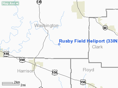
Location
& QuickFacts
|
FAA
Information Effective: |
2008-06-05 |
|
Airport
Identifier: |
33IN |
|
Airport
Status: |
Operational |
|
Longitude/Latitude: |
086-03-28.0000W/38-26-35.0000N
-86.057778/38.443056 (Estimated) |
|
Elevation: |
750 ft / 228.60 m (Estimated) |
|
Land: |
20 acres |
|
From nearest
city: |
4 nautical miles NE of Palmyra, IN |
|
Location: |
Washington County, IN |
|
Magnetic
Variation: |
() |
Owner
& Manager
|
Ownership: |
Privately
owned |
|
Owner: |
Eric P. Rusby |
|
Address: |
2220 E. Martinsburg Fire Rd
Palmyra,
IN 47164 |
|
Phone
number: |
812-967-2416 |
|
Manager: |
Eric P. Rusby |
|
Address: |
2220 E. Martinsburg Fire Rd
Palmyra,
IN 47164 |
|
Phone
number: |
812-967-2416 |
Airport Operations
and Facilities
|
Airport Use: |
Private |
|
Wind
indicator: |
Yes |
|
Segmented
Circle: |
No |
|
Control
Tower: |
No |
|
Sectional
chart: |
St Louis |
|
Region: |
AGL - Great Lakes |
|
Boundary
ARTCC: |
ZID - Indianapolis |
|
Tie-in
FSS: |
HUF - Terre Haute |
|
FSS Toll
Free: |
1-800-WX-BRIEF |
Airport Services
|
Fuel
available: |
100LL
100LL AVGAS AVAILABLE FOR EMERGENCY ONLY - CALL 812-967-2416. |
|
Runway Information
Helipad H1
|
Dimension: |
40 x 40 ft /
12.2 x 12.2 m |
|
Surface: |
CONC, |
|
|
Runway H1 |
Runway |
|
Traffic
Pattern: |
Left |
Left |
|
Radio Navigation
Aids
|
ID |
Type |
Name |
Ch |
Freq |
Var |
Dist |
|
RRJ |
NDB |
Oranj |
|
368.00 |
02W |
22.7 nm |
|
EQZ |
NDB |
Captain |
|
308.00 |
02W |
25.8 nm |
|
GOI |
NDB |
Godman |
|
396.00 |
02W |
29.4 nm |
|
BFR |
NDB |
Bedford |
|
344.00 |
02W |
29.7 nm |
|
IMS |
NDB |
Madison |
|
404.00 |
03W |
33.9 nm |
|
FNZ |
NDB |
Ferdinand |
|
239.00 |
00E |
38.6 nm |
|
TEL |
NDB |
Tell City |
|
206.00 |
02W |
39.4 nm |
|
OVO |
NDB |
North Vernon |
|
374.00 |
02W |
42.3 nm |
|
BM |
NDB |
Claye |
|
382.00 |
02W |
44.8 nm |
|
BRY |
NDB |
Bardstown/dcmsnd |
|
248.00 |
02W |
44.9 nm |
|
MYS |
VOR |
Mystic |
|
108.20 |
01W |
34.2 nm |
|
BQM |
VOR/DME |
Bowman |
059X |
112.20 |
01W |
22.5 nm |
|
FTK |
VOR/DME |
Fort Knox |
033X |
109.60 |
01W |
32.4 nm |
|
HNB |
VOR/DME |
Huntingburg |
029X |
109.20 |
00E |
43.9 nm |
|
ABB |
VORTAC |
Nabb |
071X |
112.40 |
01E |
21.7 nm |
|
IIU |
VORTAC |
Louisville |
095X |
114.80 |
01E |
30.5 nm |
|
OOM |
VORTAC |
Hoosier |
039X |
110.20 |
02W |
49.5 nm |
|
SDF |
VOT |
Louisville Standifd |
|
111.00 |
|
22.0 nm |
Remarks
- PRVDD
APCH/DEP FROM 060 DEGS CLOCKWISE TO 240 DEGS, AND 290 DEGS THROUGH 350
DEGS; AREA IS MARKED; AND WIND INDICATOR IS MAINTAINED.
Based Aircraft
|
Aircraft
based on field: |
1 |
|
Helicopters: |
1 |
Rusby Field Heliport
Address:
Washington County, IN
Tel:
812-967-2416
Images
and information placed above are from
http://www.airport-data.com/airport/33IN/
We
thank them for the data!
We don't guarantee the information is fresh and accurate. The data may
be wrong or outdated.
For more up-to-date information please refer to other sources.
|
|


