 |
|
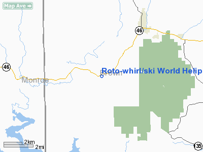
Roto-whirl / Ski World Heliport |
Location
& QuickFacts
|
FAA
Information Effective: |
2008-06-05 |
|
Airport
Identifier: |
32IN |
|
Airport
Status: |
Operational |
|
Longitude/Latitude: |
086-17-49.9650W/39-09-18.1750N
-86.297213/39.155049 (Estimated) |
|
Elevation: |
593 ft / 180.75 m (Estimated) |
|
Land: |
0 acres |
|
From nearest
city: |
5 nautical miles SW of Nashville, IN |
|
Location: |
Brown County, IN |
|
Magnetic
Variation: |
01W (1985) |
Owner
& Manager
|
Ownership: |
Privately
owned |
|
Owner: |
Parker Air Corp |
|
Address: |
Dba Roto Whirl; 2030 Hillside
Indianapolis, IN 46218 |
|
Manager: |
Melvin Heck |
|
Address: |
Rr 3, Box 229
Wabash, IN 46992 |
|
Phone
number: |
317-241-2484 |
Airport
Operations and Facilities
|
Airport
Use: |
Private |
|
Wind indicator: |
Yes |
|
Segmented
Circle: |
No |
|
Control
Tower: |
No |
|
Sectional
chart: |
St Louis |
|
Region: |
AGL - Great Lakes |
|
Boundary
ARTCC: |
ZID - Indianapolis |
|
Tie-in
FSS: |
HUF - Terre Haute |
|
FSS Toll
Free: |
1-800-WX-BRIEF |
|
Runway Information
Helipad H1
|
Dimension: |
50 x 50 ft /
15.2 x 15.2 m |
|
Surface: |
GRAVEL, |
|
|
Runway H1 |
Runway |
|
Traffic
Pattern: |
Left |
Left |
|
Radio Navigation
Aids
|
ID |
Type |
Name |
Ch |
Freq |
Var |
Dist |
|
BM |
NDB |
Claye |
|
382.00 |
02W |
15.3 nm |
|
BFR |
NDB |
Bedford |
|
344.00 |
02W |
20.1 nm |
|
EQZ |
NDB |
Captain |
|
308.00 |
02W |
23.0 nm |
|
BA |
NDB |
Clifs |
|
410.00 |
03W |
24.4 nm |
|
HFY |
NDB |
Greenwood |
|
398.00 |
02W |
30.3 nm |
|
OVO |
NDB |
North Vernon |
|
374.00 |
02W |
33.1 nm |
|
RRJ |
NDB |
Oranj |
|
368.00 |
02W |
39.2 nm |
|
TVX |
NDB |
Greencastle |
|
521.00 |
03W |
41.1 nm |
|
IMS |
NDB |
Madison |
|
404.00 |
03W |
45.7 nm |
|
HZP |
NDB |
Zionsville |
|
248.00 |
03W |
47.2 nm |
|
DCY |
NDB |
Washington |
|
212.00 |
03W |
47.8 nm |
|
UMP |
NDB |
Metropolitan |
|
338.00 |
03W |
48.4 nm |
|
HLB |
NDB |
Batesville |
|
254.00 |
02W |
49.8 nm |
|
OOM |
VORTAC |
Hoosier |
039X |
110.20 |
02W |
14.7 nm |
|
SHB |
VORTAC |
Shelbyville |
057X |
112.00 |
01E |
36.1 nm |
|
VHP |
VORTAC |
Brickyard |
110X |
116.30 |
01E |
39.8 nm |
|
ABB |
VORTAC |
Nabb |
071X |
112.40 |
01E |
46.0 nm |
|
TTH |
VORTAC |
Terre Haute |
100X |
115.30 |
02E |
48.6 nm |
|
IND |
VOT |
Indianapolis Intl |
|
109.60 |
|
34.2 nm |
Remarks
- HELIPORT
USED ON OCCASIONAL BASIS.
- OPERATIONS
ARE CONDUCTED FROM 50 DEGS TO 80 DEGS; AREA IS MARKED & LIGHTED;
WIND INDICATOR BE MAINTAINED; NO NIGHT OPERATIONS.
Roto-whirl/ski World Heliport
Address:
Brown County, IN
Tel:
317-241-2484
Images
and information placed above are from
http://www.airport-data.com/airport/32IN/
We
thank them for the data!
| General
Info |
| Country |
United
States |
| State |
INDIANA
|
| FAA ID |
32IN |
| Latitude |
39-09-18.175N
|
| Longitude |
086-17-49.965W
|
| Elevation |
593 feet
|
| Near City |
NASHVILLE
|
We don't guarantee the information is fresh and accurate. The data may
be wrong or outdated.
For more up-to-date information please refer to other sources.
|
|


