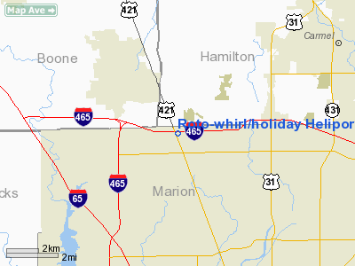
Roto-whirl / Holiday Heliport |
Location
& QuickFacts
|
FAA
Information Effective: |
2008-06-05 |
|
Airport
Identifier: |
0IN7 |
|
Airport
Status: |
Operational |
|
Longitude/Latitude: |
086-13-33.9670W/39-55-21.1440N
-86.226102/39.922540 (Estimated) |
|
Elevation: |
875 ft / 266.70 m (Estimated) |
|
Land: |
0 acres |
|
From nearest
city: |
8 nautical miles NW of Indianapolis, IN |
|
Location: |
Marion County, IN |
|
Magnetic
Variation: |
02W (1985) |
Owner & Manager
|
Ownership: |
Privately
owned |
|
Owner: |
Parker Air Corp |
|
Address: |
Rr 3 Box 229
Wabash, IN 46992 |
|
Phone
number: |
317-241-2484 |
|
Address: |
|
Airport
Operations and Facilities
|
Airport
Use: |
Private |
|
Segmented
Circle: |
No |
|
Control
Tower: |
No |
|
Sectional
chart: |
St Louis |
|
Region: |
AGL - Great Lakes |
|
Boundary
ARTCC: |
ZID - Indianapolis |
|
Tie-in
FSS: |
HUF - Terre Haute |
|
FSS on
Airport: |
No |
|
FSS Toll
Free: |
1-800-WX-BRIEF |
|
Runway Information
Helipad H1
|
Dimension: |
50 x 50 ft /
15.2 x 15.2 m |
|
Surface: |
ASPH, |
|
|
Runway H1 |
Runway |
|
Traffic
Pattern: |
Left |
Left |
|
Radio Navigation
Aids
|
ID |
Type |
Name |
Ch |
Freq |
Var |
Dist |
|
HZP |
NDB |
Zionsville |
|
248.00 |
03W |
1.5 nm |
|
UMP |
NDB |
Metropolitan |
|
338.00 |
03W |
8.2 nm |
|
HFY |
NDB |
Greenwood |
|
398.00 |
02W |
18.5 nm |
|
FKR |
NDB |
Frankfort |
|
278.00 |
02W |
26.0 nm |
|
TVX |
NDB |
Greencastle |
|
521.00 |
03W |
29.6 nm |
|
CFJ |
NDB |
Crawfordsville |
|
388.00 |
02W |
32.0 nm |
|
AI |
NDB |
Video |
|
371.00 |
03W |
34.1 nm |
|
BA |
NDB |
Clifs |
|
410.00 |
03W |
40.7 nm |
|
UWL |
NDB |
New Castle |
|
385.00 |
02W |
41.9 nm |
|
GGP |
NDB |
Logansport |
|
263.00 |
01W |
47.8 nm |
|
MZZ |
VOR/DME |
Marion |
023X |
108.60 |
03W |
42.5 nm |
|
MIE |
VOR/DME |
Muncie |
091X |
114.40 |
03W |
42.7 nm |
|
VHP |
VORTAC |
Brickyard |
110X |
116.30 |
01E |
9.2 nm |
|
SHB |
VORTAC |
Shelbyville |
057X |
112.00 |
01E |
25.5 nm |
|
OKK |
VORTAC |
Kokomo |
082X |
113.50 |
00E |
37.2 nm |
|
GUS |
VORTAC |
Grissom |
21Y |
108.45 |
02W |
43.6 nm |
|
IND |
VOT |
Indianapolis Intl |
|
109.60 |
|
12.2 nm |
Remarks
- MOVE
AREA 20 FT S; APP/DEP OPNS CONDUCTED TO/FROM 090 DEGS WITH MAX. 10KT
TAILWIND; AREA MARKED; INSTALL BALL MARKERS ON POLE LINE; WIND INDICATOR
BLOCK OFF STREET 200 FT S; UNAUTHORIZED PERSONS/VEHICLES RESTRAINED
FM ACCESS TO AREA DURING OPNS.
Roto-whirl/holiday Heliport
Address:
Marion County, IN
Tel:
317-241-2484
Images
and information placed above are from
http://www.airport-data.com/airport/0IN7/
We
thank them for the data!
| General
Info |
| Country |
United
States |
| State |
INDIANA
|
| FAA ID |
0IN7 |
| Latitude |
39-55-21.144N
|
| Longitude |
086-13-33.967W
|
| Elevation |
875 feet
|
| Near City |
INDIANAPOLIS
|
We don't guarantee the information is fresh and accurate. The data may
be wrong or outdated.
For more up-to-date information please refer to other sources.
|


