 |
|
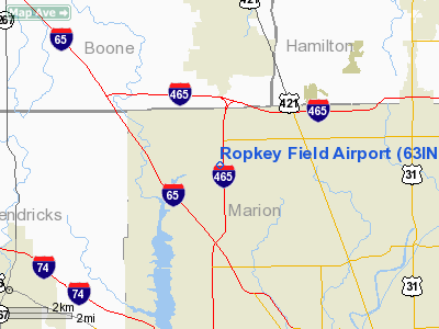
Location
& QuickFacts
|
FAA
Information Effective: |
2008-06-05 |
|
Airport
Identifier: |
63IN |
|
Airport
Status: |
Operational |
|
Longitude/Latitude: |
086-16-17.9710W/39-53-58.1480N
-86.271659/39.899486 (Estimated) |
|
Elevation: |
880 ft / 268.22 m (Surveyed) |
|
Land: |
0 acres |
|
From nearest
city: |
10 nautical miles NW of Indianapolis, IN |
|
Location: |
Marion County, IN |
|
Magnetic
Variation: |
02W (1985) |
Owner
& Manager
|
Ownership: |
Privately
owned |
|
Owner: |
Fred N Ropkey |
|
Address: |
117 N East St
Indianapolis,
IN 46206 |
|
Phone
number: |
317-872-6838 |
|
Address: |
|
Airport Operations
and Facilities
|
Airport
Use: |
Private |
|
Wind indicator: |
Yes |
|
Segmented
Circle: |
No |
|
Control
Tower: |
No |
|
Landing
fee charge: |
No |
|
Sectional
chart: |
St Louis |
|
Region: |
AGL - Great Lakes |
|
Boundary
ARTCC: |
ZID - Indianapolis |
|
Tie-in
FSS: |
HUF - Terre Haute |
|
FSS on
Airport: |
No |
|
FSS Toll
Free: |
1-800-WX-BRIEF |
|
Runway Information
Runway 18/36
|
Dimension: |
1800 x 100 ft
/ 548.6 x 30.5 m |
|
Surface: |
TURF, |
|
|
Runway 18 |
Runway 36 |
|
Traffic
Pattern: |
Left |
Left |
|
Radio Navigation
Aids
|
ID |
Type |
Name |
Ch |
Freq |
Var |
Dist |
|
HZP |
NDB |
Zionsville |
|
248.00 |
03W |
2.6 nm |
|
UMP |
NDB |
Metropolitan |
|
338.00 |
03W |
10.5 nm |
|
HFY |
NDB |
Greenwood |
|
398.00 |
02W |
18.1 nm |
|
FKR |
NDB |
Frankfort |
|
278.00 |
02W |
26.0 nm |
|
TVX |
NDB |
Greencastle |
|
521.00 |
03W |
27.1 nm |
|
CFJ |
NDB |
Crawfordsville |
|
388.00 |
02W |
30.1 nm |
|
AI |
NDB |
Video |
|
371.00 |
03W |
36.5 nm |
|
BA |
NDB |
Clifs |
|
410.00 |
03W |
40.6 nm |
|
UWL |
NDB |
New Castle |
|
385.00 |
02W |
44.0 nm |
|
GGP |
NDB |
Logansport |
|
263.00 |
01W |
48.9 nm |
|
MZZ |
VOR/DME |
Marion |
023X |
108.60 |
03W |
44.9 nm |
|
MIE |
VOR/DME |
Muncie |
091X |
114.40 |
03W |
45.2 nm |
|
VHP |
VORTAC |
Brickyard |
110X |
116.30 |
01E |
6.7 nm |
|
SHB |
VORTAC |
Shelbyville |
057X |
112.00 |
01E |
26.2 nm |
|
OKK |
VORTAC |
Kokomo |
082X |
113.50 |
00E |
39.0 nm |
|
GUS |
VORTAC |
Grissom |
21Y |
108.45 |
02W |
45.1 nm |
|
OOM |
VORTAC |
Hoosier |
039X |
110.20 |
02W |
48.1 nm |
|
IND |
VOT |
Indianapolis Intl |
|
109.60 |
|
10.5 nm |
Based Aircraft
|
Aircraft
based on field: |
1 |
|
Single Engine
Airplanes: |
1 |
Ropkey Field Airport
Address:
Marion County, IN
Tel:
317-872-6838
Images
and information placed above are from
http://www.airport-data.com/airport/63IN/
We
thank them for the data!
| General
Info |
| Country |
United
States |
| State |
INDIANA
|
| FAA ID |
63IN |
| Latitude |
39-53-58.148N
|
| Longitude |
086-16-17.971W
|
| Elevation |
880 feet
|
| Near City |
INDIANAPOLIS
|
We don't guarantee the information is fresh and accurate. The data may
be wrong or outdated.
For more up-to-date information please refer to other sources.
|
|


