 |
|
|
|
|
|
Location
& QuickFacts
|
FAA
Information Effective: |
2008-06-05 |
|
Airport
Identifier: |
8I1 |
|
Airport
Status: |
Operational |
|
Longitude/Latitude: |
085-11-53.8330W/38-41-40.2230N
-85.198287/38.694506 (Estimated) |
|
Elevation: |
484 ft / 147.52 m (Estimated) |
|
Land: |
7 acres |
|
From nearest
city: |
7 nautical miles SW of Vevay, IN |
|
Location: |
Switzerland County, IN |
|
Magnetic
Variation: |
03W (1985) |
Owner & Manager
|
Ownership: |
Privately
owned |
|
Owner: |
Frank E. Robinson |
|
Address: |
6 Hwy 56
Vevay, IN 47043 |
|
Phone
number: |
812-427-3002 |
|
Manager: |
Cliff Robinson |
|
Address: |
220 Cliffy Dr.
Madison, IN 47250 |
|
Phone
number: |
812-427-3002 |
Airport
Operations and Facilities
|
Airport
Use: |
Open
to public |
|
Wind indicator: |
Yes |
|
Segmented
Circle: |
No |
|
Control
Tower: |
No |
|
Landing
fee charge: |
No |
|
Sectional
chart: |
St Louis |
|
Region: |
AGL - Great Lakes |
|
Traffic
Pattern Alt: |
800 ft |
|
Boundary
ARTCC: |
ZID - Indianapolis |
|
Tie-in
FSS: |
HUF - Terre Haute |
|
FSS on
Airport: |
No |
|
FSS Toll
Free: |
1-800-WX-BRIEF |
|
NOTAMs
Facility: |
HUF (NOTAM-d service avaliable) |
Airport Communications
Airport Services
|
Airframe
Repair: |
MINOR |
|
Power
Plant Repair: |
MINOR |
|
Bottled
Oxygen: |
NONE |
|
Bulk Oxygen: |
NONE |
|
Runway Information
Runway 09/27
|
Dimension: |
1670 x 50 ft
/ 509.0 x 15.2 m |
|
Surface: |
TURF, Poor Condition
ROUGH & ROLLING TURF. |
|
|
Runway 09 |
Runway 27 |
|
Longitude: |
085-12-02.8300W |
085-11-41.8800W |
|
Latitude: |
38-41-41.2200N |
38-41-39.4900N |
|
Elevation: |
484.00 ft |
480.00 ft |
|
Traffic
Pattern: |
Left |
Left |
|
Displaced
threshold: |
150.00 ft |
0.00 ft |
|
Runway End
Identifier: |
No |
No |
|
Centerline
Lights: |
No |
No |
|
Touchdown
Lights: |
No |
No |
|
Obstruction: |
10 ft road, 10.0 ft from runway, 1:1 slope
to clear
RWY 09 APCH SLOPE 16:1 AT DSPLCD THLD. +25'
TREE 200' FRM RWY END & 80' N. |
70 ft trees, 280.0 ft from runway, 130 ft left
of centerline, 4:1 slope to clear |
|
Radio Navigation
Aids
|
ID |
Type |
Name |
Ch |
Freq |
Var |
Dist |
|
IMS |
NDB |
Madison |
|
404.00 |
03W |
12.9 nm |
|
OVO |
NDB |
North Vernon |
|
374.00 |
02W |
28.5 nm |
|
UR |
NDB |
Burln |
|
321.00 |
04W |
29.0 nm |
|
FEU |
NDB |
Arnold |
|
521.00 |
03W |
33.9 nm |
|
EQZ |
NDB |
Captain |
|
308.00 |
02W |
37.8 nm |
|
HLB |
NDB |
Batesville |
|
254.00 |
02W |
39.5 nm |
|
BA |
NDB |
Clifs |
|
410.00 |
03W |
47.6 nm |
|
LUK |
NDB |
Cincinnati |
|
335.00 |
04W |
48.9 nm |
|
LE |
NDB |
Blayd |
|
242.00 |
04W |
49.5 nm |
|
FFT |
VOR |
Frankfort |
|
109.40 |
03W |
33.7 nm |
|
BQM |
VOR/DME |
Bowman |
059X |
112.20 |
01W |
35.5 nm |
|
FLM |
VOR/DME |
Falmouth |
117X |
117.00 |
04W |
41.7 nm |
|
ABB |
VORTAC |
Nabb |
071X |
112.40 |
01E |
21.5 nm |
|
CVG |
VORTAC |
Cincinnati |
120X |
117.30 |
04W |
30.2 nm |
|
IIU |
VORTAC |
Louisville |
095X |
114.80 |
01E |
39.8 nm |
|
SDF |
VOT |
Louisville Standifd |
|
111.00 |
|
40.1 nm |
|
LUK |
VOT |
Cincinnati Muni/lunken |
|
108.40 |
|
45.2 nm |
Based Aircraft
|
Aircraft
based on field: |
3 |
|
Single Engine
Airplanes: |
3 |
Operational Statistics
Time
Period: 2006-03-01 - 2007-02-28
|
Aircraft
Operations: |
17/Week |
|
General Aviation
Local: |
92.3% |
|
General Aviation
Itinerant: |
7.7% |
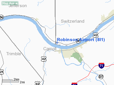
Robinson Airport
Address:
Switzerland County, IN
Tel:
812-427-3002
Images
and information placed above are from
http://www.airport-data.com/airport/8I1/
We
thank them for the data!
| General
Info |
| Country |
United
States |
| State |
INDIANA
|
| FAA ID |
8I1 |
| Latitude |
38-41-40.223N
|
| Longitude |
085-11-53.833W
|
| Elevation |
484 feet
|
| Near City |
VEVAY
|
We don't guarantee the information is fresh and accurate. The data may
be wrong or outdated.
For more up-to-date information please refer to other sources.
|
|


