 |
|
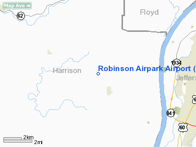
Location
& QuickFacts
|
FAA
Information Effective: |
2008-06-05 |
|
Airport
Identifier: |
1IN4 |
|
Airport
Status: |
Operational |
|
Longitude/Latitude: |
085-59-16.0000W/38-08-35.0000N
-85.987778/38.143056 (Estimated) |
|
Elevation: |
775 ft / 236.22 m (Estimated) |
|
Land: |
0 acres |
|
From nearest
city: |
1 nautical miles NW of Elizabeth, IN |
|
Location: |
Harrison County, IN |
|
Magnetic
Variation: |
03W (1995) |
Owner
& Manager
|
Ownership: |
Privately
owned |
|
Owner: |
James E. Robinson |
|
Address: |
7300 Pine Shore Drive
Elizabeth,
IN 47117 |
|
Phone
number: |
812-969-2859 |
|
Manager: |
James E. Robinson |
|
Address: |
7300 Pine Shore Drive
Elizabeth,
IN 47117 |
|
Phone
number: |
812-969-2859 |
Airport Operations
and Facilities
|
Airport
Use: |
Private |
|
Segmented
Circle: |
No |
|
Control
Tower: |
No |
|
Sectional
chart: |
St Louis |
|
Region: |
AGL - Great Lakes |
|
Boundary
ARTCC: |
ZID - Indianapolis |
|
Tie-in
FSS: |
HUF - Terre Haute |
|
FSS on
Airport: |
No |
|
FSS Toll
Free: |
1-800-WX-BRIEF |
|
Runway Information
Runway 09/27
|
Dimension: |
900 x 100 ft
/ 274.3 x 30.5 m |
|
Surface: |
TURF, Good Condition |
|
|
Runway 09 |
Runway 27 |
|
Traffic
Pattern: |
Left |
Left |
|
Obstruction: |
|
30 ft trees, 500.0 ft from runway |
|
Radio Navigation
Aids
|
ID |
Type |
Name |
Ch |
Freq |
Var |
Dist |
|
GOI |
NDB |
Godman |
|
396.00 |
02W |
11.1 nm |
|
BRY |
NDB |
Bardstown/dcmsnd |
|
248.00 |
02W |
29.8 nm |
|
TEL |
NDB |
Tell City |
|
206.00 |
02W |
34.1 nm |
|
RRJ |
NDB |
Oranj |
|
368.00 |
02W |
34.4 nm |
|
FNZ |
NDB |
Ferdinand |
|
239.00 |
00E |
40.7 nm |
|
EQZ |
NDB |
Captain |
|
308.00 |
02W |
43.5 nm |
|
IMS |
NDB |
Madison |
|
404.00 |
03W |
44.7 nm |
|
BFR |
NDB |
Bedford |
|
344.00 |
02W |
46.9 nm |
|
IKY |
NDB |
Springfield |
|
429.00 |
03W |
46.9 nm |
|
MYS |
VOR |
Mystic |
|
108.20 |
01W |
19.3 nm |
|
FTK |
VOR/DME |
Fort Knox |
033X |
109.60 |
01W |
14.2 nm |
|
BQM |
VOR/DME |
Bowman |
059X |
112.20 |
01W |
16.1 nm |
|
EWO |
VOR/DME |
New Hope |
045X |
110.80 |
01E |
34.1 nm |
|
HNB |
VOR/DME |
Huntingburg |
029X |
109.20 |
00E |
46.2 nm |
|
IIU |
VORTAC |
Louisville |
095X |
114.80 |
01E |
19.5 nm |
|
ABB |
VORTAC |
Nabb |
071X |
112.40 |
01E |
31.5 nm |
|
SDF |
VOT |
Louisville Standifd |
|
111.00 |
|
12.1 nm |
Remarks
- PRVDD
20:1 APCH SLOPE; 125 FT EITHER SIDE & 200 FT EACH END OF RY CLEAR
OF OBSTNS; TFC PAT E OF BLACK CHAPEL ROAD.
Robinson Airpark Airport
Address:
Harrison County, IN
Tel:
812-969-2859
Images
and information placed above are from
http://www.airport-data.com/airport/1IN4/
We
thank them for the data!
| General
Info |
| Country |
United
States |
| State |
INDIANA
|
| FAA ID |
1IN4 |
| Latitude |
38-08-35.000N
|
| Longitude |
085-59-16.000W
|
| Elevation |
775 feet
|
| Near City |
ELIZABETH
|
We don't guarantee the information is fresh and accurate. The data may
be wrong or outdated.
For more up-to-date information please refer to other sources.
|
|


