 |
|
Location
& QuickFacts
|
FAA
Information Effective: |
2008-06-05 |
|
Airport
Identifier: |
32II |
|
Airport
Status: |
Operational |
|
Longitude/Latitude: |
085-06-22.8280W/38-48-59.2180N
-85.106341/38.816449 (Estimated) |
|
Elevation: |
820 ft / 249.94 m (Estimated) |
|
Land: |
0 acres |
|
From nearest
city: |
4 nautical miles NW of Vevay, IN |
|
Location: |
Switzerland County, IN |
|
Magnetic
Variation: |
02W (1985) |
Owner
& Manager
|
Ownership: |
Privately
owned |
|
Owner: |
Roberts Pipeline Const Co Inc |
|
Address: |
P.o. Box 169
Sulphur
Springs, IN 47388 |
|
Phone
number: |
317-533-4728 |
|
Manager: |
Gary L. Roberts |
|
Address: |
P.o. Box 169
Sulphur
Springs, IN 47388 |
|
Phone
number: |
317-533-4728 |
Airport Operations
and Facilities
|
Airport
Use: |
Private |
|
Wind indicator: |
Yes |
|
Segmented
Circle: |
No |
|
Control
Tower: |
No |
|
Sectional
chart: |
Cincinnati |
|
Region: |
AGL - Great Lakes |
|
Boundary
ARTCC: |
ZID - Indianapolis |
|
Tie-in
FSS: |
HUF - Terre Haute |
|
FSS Toll
Free: |
1-800-WX-BRIEF |
|
Runway Information
Runway 07/25
|
Dimension: |
2000 x 100 ft
/ 609.6 x 30.5 m |
|
Surface: |
TURF, |
|
|
Runway 07 |
Runway 25 |
|
Traffic
Pattern: |
Left |
Left |
|
Radio Navigation
Aids
|
ID |
Type |
Name |
Ch |
Freq |
Var |
Dist |
|
IMS |
NDB |
Madison |
|
404.00 |
03W |
16.9 nm |
|
UR |
NDB |
Burln |
|
321.00 |
04W |
20.8 nm |
|
OVO |
NDB |
North Vernon |
|
374.00 |
02W |
27.1 nm |
|
HLB |
NDB |
Batesville |
|
254.00 |
02W |
32.8 nm |
|
FEU |
NDB |
Arnold |
|
521.00 |
03W |
38.6 nm |
|
EQZ |
NDB |
Captain |
|
308.00 |
02W |
40.7 nm |
|
LUK |
NDB |
Cincinnati |
|
335.00 |
04W |
41.3 nm |
|
HAO |
NDB |
Hamilton |
|
260.00 |
04W |
41.7 nm |
|
ISZ |
NDB |
Cincinnati-blue Ash |
|
388.00 |
04W |
42.4 nm |
|
MDE |
NDB |
Madeira |
|
379.00 |
04W |
42.7 nm |
|
OXD |
NDB |
Oxford |
|
282.00 |
04W |
44.2 nm |
|
PWF |
NDB |
Sportys |
|
245.00 |
04W |
44.5 nm |
|
BA |
NDB |
Clifs |
|
410.00 |
03W |
45.0 nm |
|
FFT |
VOR |
Frankfort |
|
109.40 |
03W |
39.2 nm |
|
FLM |
VOR/DME |
Falmouth |
117X |
117.00 |
04W |
38.6 nm |
|
BQM |
VOR/DME |
Bowman |
059X |
112.20 |
01W |
43.9 nm |
|
CVG |
VORTAC |
Cincinnati |
120X |
117.30 |
04W |
22.3 nm |
|
ABB |
VORTAC |
Nabb |
071X |
112.40 |
01E |
28.4 nm |
|
IIU |
VORTAC |
Louisville |
095X |
114.80 |
01E |
48.3 nm |
|
LUK |
VOT |
Cincinnati Muni/lunken |
|
108.40 |
|
37.6 nm |
|
SDF |
VOT |
Louisville Standifd |
|
111.00 |
|
48.5 nm |
Remarks
- PRVDD
A 20:1 APCH CLNC; AREA 125 FT EITHER SIDE CLEAR FM OBSTRUCTIONS.
Based Aircraft
|
Aircraft
based on field: |
1 |
|
Single Engine
Airplanes: |
1 |
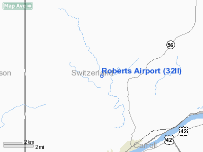
Roberts Airport
Address:
Switzerland County, IN
Tel:
317-533-4728
Images
and information placed above are from
http://www.airport-data.com/airport/32II/
We
thank them for the data!
| General
Info |
| Country |
United
States |
| State |
INDIANA
|
| FAA ID |
32II |
| Latitude |
38-48-59.218N
|
| Longitude |
085-06-22.828W
|
| Elevation |
820 feet
|
| Near City |
VEVAY
|
We don't guarantee the information is fresh and accurate. The data may
be wrong or outdated.
For more up-to-date information please refer to other sources.
|
|


