 |
|
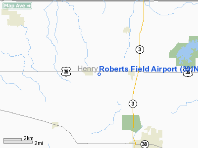
Location
& QuickFacts
|
FAA
Information Effective: |
2008-06-05 |
|
Airport
Identifier: |
39IN |
|
Airport
Status: |
Operational |
|
Longitude/Latitude: |
085-25-43.9000W/40-00-08.1660N
-85.428861/40.002268 (Estimated) |
|
Elevation: |
1085 ft / 330.71 m (Estimated) |
|
Land: |
0 acres |
|
From nearest
city: |
1 nautical miles E of Sulphur Springs, IN |
|
Location: |
Henry County, IN |
|
Magnetic
Variation: |
02W (1985) |
Owner
& Manager
|
Ownership: |
Privately
owned |
|
Owner: |
Roberts Pipeline |
|
Address: |
P.o. Box 169
Sulphur
Springs, IN 47388 |
|
Phone
number: |
317-533-4728 |
|
Address: |
|
Airport Operations
and Facilities
|
Airport
Use: |
Private
PERSONAL USE. |
|
Wind indicator: |
Yes |
|
Segmented
Circle: |
No |
|
Control
Tower: |
No |
|
Lighting
Schedule: |
RDO-CTL
ACTVT LIRL RY 12/30 - 122.9. |
|
Sectional
chart: |
St Louis |
|
Region: |
AGL - Great Lakes |
|
Boundary
ARTCC: |
ZID - Indianapolis |
|
Tie-in
FSS: |
HUF - Terre Haute |
|
FSS Toll
Free: |
1-800-WX-BRIEF |
|
Runway Information
Runway 12/30
|
Dimension: |
4000 x 100 ft
/ 1219.2 x 30.5 m |
|
Surface: |
TURF, |
|
Edge Lights: |
Low |
|
|
Runway 12 |
Runway 30 |
|
Traffic
Pattern: |
Left |
Left |
|
Radio Navigation
Aids
|
ID |
Type |
Name |
Ch |
Freq |
Var |
Dist |
|
AI |
NDB |
Video |
|
371.00 |
03W |
5.5 nm |
|
UWL |
NDB |
New Castle |
|
385.00 |
02W |
8.9 nm |
|
UMP |
NDB |
Metropolitan |
|
338.00 |
03W |
28.9 nm |
|
PLD |
NDB |
Portland |
|
257.00 |
03W |
34.0 nm |
|
HFY |
NDB |
Greenwood |
|
398.00 |
02W |
37.8 nm |
|
HZP |
NDB |
Zionsville |
|
248.00 |
03W |
38.0 nm |
|
HLB |
NDB |
Batesville |
|
254.00 |
02W |
40.0 nm |
|
OXD |
NDB |
Oxford |
|
282.00 |
04W |
42.2 nm |
|
VES |
NDB |
Versailles |
|
356.00 |
04W |
43.4 nm |
|
BA |
NDB |
Clifs |
|
410.00 |
03W |
44.7 nm |
|
IWH |
NDB |
Wabash |
|
329.00 |
03W |
48.8 nm |
|
CQA |
NDB |
Lakefield |
|
205.00 |
04W |
49.0 nm |
|
MIE |
VOR/DME |
Muncie |
091X |
114.40 |
03W |
14.2 nm |
|
MZZ |
VOR/DME |
Marion |
023X |
108.60 |
03W |
31.7 nm |
|
DQN |
VOR/DME |
Dayton |
092X |
114.50 |
01W |
47.5 nm |
|
SHB |
VORTAC |
Shelbyville |
057X |
112.00 |
01E |
28.8 nm |
|
RID |
VORTAC |
Richmond |
043X |
110.60 |
03W |
31.0 nm |
|
OKK |
VORTAC |
Kokomo |
082X |
113.50 |
00E |
42.8 nm |
|
VHP |
VORTAC |
Brickyard |
110X |
116.30 |
01E |
44.7 nm |
|
IND |
VOT |
Indianapolis Intl |
|
109.60 |
|
42.8 nm |
Remarks
- PRVDD
ANY OBSTNS IN RY APCH SLOPE REMOVED/LOWERED OR THR DSPLCD & MKD
TO PRVD 20:1 APCH SFC CLNC OVER OBSTNS.
Based Aircraft
|
Aircraft
based on field: |
1 |
|
Single Engine
Airplanes: |
1 |
Roberts Field Airport
Address:
Henry County, IN
Tel:
317-533-4728
Images
and information placed above are from
http://www.airport-data.com/airport/39IN/
We
thank them for the data!
| General
Info |
| Country |
United
States |
| State |
INDIANA
|
| FAA ID |
39IN |
| Latitude |
40-00-08.166N
|
| Longitude |
085-25-43.900W
|
| Elevation |
1085 feet
|
| Near City |
SULPHUR
SPRINGS |
We don't guarantee the information is fresh and accurate. The data may
be wrong or outdated.
For more up-to-date information please refer to other sources.
|
|


