 |
|
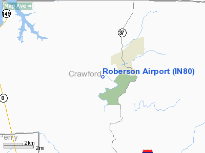
Location
& QuickFacts
|
FAA
Information Effective: |
2008-06-05 |
|
Airport
Identifier: |
IN80 |
|
Airport
Status: |
Operational |
|
Longitude/Latitude: |
086-29-27.0000W/38-19-17.0000N
-86.490833/38.321389 (Estimated) |
|
Elevation: |
690 ft / 210.31 m (Estimated) |
|
Land: |
0 acres |
|
From nearest
city: |
3 nautical miles SW of English, IN |
|
Location: |
Crawford County, IN |
|
Magnetic
Variation: |
02W (1995) |
Owner
& Manager
|
Ownership: |
Privately
owned |
|
Owner: |
J0hn Roberson |
|
Address: |
Route 3, P.o. Box 183
English, IN 47118 |
|
Phone
number: |
812-338-2343 |
|
Manager: |
John Roberson |
|
Address: |
Route 3, P.o. Box 183
English, IN 47118 |
|
Phone
number: |
812-338-2343 |
Airport Operations
and Facilities
|
Airport
Use: |
Private |
|
Segmented
Circle: |
No |
|
Control
Tower: |
No |
|
Sectional
chart: |
St Louis |
|
Region: |
AGL - Great Lakes |
|
Boundary
ARTCC: |
ZID - Indianapolis |
|
Tie-in
FSS: |
HUF - Terre Haute |
|
FSS on
Airport: |
No |
|
FSS Toll
Free: |
1-800-WX-BRIEF |
|
Runway Information
Runway 10/28
|
Dimension: |
1800 x 60 ft
/ 548.6 x 18.3 m |
|
Surface: |
TURF, Good Condition |
|
|
Runway 10 |
Runway 28 |
|
Traffic
Pattern: |
Left |
Left |
|
Obstruction: |
40 ft trees, 1000.0 ft from runway |
|
|
Radio Navigation
Aids
|
ID |
Type |
Name |
Ch |
Freq |
Var |
Dist |
|
RRJ |
NDB |
Oranj |
|
368.00 |
02W |
12.5 nm |
|
FNZ |
NDB |
Ferdinand |
|
239.00 |
00E |
16.9 nm |
|
TEL |
NDB |
Tell City |
|
206.00 |
02W |
20.7 nm |
|
BFR |
NDB |
Bedford |
|
344.00 |
02W |
31.2 nm |
|
GOI |
NDB |
Godman |
|
396.00 |
02W |
32.7 nm |
|
DCY |
NDB |
Washington |
|
212.00 |
03W |
37.7 nm |
|
EQZ |
NDB |
Captain |
|
308.00 |
02W |
40.9 nm |
|
BM |
NDB |
Claye |
|
382.00 |
02W |
44.5 nm |
|
MYS |
VOR |
Mystic |
|
108.20 |
01W |
28.2 nm |
|
HNB |
VOR/DME |
Huntingburg |
029X |
109.20 |
00E |
22.4 nm |
|
FTK |
VOR/DME |
Fort Knox |
033X |
109.60 |
01W |
34.9 nm |
|
BQM |
VOR/DME |
Bowman |
059X |
112.20 |
01W |
39.4 nm |
|
OWB |
VOR/DME |
Owensboro |
023X |
108.60 |
01E |
47.2 nm |
|
ABB |
VORTAC |
Nabb |
071X |
112.40 |
01E |
43.3 nm |
|
IIU |
VORTAC |
Louisville |
095X |
114.80 |
01E |
45.1 nm |
|
OOM |
VORTAC |
Hoosier |
039X |
110.20 |
02W |
49.8 nm |
|
SDF |
VOT |
Louisville Standifd |
|
111.00 |
|
36.6 nm |
Remarks
- PRVDD
OBSTNS REMOVED/LOWERED OR THLD DSPLCD TO PROVIDE 20:1 APCH CLNC; 125
FT EITHER SIDE OF RY & 200 FT OFF RY ENDS ARE CLEAR OF OBSTNS; 60
FT EITHER SIDE OF RY & 240 FT OFF RY ENDS IS CLEARED & GRADED
WITH NO SFC VARIATIONS.
Based Aircraft
|
Aircraft
based on field: |
1 |
|
Single Engine
Airplanes: |
1 |
Roberson Airport
Address:
Crawford County, IN
Tel:
812-338-2343
Images
and information placed above are from
http://www.airport-data.com/airport/IN80/
We
thank them for the data!
| General
Info |
| Country |
United
States |
| State |
INDIANA
|
| FAA ID |
IN80 |
| Latitude |
38-19-17.000N
|
| Longitude |
086-29-27.000W
|
| Elevation |
690 feet
|
| Near City |
ENGLISH
|
We don't guarantee the information is fresh and accurate. The data may
be wrong or outdated.
For more up-to-date information please refer to other sources.
|
|


