 |
|
Location
& QuickFacts
|
FAA
Information Effective: |
2008-06-05 |
|
Airport
Identifier: |
31II |
|
Airport
Status: |
Operational |
|
Longitude/Latitude: |
084-54-42.8190W/38-55-33.2160N
-84.911894/38.925893 (Estimated) |
|
Elevation: |
830 ft / 252.98 m (Estimated) |
|
Land: |
0 acres |
|
From nearest
city: |
3 nautical miles SW of Rising Sun, IN |
|
Location: |
Ohio County, IN |
|
Magnetic
Variation: |
03W (1985) |
Owner
& Manager
|
Ownership: |
Privately
owned |
|
Owner: |
Gerald R. Parcell |
|
Address: |
4515 Smith Road
Rising
Sun, IN 47040 |
|
Phone
number: |
812-438-3217 |
|
Manager: |
Same |
|
Address: |
|
Airport Operations
and Facilities
|
Airport Use: |
Private |
|
Wind
indicator: |
Yes |
|
Segmented
Circle: |
No |
|
Control
Tower: |
No |
|
Landing
fee charge: |
No |
|
Sectional
chart: |
St Louis |
|
Region: |
AGL - Great Lakes |
|
Boundary
ARTCC: |
ZID - Indianapolis |
|
Tie-in
FSS: |
HUF - Terre Haute |
|
FSS on
Airport: |
No |
|
FSS Toll
Free: |
1-800-WX-BRIEF |
Airport
Communications
|
Runway Information
Runway E/W
|
Dimension: |
2100 x 60 ft
/ 640.1 x 18.3 m |
|
Surface: |
TURF, |
|
|
Runway E |
Runway W |
|
Traffic
Pattern: |
Left |
Left |
|
Radio Navigation
Aids
|
ID |
Type |
Name |
Ch |
Freq |
Var |
Dist |
|
UR |
NDB |
Burln |
|
321.00 |
04W |
9.7 nm |
|
IMS |
NDB |
Madison |
|
404.00 |
03W |
27.5 nm |
|
LUK |
NDB |
Cincinnati |
|
335.00 |
04W |
30.1 nm |
|
HLB |
NDB |
Batesville |
|
254.00 |
02W |
30.2 nm |
|
ISZ |
NDB |
Cincinnati-blue Ash |
|
388.00 |
04W |
31.2 nm |
|
HAO |
NDB |
Hamilton |
|
260.00 |
04W |
31.2 nm |
|
MDE |
NDB |
Madeira |
|
379.00 |
04W |
31.5 nm |
|
OVO |
NDB |
North Vernon |
|
374.00 |
02W |
33.0 nm |
|
PWF |
NDB |
Sportys |
|
245.00 |
04W |
33.8 nm |
|
OXD |
NDB |
Oxford |
|
282.00 |
04W |
35.5 nm |
|
HKF |
NDB |
Hook Field |
|
239.00 |
04W |
40.7 nm |
|
FEU |
NDB |
Arnold |
|
521.00 |
03W |
43.0 nm |
|
BA |
NDB |
Clifs |
|
410.00 |
03W |
48.5 nm |
|
EQZ |
NDB |
Captain |
|
308.00 |
02W |
49.8 nm |
|
FFT |
VOR |
Frankfort |
|
109.40 |
03W |
44.7 nm |
|
FLM |
VOR/DME |
Falmouth |
117X |
117.00 |
04W |
32.7 nm |
|
CVG |
VORTAC |
Cincinnati |
120X |
117.30 |
04W |
11.1 nm |
|
ABB |
VORTAC |
Nabb |
071X |
112.40 |
01E |
39.5 nm |
|
RID |
VORTAC |
Richmond |
043X |
110.60 |
03W |
50.0 nm |
|
LUK |
VOT |
Cincinnati Muni/lunken |
|
108.40 |
|
26.5 nm |
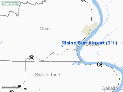
Rising Sun Airport
Address:
Ohio County, IN
Tel:
812-438-3217
Images
and information placed above are from
http://www.airport-data.com/airport/31II/
We
thank them for the data!
| General
Info |
| Country |
United
States |
| State |
INDIANA
|
| FAA ID |
31II |
| Latitude |
38-55-33.216N
|
| Longitude |
084-54-42.819W
|
| Elevation |
830 feet
|
| Near City |
RISING
SUN |
We don't guarantee the information is fresh and accurate. The data may
be wrong or outdated.
For more up-to-date information please refer to other sources.
|
|


