 |
|
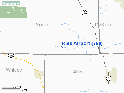
Location
& QuickFacts
|
FAA
Information Effective: |
2008-06-05 |
|
Airport
Identifier: |
76II |
|
Airport
Status: |
Operational |
|
Longitude/Latitude: |
085-16-15.9110W/41-16-35.1740N
-85.271086/41.276437 (Estimated) |
|
Elevation: |
880 ft / 268.22 m (Estimated) |
|
Land: |
0 acres |
|
From nearest
city: |
4 nautical miles W of Laotto, IN |
|
Location: |
Noble County, IN |
|
Magnetic
Variation: |
04W (1990) |
Owner & Manager
|
Ownership: |
Privately
owned |
|
Owner: |
Eugene R Ries |
|
Address: |
51185-800e
Laotto, IN 46763 |
|
Phone
number: |
219-693-3605 |
|
Manager: |
Eugene R Ries |
|
Address: |
51185-800e
Laotto, IN 46763 |
|
Phone
number: |
219-489-6197 |
Airport
Operations and Facilities
|
Airport
Use: |
Private |
|
Segmented
Circle: |
No |
|
Control
Tower: |
No |
|
Sectional
chart: |
Chicago |
|
Region: |
AGL - Great Lakes |
|
Boundary
ARTCC: |
ZAU - Chicago |
|
Tie-in
FSS: |
HUF - Terre Haute |
|
FSS on
Airport: |
No |
|
FSS Toll
Free: |
1-800-WX-BRIEF |
|
Runway Information
Runway 12/30
|
Dimension: |
1150 x 40 ft
/ 350.5 x 12.2 m |
|
Surface: |
TURF, |
|
|
Runway 12 |
Runway 30 |
|
Traffic
Pattern: |
Left |
Left |
|
Obstruction: |
|
20 ft pline, 400.0 ft from runway |
|
Radio Navigation
Aids
|
ID |
Type |
Name |
Ch |
Freq |
Var |
Dist |
|
ANQ |
NDB |
Angola |
|
347.00 |
05W |
23.4 nm |
|
HHG |
NDB |
Huntington |
|
417.00 |
03W |
26.8 nm |
|
IRS |
NDB |
Sturgis |
|
382.00 |
04W |
33.1 nm |
|
DFI |
NDB |
Defiance |
|
246.00 |
05W |
38.3 nm |
|
BYN |
NDB |
Bryan |
|
260.00 |
04W |
38.3 nm |
|
VFU |
NDB |
Stanley |
|
411.00 |
05W |
38.8 nm |
|
IWH |
NDB |
Wabash |
|
329.00 |
03W |
39.0 nm |
|
HAI |
NDB |
Three Rivers |
|
407.00 |
02W |
43.4 nm |
|
RCR |
NDB |
Rochester |
|
216.00 |
03W |
43.5 nm |
|
OLK |
VOR |
Wolf Lake |
|
110.40 |
03W |
10.4 nm |
|
FWA |
VORTAC |
Fort Wayne |
125X |
117.80 |
00E |
18.3 nm |
|
GSH |
VORTAC |
Goshen |
084X |
113.70 |
00E |
37.3 nm |
|
FWA |
VOT |
Fort Wayne Baer |
|
111.00 |
|
18.3 nm |
Remarks
- AREA
125 FT EITHER SIDE OF CNTRLN +200 FT OFF RY ENDS REMAIN OBSTN FREE;
OBSTNS BE REMOVED/LOWERED OR THRS DSPLCD TO PRVD 20:1
Ries Airport
Address:
Noble County, IN
Tel:
219-693-3605,
219-489-6197
Images
and information placed above are from
http://www.airport-data.com/airport/76II/
We
thank them for the data!
| General
Info |
| Country |
United
States |
| State |
INDIANA
|
| FAA ID |
76II |
| Latitude |
41-16-35.174N
|
| Longitude |
085-16-15.911W
|
| Elevation |
880 feet
|
| Near City |
LAOTTO
|
We don't guarantee the information is fresh and accurate. The data may
be wrong or outdated.
For more up-to-date information please refer to other sources.
|
|


