|
|
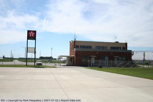
Richmond Municipal Airport |
|
 |
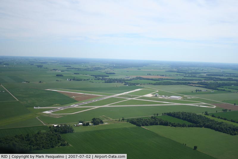
(Click on the photo to enlarge) |
|
 |
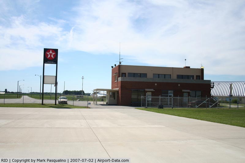
(Click on the photo to enlarge) |
Location
& QuickFacts
|
FAA
Information Effective: |
2008-06-05 |
|
Airport
Identifier: |
RID |
|
Airport
Status: |
Operational |
|
Longitude/Latitude: |
084-50-34.1520W/39-45-25.9750N
-84.842820/39.757215 (Estimated) |
|
Elevation: |
1140 ft / 347.47 m (Surveyed) |
|
Land: |
702 acres |
|
From nearest
city: |
5 nautical miles SE of Richmond, IN |
|
Location: |
Wayne County, IN |
|
Magnetic
Variation: |
03W (1985) |
Owner & Manager
|
Ownership: |
Publicly
owned |
|
Owner: |
Richmond Boac |
|
Address: |
5169 Sr 227 S.
Richmond, IN 47375 |
|
Phone
number: |
765-983-7296 |
|
Manager: |
Rodney Mayse |
|
Address: |
5169 Sr 227 S.
Richmond, IN 47374 |
|
Phone
number: |
765-983-7296 |
Airport
Operations and Facilities
|
Airport
Use: |
Open
to public |
|
Wind indicator: |
Yes |
|
Segmented
Circle: |
No |
|
Control
Tower: |
No |
|
Lighting
Schedule: |
DUSK-DAWN
ACTVT MIRL RY 15/33; REIL & PAPI RYS 06 & 24, &
LDIN RY 24 - CTAF. |
|
Beacon
Color: |
Clear-Green (lighted land airport) |
|
Landing
fee charge: |
No |
|
Sectional
chart: |
Cincinnati |
|
Region: |
AGL - Great Lakes |
|
Boundary
ARTCC: |
ZID - Indianapolis |
|
Tie-in
FSS: |
HUF - Terre Haute |
|
FSS on
Airport: |
No |
|
FSS Toll
Free: |
1-800-WX-BRIEF |
|
NOTAMs
Facility: |
HUF (NOTAM-d service avaliable) |
|
Federal
Agreements: |
NGY3 |
Airport Communications
|
CTAF: |
122.700 |
|
Unicom: |
122.700
|
Airport
Services
|
Runway Information
Runway 06/24
|
Dimension: |
5500 x 150 ft
/ 1676.4 x 45.7 m |
|
Surface: |
ASPH, Fair Condition
IN POOR CONDITION WITH NUMEROUS CRACKS. |
|
Weight Limit: |
Single wheel: 30000 lbs.
Dual wheel: 40000 lbs.
Dual tandem wheel: 60000 lbs. |
|
|
Runway 06 |
Runway 24 |
|
Longitude: |
084-51-00.3700W |
084-50-02.5770W |
|
Latitude: |
39-45-05.9500N |
39-45-37.0070N |
|
Elevation: |
1134.00 ft |
1138.00 ft |
|
Alignment: |
55 |
127 |
|
ILS Type: |
|
LOC/GS |
|
Traffic
Pattern: |
Left |
Left |
|
Markings: |
Precision instrument, Fair Condition |
Precision instrument, Fair Condition |
|
Crossing
Height: |
25.00 ft |
47.00 ft |
|
Displaced
threshold: |
300.00 ft |
0.00 ft |
|
VASI: |
4-light PAPI on left side |
4-light PAPI on left side |
|
Visual Glide
Angle: |
3.00° |
3.00° |
|
Approach
lights: |
|
LDIN |
|
Runway End
Identifier: |
Yes
REIL OTS INDEFLY. |
Yes |
|
Centerline
Lights: |
No |
No |
|
Touchdown
Lights: |
No |
No |
|
Obstruction: |
20 ft road, 625.0 ft from runway, 21:1 slope
to clear |
7 ft crops, 230.0 ft from runway, 4:1 slope
to clear |
|
Decleard
distances: |
Take off run available 5500.00 ft
Take off distance available 5500.00 ft
Actual stop distance available 5500.00 ft
Landing distance available 5200.00 ft |
Take off run available 5500.00 ft
Take off distance available 5500.00 ft
Actual stop distance available 5500.00 ft
Landing distance available 5500.00 ft |
|
Runway 10/28
|
Dimension: |
3560 x 150 ft
/ 1085.1 x 45.7 m |
|
Surface: |
ASPH, Poor Condition
IN POOR CONDITION WITH NUMEROUS CRACKS. |
|
Weight Limit: |
Single wheel: 30000 lbs.
Dual wheel: 40000 lbs.
Dual tandem wheel: 60000 lbs. |
|
|
Runway 10 |
Runway 28 |
|
Longitude: |
084-50-59.6040W |
084-50-14.7310W |
|
Latitude: |
39-45-39.1450N |
39-45-32.9510N |
|
Elevation: |
1124.00 ft |
1137.00 ft |
|
Alignment: |
100 |
127 |
|
Traffic
Pattern: |
Left |
Left |
|
Markings: |
Basic, Poor Condition
10/28 MARKINGS FADED & CHIPPING. |
Basic, Poor Condition |
|
Runway End
Identifier: |
No |
No |
|
Centerline
Lights: |
No |
No |
|
Touchdown
Lights: |
No |
No |
|
Obstruction: |
10 ft crops, 275.0 ft from runway, 7:1 slope
to clear |
, 50:1 slope to clear |
|
Runway 15/33
|
Dimension: |
5000 x 100 ft
/ 1524.0 x 30.5 m |
|
Surface: |
ASPH, Fair Condition
IN POOR CONDITION WITH NUMEROUS CRACKS. |
|
Weight Limit: |
Single wheel: 30000 lbs.
Dual wheel: 40000 lbs.
Dual tandem wheel: 60000 lbs. |
|
Edge Lights: |
Medium |
|
|
Runway 15 |
Runway 33 |
|
Longitude: |
084-50-54.6360W |
084-50-18.0090W |
|
Latitude: |
39-45-42.7670N |
39-45-02.2210N |
|
Elevation: |
1127.00 ft |
1140.00 ft |
|
Alignment: |
127 |
127 |
|
Traffic
Pattern: |
Left |
Left |
|
Markings: |
Non-precision instrument, Good Condition |
Non-precision instrument, Good Condition |
|
Centerline
Lights: |
No |
No |
|
Touchdown
Lights: |
No |
No |
|
Obstruction: |
52 ft trees, 1350.0 ft from runway, 22:1 slope
to clear |
93 ft trees, 3000.0 ft from runway, 150 ft
left of centerline, 30:1 slope to clear |
|
Radio Navigation
Aids
|
ID |
Type |
Name |
Ch |
Freq |
Var |
Dist |
|
OXD |
NDB |
Oxford |
|
282.00 |
04W |
15.3 nm |
|
UWL |
NDB |
New Castle |
|
385.00 |
02W |
23.2 nm |
|
HKF |
NDB |
Hook Field |
|
239.00 |
04W |
24.0 nm |
|
HAO |
NDB |
Hamilton |
|
260.00 |
04W |
26.3 nm |
|
VES |
NDB |
Versailles |
|
356.00 |
04W |
30.7 nm |
|
HLB |
NDB |
Batesville |
|
254.00 |
02W |
31.1 nm |
|
AI |
NDB |
Video |
|
371.00 |
03W |
36.1 nm |
|
ISZ |
NDB |
Cincinnati-blue Ash |
|
388.00 |
04W |
37.1 nm |
|
MDE |
NDB |
Madeira |
|
379.00 |
04W |
39.3 nm |
|
XEN |
NDB |
Xenia |
|
395.00 |
03W |
42.3 nm |
|
PLD |
NDB |
Portland |
|
257.00 |
03W |
42.4 nm |
|
LUK |
NDB |
Cincinnati |
|
335.00 |
04W |
42.8 nm |
|
UR |
NDB |
Burln |
|
321.00 |
04W |
42.9 nm |
|
CQA |
NDB |
Lakefield |
|
205.00 |
04W |
45.4 nm |
|
CCJ |
NDB |
Clark County |
|
341.00 |
04W |
49.6 nm |
|
FFO |
TACAN |
Patterson |
099X |
|
04W |
36.6 nm |
|
XSF |
TACAN |
Springfield |
065X |
|
04W |
46.5 nm |
|
DQN |
VOR/DME |
Dayton |
092X |
114.50 |
01W |
25.8 nm |
|
MIE |
VOR/DME |
Muncie |
091X |
114.40 |
03W |
38.4 nm |
|
SGH |
VOR/DME |
Springfield |
079X |
113.20 |
04W |
46.3 nm |
|
RID |
VORTAC |
Richmond |
043X |
110.60 |
03W |
0.2 nm |
|
CVG |
VORTAC |
Cincinnati |
120X |
117.30 |
04W |
45.0 nm |
|
SHB |
VORTAC |
Shelbyville |
057X |
112.00 |
01E |
46.0 nm |
|
ROD |
VORTAC |
Rosewood |
122X |
117.50 |
05W |
48.7 nm |
|
DAY |
VOT |
Dayton J M Cox-day |
|
111.00 |
|
30.0 nm |
|
LUK |
VOT |
Cincinnati Muni/lunken |
|
108.40 |
|
43.6 nm |
Based Aircraft
|
Aircraft
based on field: |
38 |
|
Single Engine
Airplanes: |
35 |
|
Multi Engine Airplanes: |
3 |
Operational Statistics
Time
Period: 2006-01-01 - 2006-12-31
|
Aircraft
Operations: |
95/Day |
|
Air Taxi: |
2.0% |
|
General Aviation
Local: |
85.0% |
|
General Aviation
Itinerant: |
12.0% |
|
Military: |
1.0% |
Richmond Municipal Airport
Address:
Wayne County, IN
Tel:
765-983-7296
Images
and information placed above are from
http://www.airport-data.com/airport/RID/
We
thank them for the data!
| General
Info |
| Country |
United
States |
| State |
INDIANA
|
| FAA ID |
RID |
| Latitude |
39-45-25.975N
|
| Longitude |
084-50-34.152W
|
| Elevation |
1140 feet
|
| Near City |
RICHMOND
|
We don't guarantee the information is fresh and accurate. The data may
be wrong or outdated.
For more up-to-date information please refer to other sources.
|
|