 |
|
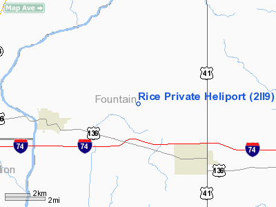
Location
& QuickFacts
|
FAA
Information Effective: |
2008-06-05 |
|
Airport
Identifier: |
2II9 |
|
Airport
Status: |
Operational |
|
Longitude/Latitude: |
087-18-29.0400W/40-09-10.1370N
-87.308067/40.152816 (Estimated) |
|
Elevation: |
660 ft / 201.17 m (Estimated) |
|
Land: |
3 acres |
|
From nearest
city: |
5 nautical miles E of Covington, IN |
|
Location: |
Fountain County, IN |
|
Magnetic
Variation: |
01W (1985) |
Owner & Manager
|
Ownership: |
Privately
owned |
|
Owner: |
William E. Rice |
|
Address: |
Rt 3, Box 20
Covington, IN 47932 |
|
Phone
number: |
317-793-7241 |
|
Manager: |
William E. Rice |
|
Address: |
Rt 3, Box 20
Covington, IN 47932 |
|
Phone
number: |
317-793-7241 |
Airport
Operations and Facilities
|
Airport
Use: |
Private |
|
Wind indicator: |
Yes |
|
Segmented
Circle: |
No |
|
Control
Tower: |
No |
|
Landing
fee charge: |
No |
|
Sectional
chart: |
Chicago |
|
Region: |
AGL - Great Lakes |
|
Boundary
ARTCC: |
ZAU - Chicago |
|
Tie-in
FSS: |
HUF - Terre Haute |
|
FSS on
Airport: |
No |
|
FSS Toll
Free: |
1-800-WX-BRIEF |
|
Runway Information
Helipad H1
|
Dimension: |
300 x 300 ft
/ 91.4 x 91.4 m |
|
Surface: |
TURF, |
|
|
Runway H1 |
Runway |
|
Traffic
Pattern: |
Left |
Left |
|
Radio Navigation
Aids
|
ID |
Type |
Name |
Ch |
Freq |
Var |
Dist |
|
CFJ |
NDB |
Crawfordsville |
|
388.00 |
02W |
20.8 nm |
|
HMJ |
NDB |
Homer |
|
281.00 |
01E |
30.6 nm |
|
PRG |
NDB |
Paris |
|
341.00 |
01E |
32.1 nm |
|
FKR |
NDB |
Frankfort |
|
278.00 |
02W |
34.9 nm |
|
TVX |
NDB |
Greencastle |
|
521.00 |
03W |
35.1 nm |
|
MCX |
NDB |
White County |
|
377.00 |
03W |
41.8 nm |
|
HU |
NDB |
Yinno |
|
245.00 |
02W |
46.2 nm |
|
RZL |
NDB |
Rensselaer |
|
362.00 |
02W |
48.1 nm |
|
RBS |
VOR/DME |
Roberts |
115X |
116.80 |
02E |
46.9 nm |
|
DNV |
VORTAC |
Danville |
047X |
111.00 |
02E |
14.2 nm |
|
BVT |
VORTAC |
Boiler |
098X |
115.10 |
01E |
26.6 nm |
|
TTH |
VORTAC |
Terre Haute |
100X |
115.30 |
02E |
40.0 nm |
|
CMI |
VORTAC |
Champaign |
037X |
110.00 |
03E |
45.1 nm |
|
VHP |
VORTAC |
Brickyard |
110X |
116.30 |
01E |
47.8 nm |
Remarks
- PROVIDED
ALL OPERATIONS ARE CONDUCTED IN AN AREA FROM 360 DEGS CLOCKWISE TO 90
DEGS; AREA IS APPROPRIATELY MARKED; WIND INDICATOR IS MAINTAINED; UTILITY
LINES SOUTH ARE MARKED.
Based Aircraft
|
Aircraft
based on field: |
3 |
|
Helicopters: |
3 |
Rice Private Heliport
Address:
Fountain County, IN
Tel:
317-793-7241
Images
and information placed above are from
http://www.airport-data.com/airport/2II9/
We
thank them for the data!
| General
Info |
| Country |
United
States |
| State |
INDIANA
|
| FAA ID |
2II9 |
| Latitude |
40-09-10.137N
|
| Longitude |
087-18-29.040W
|
| Elevation |
660 feet
|
| Near City |
COVINGTON
|
We don't guarantee the information is fresh and accurate. The data may
be wrong or outdated.
For more up-to-date information please refer to other sources.
|
|


