 |
|
Location
& QuickFacts
|
FAA
Information Effective: |
2008-06-05 |
|
Airport
Identifier: |
49II |
|
Airport
Status: |
Operational |
|
Longitude/Latitude: |
087-00-55.0460W/39-36-35.1560N
-87.015291/39.609766 (Estimated) |
|
Elevation: |
800 ft / 243.84 m (Estimated) |
|
Land: |
0 acres |
|
From nearest
city: |
1 nautical miles E of Lena, IN |
|
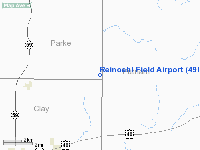
Location: |
Parke County, IN |
|
Magnetic
Variation: |
01W (1985) |
Owner
& Manager
|
Ownership: |
Privately
owned |
|
Owner: |
Gregg A Reinoehl |
|
Address: |
Rr 1 Box 152b
Reelsville, IN 46171 |
|
Phone
number: |
317-672-8373 |
|
Manager: |
Gregg A. Reinoehl |
|
Address: |
Rr 1 Box 152b
Reelsville, IN 46171 |
|
Phone
number: |
317-672-8373 |
Airport Operations
and Facilities
|
Airport
Use: |
Private |
|
Wind indicator: |
Yes |
|
Segmented
Circle: |
No |
|
Control
Tower: |
No |
|
Sectional
chart: |
St Louis |
|
Region: |
AGL - Great Lakes |
|
Boundary
ARTCC: |
ZID - Indianapolis |
|
Tie-in
FSS: |
HUF - Terre Haute |
|
FSS Toll
Free: |
1-800-WX-BRIEF |
|
Runway Information
Runway 02/20
|
Dimension: |
1900 x 60 ft
/ 579.1 x 18.3 m |
|
Surface: |
TURF, |
|
|
Runway 02 |
Runway 20 |
|
Traffic
Pattern: |
Left |
Left |
|
Obstruction: |
40 ft trees, 500.0 ft from runway |
15 ft wires |
|
Radio Navigation
Aids
|
ID |
Type |
Name |
Ch |
Freq |
Var |
Dist |
|
TVX |
NDB |
Greencastle |
|
521.00 |
03W |
11.5 nm |
|
HU |
NDB |
Yinno |
|
245.00 |
02W |
22.2 nm |
|
CFJ |
NDB |
Crawfordsville |
|
388.00 |
02W |
22.8 nm |
|
PRG |
NDB |
Paris |
|
341.00 |
01E |
31.0 nm |
|
SIV |
NDB |
Sullivan |
|
326.00 |
02W |
35.9 nm |
|
BM |
NDB |
Claye |
|
382.00 |
02W |
38.5 nm |
|
HZP |
NDB |
Zionsville |
|
248.00 |
03W |
40.6 nm |
|
HFY |
NDB |
Greenwood |
|
398.00 |
02W |
42.8 nm |
|
FKR |
NDB |
Frankfort |
|
278.00 |
02W |
44.9 nm |
|
PLX |
NDB |
Palestine |
|
391.00 |
00W |
46.2 nm |
|
UMP |
NDB |
Metropolitan |
|
338.00 |
03W |
48.7 nm |
|
CZB |
NDB |
Casey |
|
359.00 |
00E |
49.3 nm |
|
RSV |
VOR/DME |
Robinson |
021X |
108.40 |
02E |
46.2 nm |
|
TTH |
VORTAC |
Terre Haute |
100X |
115.30 |
02E |
13.0 nm |
|
VHP |
VORTAC |
Brickyard |
110X |
116.30 |
01E |
32.4 nm |
|
OOM |
VORTAC |
Hoosier |
039X |
110.20 |
02W |
33.7 nm |
|
DNV |
VORTAC |
Danville |
047X |
111.00 |
02E |
48.1 nm |
|
IND |
VOT |
Indianapolis Intl |
|
109.60 |
|
34.6 nm |
Remarks
- PRVDD
OBSTRUCTION IN RY APCH SLOPE BE REMOVED/LOWERED OR THR DSPLCD TO PROVIDE
20:1 APCH CLNC; INSTALL GATES OR CHAINS & SIGNS FOR RY SECURITY;
AREA 125 FT EITHER SIDE OF RY CNTRLN CLEAR OF OBSTN.
Reinoehl Field Airport
Address:
Parke County, IN
Tel:
317-672-8373
Images
and information placed above are from
http://www.airport-data.com/airport/49II/
We
thank them for the data!
| General
Info |
| Country |
United
States |
| State |
INDIANA
|
| FAA ID |
49II |
| Latitude |
39-36-35.156N
|
| Longitude |
087-00-55.046W
|
| Elevation |
800 feet
|
| Near City |
LENA |
We don't guarantee the information is fresh and accurate. The data may
be wrong or outdated.
For more up-to-date information please refer to other sources.
|
|


