 |
|
Location
& QuickFacts
|
FAA
Information Effective: |
2008-06-05 |
|
Airport
Identifier: |
57II |
|
Airport
Status: |
Operational |
|
Longitude/Latitude: |
086-34-03.0090W/39-57-51.1550N
-86.567503/39.964210 (Estimated) |
|
Elevation: |
930 ft / 283.46 m (Estimated) |
|
Land: |
0 acres |
|
From nearest
city: |
5 nautical miles NE of Jamestown, IN |
|
Location: |
Boone County, IN |
|
Magnetic
Variation: |
01W (1985) |
Owner & Manager
|
Ownership: |
Privately
owned |
|
Owner: |
Ken & Jacqueline Reimer |
|
Address: |
5204 S. 500 W.
Jamestown, IN 46147 |
|
Phone
number: |
317-676-6488 |
|
Manager: |
Ken Reimer |
|
Address: |
5205 S. 500 W.
Jamestown, IN 46147 |
|
Phone
number: |
317-676-6488 |
Airport
Operations and Facilities
|
Airport
Use: |
Private |
|
Segmented
Circle: |
No |
|
Control
Tower: |
No |
|
Sectional
chart: |
St Louis |
|
Region: |
AGL - Great Lakes |
|
Boundary
ARTCC: |
ZID - Indianapolis |
|
Tie-in
FSS: |
HUF - Terre Haute |
|
FSS Toll
Free: |
1-800-WX-BRIEF |
|
Runway Information
Runway E/W
|
Dimension: |
2000 x 80 ft
/ 609.6 x 24.4 m |
|
Surface: |
TURF, |
|
|
Runway E |
Runway W |
|
Traffic
Pattern: |
Left |
Left |
|
Obstruction: |
|
22 ft pline, 10.0 ft from runway |
|
Radio Navigation
Aids
|
ID |
Type |
Name |
Ch |
Freq |
Var |
Dist |
|
HZP |
NDB |
Zionsville |
|
248.00 |
03W |
14.7 nm |
|
CFJ |
NDB |
Crawfordsville |
|
388.00 |
02W |
16.1 nm |
|
FKR |
NDB |
Frankfort |
|
278.00 |
02W |
18.4 nm |
|
TVX |
NDB |
Greencastle |
|
521.00 |
03W |
18.6 nm |
|
UMP |
NDB |
Metropolitan |
|
338.00 |
03W |
23.9 nm |
|
HFY |
NDB |
Greenwood |
|
398.00 |
02W |
29.7 nm |
|
GGP |
NDB |
Logansport |
|
263.00 |
01W |
45.6 nm |
|
MCX |
NDB |
White County |
|
377.00 |
03W |
45.7 nm |
|
AI |
NDB |
Video |
|
371.00 |
03W |
49.1 nm |
|
VHP |
VORTAC |
Brickyard |
110X |
116.30 |
01E |
12.9 nm |
|
SHB |
VORTAC |
Shelbyville |
057X |
112.00 |
01E |
39.7 nm |
|
OKK |
VORTAC |
Kokomo |
082X |
113.50 |
00E |
41.2 nm |
|
BVT |
VORTAC |
Boiler |
098X |
115.10 |
01E |
42.4 nm |
|
TTH |
VORTAC |
Terre Haute |
100X |
115.30 |
02E |
42.5 nm |
|
GUS |
VORTAC |
Grissom |
21Y |
108.45 |
02W |
45.1 nm |
|
OOM |
VORTAC |
Hoosier |
039X |
110.20 |
02W |
49.4 nm |
|
DNV |
VORTAC |
Danville |
047X |
111.00 |
02E |
49.6 nm |
|
IND |
VOT |
Indianapolis Intl |
|
109.60 |
|
19.5 nm |
Based Aircraft
|
Aircraft
based on field: |
1 |
|
Single Engine
Airplanes: |
1 |
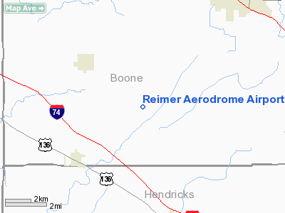
Reimer Aerodrome Airport
Address:
Boone County, IN
Tel:
317-676-6488
Images
and information placed above are from
http://www.airport-data.com/airport/57II/
We
thank them for the data!
| General
Info |
| Country |
United
States |
| State |
INDIANA
|
| FAA ID |
57II |
| Latitude |
39-57-51.155N
|
| Longitude |
086-34-03.009W
|
| Elevation |
930 feet
|
| Near City |
JAMESTOWN
|
We don't guarantee the information is fresh and accurate. The data may
be wrong or outdated.
For more up-to-date information please refer to other sources.
|
|


